- Home
- :
- All Communities
- :
- Products
- :
- ArcGIS Network Analyst
- :
- ArcGIS Network Analyst Questions
- :
- Re: Strange gaps in detailed service area (network...
- Subscribe to RSS Feed
- Mark Topic as New
- Mark Topic as Read
- Float this Topic for Current User
- Bookmark
- Subscribe
- Mute
- Printer Friendly Page
Strange gaps in detailed service area (network analyst)
- Mark as New
- Bookmark
- Subscribe
- Mute
- Subscribe to RSS Feed
- Permalink
Hello,
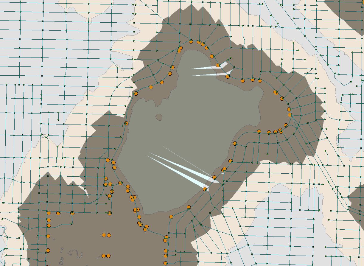
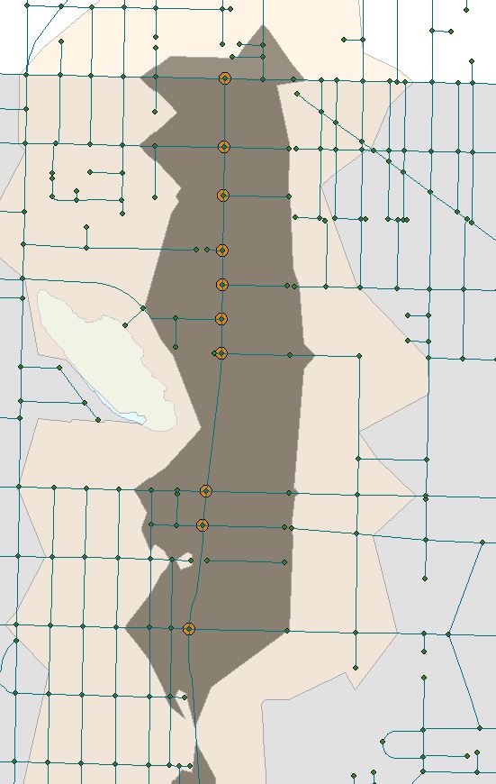
I'm running a service area analysis and when I put my polygon generation settings to detailed most of the resulting polygons seem fine, but I end up with strange gaps in a few places that should be within the service areas. When I change the settings to generalized, the resulting polygons are including large areas of land that should be gaps within the second ring of my service area. I've included examples in the screen shots below (the blue lines and green dots are my SND, and the orange dots are my entrances/facilities.) If anyone has any insights into what might cause either of these issues, it would be much appreciated!
Other polygon generation settings I am using are:
Trim polygons: 200 meters
Merge by break value
Rings
Solved! Go to Solution.
Accepted Solutions
- Mark as New
- Bookmark
- Subscribe
- Mute
- Subscribe to RSS Feed
- Permalink
Hello Cayce. I can't tell for sure without examining your data, but it looks to me like an issue with your network dataset. The areas with the strange gaps look like unreachable bits of the network. There are a couple of possible reasons for this:
- Those network edges are not properly connected to their neighbors. Either the geometry is off (tiny gaps or overhangs), the elevation field values (z-levels) are incorrect so the network thinks the roads should connect to their neighbors, or the road and its neighbors don't meet at endpoints or vertices (depending on connectivity policy).
- These road segments are restricted because you have a restriction attribute that prevents travel on them. This could be intentional, or the restriction attribute might be messed up. For example, maybe you have a one-way restriction, but the one-way restriction is preventing travel in both directions on these roads.
You can use the Network Identify tool, accessed from the Network Analyst toolbar, to click on your network dataset edges and see some information about them and which other edges they are connected to.
Hope this helps you diagnose the problem!
- Mark as New
- Bookmark
- Subscribe
- Mute
- Subscribe to RSS Feed
- Permalink
Thank you very much Melinda!! I think I just figured it out. You were right, it was an issue with the network dataset. I discovered some duplicate line segments that were causing the problem. Thanks again!