The ArcGIS Maps for Adobe® team announced its first mapping competition in February 2020. We are pleased to announce that this competition was a great success! Many mapmakers from all over the world participated. The amount, quality, and diversity of the maps that were submitted were incredible, and of these fantastic maps our panel of judges has determined the 1st, 2nd, and 3rd place winners from the multitude of amazing maps. Due to the success of this first competition, we hope to make it an annual event. Follow Maps for Adobe to learn more about this competition and other exciting announcements regarding this mapping tool.
Criteria
The rules for participating were kept very broad, which resulted in a wide variety of creative mapping approaches from participants. The one main criteria that participants needed to follow is that the map had to be created using Maps for Adobe as the designer's primary map-making tool. Each participant could submit up to two (2) maps. For a full list of rules, visit the competition announcement.
First Place
Where might I see the Yellow-Tailed Black Cockatoo? by Katelin Volkanovski
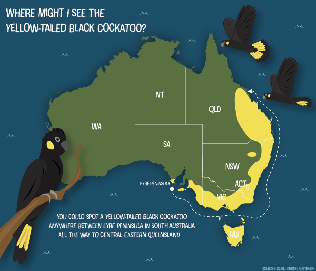
Map by Katelin Volkanovski
First place winner comes from Australia! Katelin Volkanovski's map depicting the distribution of the Yellow-tailed Black Cockatoo incorporates graphic design by illustrating the bird for which this map is created along with whimsical waves in the across the ocean. Katelin integrated the same yellow hue of her wonderfully designed birds to show the species' range on the map. Here is what Katelin had to say about the subject in her map:
Australia's Black Cockatoo populations have faced a dramatic decline, and are now a threatened species. This map focuses on the distribution of one of the six Black Cockatoo varieties, the Yellow-Tailed Black Cockatoo.
Second Place
Daffodils and Homesites of the Eno River by Madalyn Baldwin
This gorgeous map by Madalyn Baldwin highlights the connection humans have to their landscapes through the tender act of planting flowers. This map's creative topographic design, minimal clean design are among the many reasons this map is among the top three. Of this map, Madalyn writes:
Between the 1750s and the early 1900s, many mills and homes were sited along the Eno River in the piedmont of North Carolina. Today, much of the land surrounding the Eno is conserved as the Eno River State Park, with close to 30 miles of publicly accessible hiking trails. While remnants of some of the historic structures are still visible, in most cases these sites have disappeared into the landscape. But every spring, for a couple of weeks, the history of this river is revealed with vibrant yellow blankets of daffodils. In most cases, the first bulbs were planted by the original homeowners, and over the past 100 - 200 years, the flowers have naturalized and spread, persisting as memories of the people who settled along this river. The daffodils and architectural remnants each tell a unique story of home and garden.
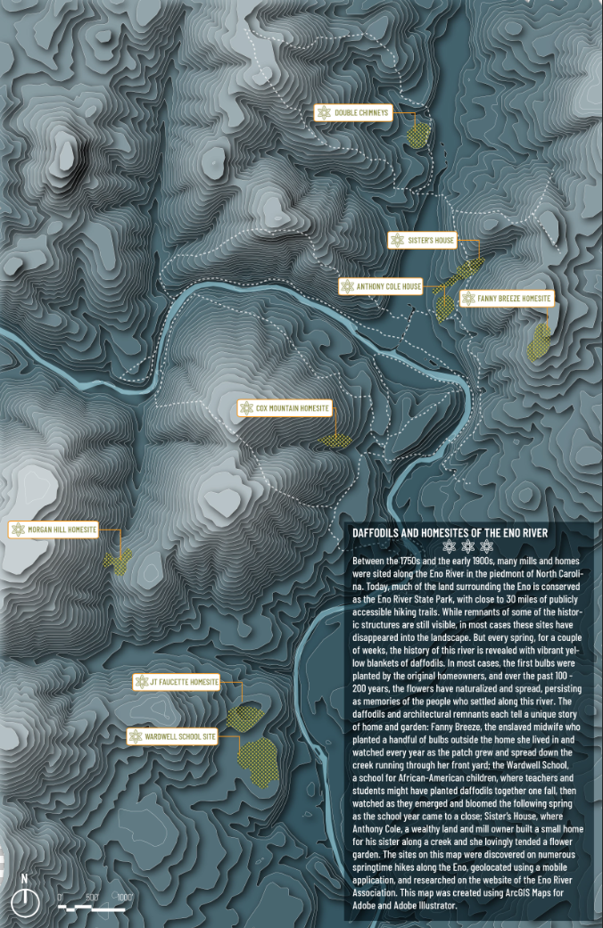
Map by Madalyn Baldwin
Third Place (3-mapper-tie!)
Kananaskis Overview Map by Ian Ladd
Congratulations to Calgary-based cartographer Ian Ladd for this wonderfully designed overview map of Kananaskis, a beautiful wild area located in Alberta, Canada. Evident in Ian's map, Kananaskis is a glaciated mountainous region where visitors may camp, hike, and ski among many other recreational activities. Ian says of this map:
I have been making maps since I was 6 years old, its my passion, hobby, and career. This map is a simple overview map of an area I spend a lot of time skiing, biking, hiking, and exploring! I wanted to really learn ArcGIS Maps for Adobe Creative Cloud and used this as a learning exercise.
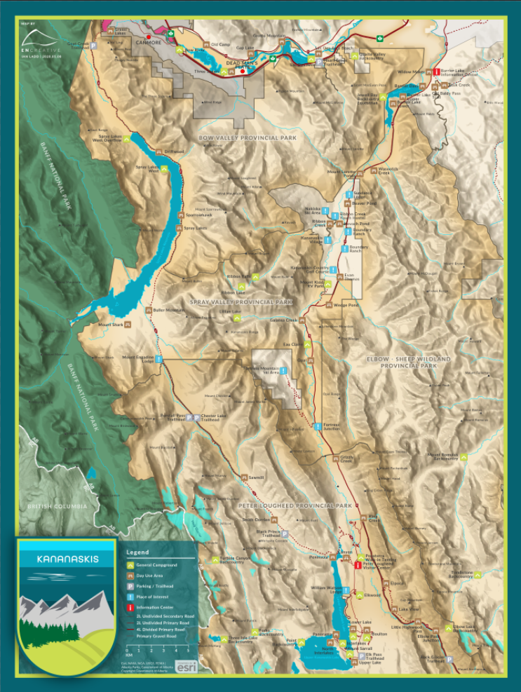
Map by Ian Ladd
Arkansas by Noah Walker
This delightfully minimalist monochrome map of Arkansas comes from Noah Walker. Noah chose to illustrate the topography of the western side of his state with simple effective graphic design.The smart label hierarchy is effective, drawing the reader throughout this wonderful map. Noah writes:
A stylized map of the state of Arkansas, my home state, using the old abbreviation format. Designed to showcase the major rivers and mountain ranges of the natural state, as well as major cities. Also depicts the highest elevation in the state, and the location of Hot Springs National Park.
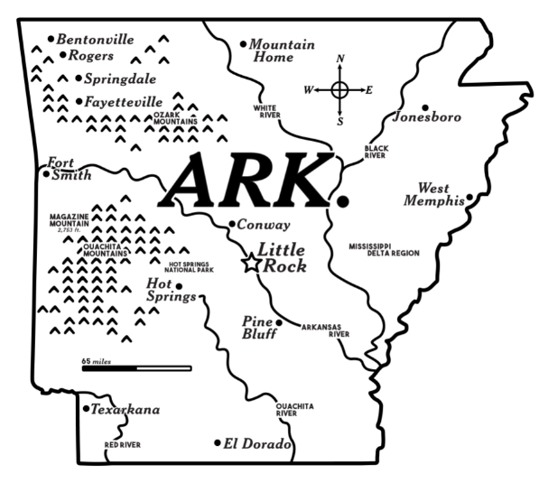
Map by Noah Walker
Kayak Launches in Eastern Talbot County, Maryland by Andrew Bernish
Talented cartographer Andrew Bernish submitted this colorful map of the kayak launches in Eastern Talbot county. The inspiration for Andrew's vibrant design comes from his family. Andrew describes this inspiration below:
I have two small children (ages 2 and 5) and they like to get out in our kayak. I started looking for more public kayak launches near our home in Easton and realized that our county is one of the best places for kayaking. I was inspired to create this map with an eye for my kids as it will hang in their shared bedroom. I used a kids' palette of colors and fonts.
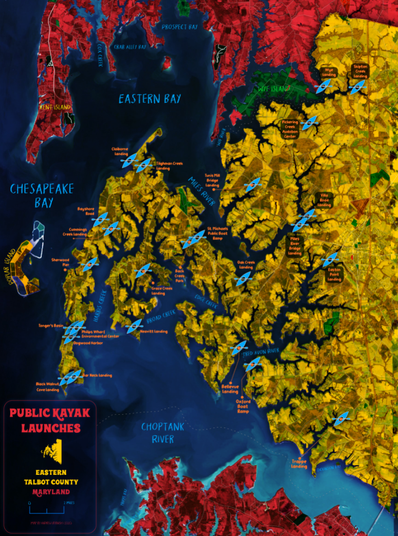
Map by Andrew Bernish
Honorable Mentions
The number of participants was much greater that we expected, and for this reason next year's competition will have categories by which the maps can be organized. This year we only were able to choose three among the many amazing maps. Below are some wonderful submissions that we have to show off.
Puffin breeding habitat throughout the year by Emma Lidbury
Emma Lidbury's map design is always a delight! This map focusing on the locations where Puffins breed is no exception. The simple effective color choice along with the clever postage design elements draw map readers in to learn more about the subject.
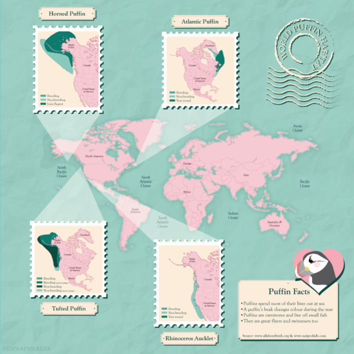
Map by Emma Lidbury
London by Mitch Kazuk
Another talented mapmaker, Mitch Kazuk submitted this map of the greater London area. This lovely map uses an effective label heirarchy to highlight some of the places that are significant to Mitch, and that gorgeous muted blue to show off the River Thames.
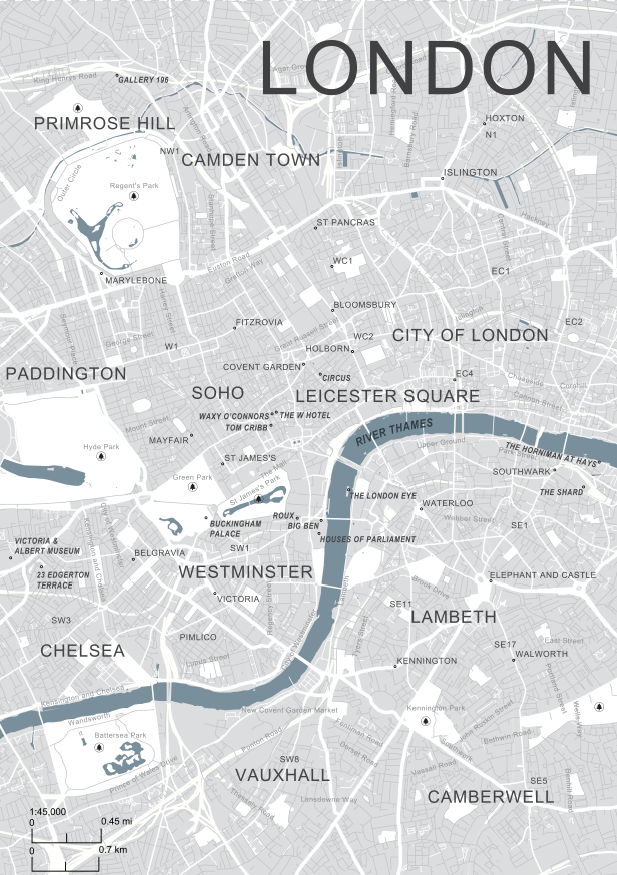
Map by Mitch Kazuk
I-10 Closure Map by Andrew Pham
It is clear that Andrew Pham is accustomed to providing information in the form of map- and graphic design. This map has a clean look, effectively informing its readers where to expect upcoming road closures.
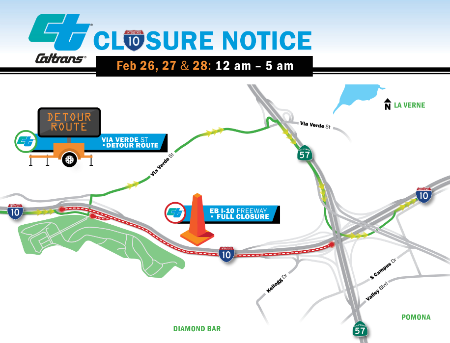
Map by Andrew Pham
I-10 Projects Map by Lalé Moradpour
Caltrans clearly has a staff of talented designers; Our final honorable mention is another from this transportation agency. This map shows a one-lane bridge structure proposal with projects segments symbolized by a yellow-to-red gradient. Lalé Moradpour has chosen to design the base as a sleek dark tone, which allows for the project colors to pop.
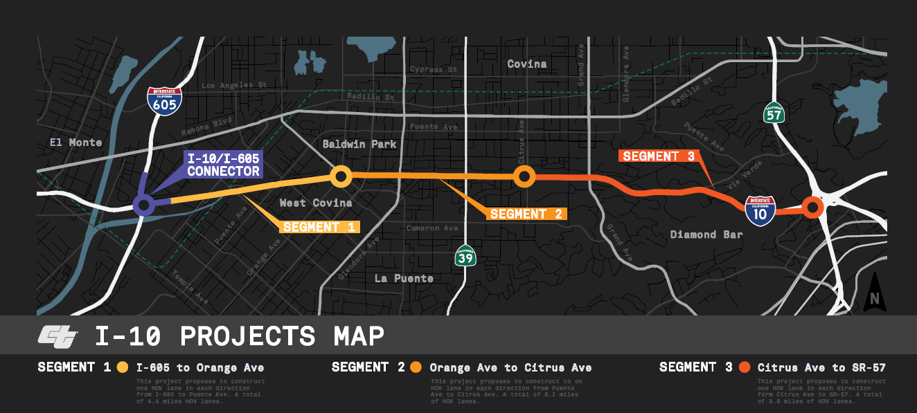
Map by Lalé Moradpour

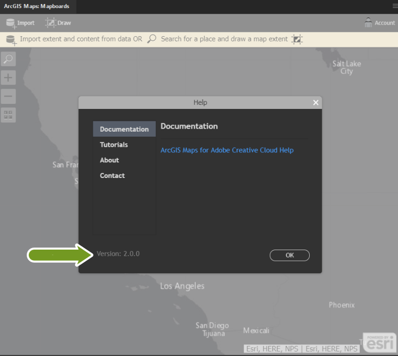


 and choose Help.)