- Home
- :
- All Communities
- :
- Developers
- :
- JavaScript Maps SDK
- :
- JavaScript Maps SDK Questions
- :
- Re: CORS error when adding WMS layers from Geoserv...
- Subscribe to RSS Feed
- Mark Topic as New
- Mark Topic as Read
- Float this Topic for Current User
- Bookmark
- Subscribe
- Mute
- Printer Friendly Page
CORS error when adding WMS layers from Geoserver layer
- Mark as New
- Bookmark
- Subscribe
- Mute
- Subscribe to RSS Feed
- Permalink
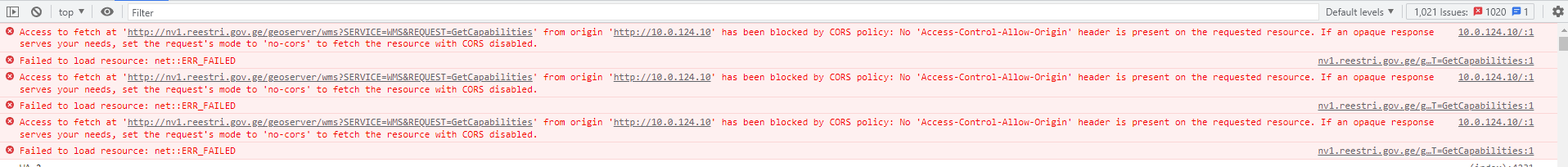
Hi Guys, need help. I try add GeoServer wms layer on my webmap. It was working good about few days ago, but now i get error: Access to fetch at 'http://nv1.reestri.gov.ge/geoserver/wms?SERVICE=WMS&REQUEST=GetCapabilities' from origin 'http://10.0.124.10' has been blocked by CORS policy: No 'Access-Control-Allow-Origin' header is present on the requested resource. If an opaque response serves your needs, set the request's mode to 'no-cors' to fetch the resource with CORS disabled. (See PIC)
I use standard code to add layer:
const registrirebuli_nakvetebi = new WMSLayer({
          url: "http://nv1.reestri.gov.ge/geoserver/wms",
          title: "xxx",
          visible: true,
          sublayers: [
            {
              name: "LR_PARCELS"
            }
          ]
        });
        map.add(registrirebuli_nakvetebi)
How can i handle this? Geoserver is not on my hand, so i can not enable/disable CORS.
Solved! Go to Solution.
Accepted Solutions
- Mark as New
- Bookmark
- Subscribe
- Mute
- Subscribe to RSS Feed
- Permalink
Looking into this, i saw the following in the api docs.
"The WMSLayer initially executes a WMS GetCapabilities request, which might require CORS or a proxy page." (source:https://developers.arcgis.com/javascript/latest/api-reference/esri-layers-WMSLayer.html )
Since you are unable to enable/disable CORS you may need to look into a proxy.
https://developers.arcgis.com/javascript/latest/proxies/
I have had some success with this proxy in the past with handling CORS issues https://github.com/Esri/resource-proxy
HOWEVER, esri has since added the following disclaimer
"We don't recommend using this resource proxy. It is not being maintained and there's been no active development for many years. There are many better solutions."
But at the very least, the GIT README can shed some light on how a proxy can be integrated depending on your environment.
I hope that helps!
- Mark as New
- Bookmark
- Subscribe
- Mute
- Subscribe to RSS Feed
- Permalink
Hi Again,
So, i followed these documentation, but still got CORS error. When i set all correctly now it says that there are multiple headers.
- Mark as New
- Bookmark
- Subscribe
- Mute
- Subscribe to RSS Feed
- Permalink
Hi @B-L ,
So, i have configured proxy using your suggestions. Now maps loads, from proxy server i get response like this: https://nv.napr.gov.ge/geoserver/ows?width=1920&height=523&bbox=4980332.152501735%2C5119742.33096146...
but it does not appear on map, still get CORS error: Access to image at 'https://nv.napr.gov.ge/geoserver/ows?width=1920&height=485&bbox=4834810.382589555%2C5082880.57407094...' from origin 'http://10.0.124.10' has been blocked by CORS policy: No 'Access-Control-Allow-Origin' header is present on the requested resource.
What else i have to do? I think it should work now, but no success.
- Mark as New
- Bookmark
- Subscribe
- Mute
- Subscribe to RSS Feed
- Permalink
I would highly recommend that you reach out to ESRI support on this one. Especially since it is dealing with CORS and Proxies, which can both come with some security considerations. Best of luck!