- Home
- :
- All Communities
- :
- Products
- :
- ArcGIS Dashboards
- :
- ArcGIS Dashboards Questions
- :
- Re: using shape_length for the indicator widget
- Subscribe to RSS Feed
- Mark Topic as New
- Mark Topic as Read
- Float this Topic for Current User
- Bookmark
- Subscribe
- Mute
- Printer Friendly Page
using shape_length for the indicator widget
- Mark as New
- Bookmark
- Subscribe
- Mute
- Subscribe to RSS Feed
- Permalink
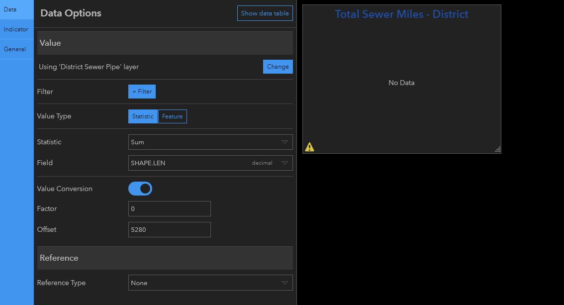
I am trying to display the total length of utility pipes by using the indicator widget and using the sum statistic of the shape_length field, I am given an error with the data by trying this, and I am wondering if it is even possible to use this field for statistics, and if not, what my other options are.
- Mark as New
- Bookmark
- Subscribe
- Mute
- Subscribe to RSS Feed
- Permalink
I happened to have the same question today. I used a factor of 0.000189394 to convert feet to miles. I left the offset at zero. I'm creating a gauge that shows the number of feet of sewer pipe inspected to the total number of miles that should be inspected in one year.
To figure out the conversion factor I googled conversion factor feet to miles
- Mark as New
- Bookmark
- Subscribe
- Mute
- Subscribe to RSS Feed
- Permalink
Were you able to use shape_length as a statistic field for your gauge? I am trying to just show the length of sewer pipe in the region in miles with the indicator widget, I figured this would be simple in OD, but its been more complicated than I thought.
- Mark as New
- Bookmark
- Subscribe
- Mute
- Subscribe to RSS Feed
- Permalink
No. The source is actually a survey123 hosted feature service. When the form is opened from a map the shape_length value is passed into a hidden field.
- Mark as New
- Bookmark
- Subscribe
- Mute
- Subscribe to RSS Feed
- Permalink
Hi Kevin,
Please see my reply below from:
https://community.esri.com/thread/116675
Andres Castillo@ Mike Liska on Mar 27, 2019 8:46 AM
I believe that in order to see the Shape.STLength() field, it needs to be a map service.
This is because if you inspect the fields that display at the rest end point of a map service vs feature service, you will notice that the feature service does not list Shape.STLength() as part of its' available fields.
If it is a map service, then you will be able to do what Alexander Baker mentioned above.
Here are some other threads talking about this:
AGO Operations Dashboard - Chrome vs IE, SHAPE.STLength() field, multi-condition variables (This one says that the error is no longer an issue.)
- Mark as New
- Bookmark
- Subscribe
- Mute
- Subscribe to RSS Feed
- Permalink
I've tried using SHAPE.LEN from both a feature layer and a map image layer and both give the same "Cannot Access Data" error. We had to create a spatial view of our SDE data and add a length column using ST_Length(). This is in Enterprise 10.6.1. Hopefully ESRI figures out this bug in 10.7 or 10.7.1.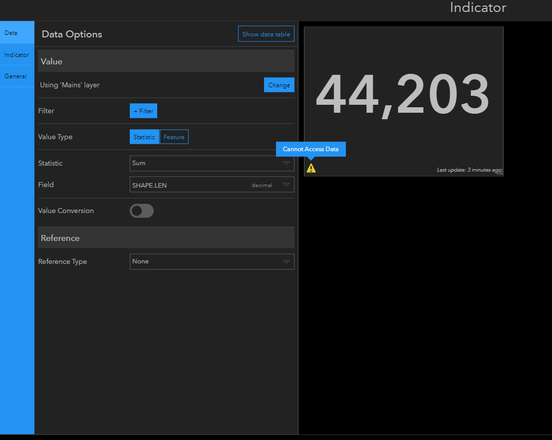
- Mark as New
- Bookmark
- Subscribe
- Mute
- Subscribe to RSS Feed
- Permalink
Currently at 11.2 and it doesn't seem to be fixed for Feature Layer or Map Image Layer 😵