Turn on suggestions
Auto-suggest helps you quickly narrow down your search results by suggesting possible matches as you type.
Cancel
- Home
- :
- All Communities
- :
- Industries
- :
- Education
- :
- Education Blog
- :
- A STEM Center Where Geospatial Is Literally at You...
A STEM Center Where Geospatial Is Literally at Your Feet… and Over Your Head
Subscribe
2242
0
06-29-2017 12:05 AM
- Subscribe to RSS Feed
- Mark as New
- Mark as Read
- Bookmark
- Subscribe
- Printer Friendly Page
06-29-2017
12:05 AM
I recently had the good fortune of conducting a professional development GIS institute for educators recently at the new Science Technology Engineering and Mathematics (STEM) center at Overland High School and Prairie Middle School in Colorado. We found out about the center after meeting its director, Dr. Richard Charles, while hosting an Esri exhibit at the International Society for Technology in Education (ISTE) last year. My colleague Charlie Fitzpatrick recently described the connections of GIS to STEM.
The center’s mission states that “The success of the United States in the 21st century – its wealth and welfare – will depend on the ideas and skills of its population. Our nation is facing a crisis in STEM related fields. Because of this, the campus offers a BOLD new approach to education featuring a creative focus in the areas of Science, Technology, Engineering, and Math with a strong liberal arts foundation. […] The courses a student selects in middle and high school can significantly impact his or her options for the future. The student must take responsibility for making informed choices, paving the pathway to success in middle and high school and in life. It is our goal to help our students make informed and wise decisions regarding his/her middle and high school programming.”
The school provides an extensive list of courses where technology is infused, from Grade 6 through 12. Students have the opportunity to select from five career concentrations that include art and technical communication, computer science and applied mathematics, engineering and technical sciences, natural resources and energy, and health sciences. This may sound like a community college or university, but remember that students ages 11 to 18 are taking these courses, which is visionary and inspiring.
The Geographic Information Systems course at the STEM center is described as “an introduction to the concepts and uses of GIS. GIS is a system of computer software, hardware, and personnel designed to visualize, manipulate, analyze, and display spatial data. A GIS can create “Smart Maps” that links a database to a map. This allows individuals to view relationships, patterns, or trends that are not possible to see with traditional charts, graphs, and spreadsheets. Through computer lab tutorials and case studies, students will learn to use ArcGIS from Esri. Some topics include City and Regional Planning, Community and Economic Planning and Development, Housing Studies, Transit and Transportation Issues, Land Use, Historic and Archeological Studies, Crime Analysis and Policing, Emergency Management and Public Works Utilities, Census and Demographic Studies, Public Health, and Business uses including Marketing and Advertising.”
What’s more, geospatial reminders surround the students and faculty, thanks to Dr. Charles’ careful work with the school’s architects and builders.
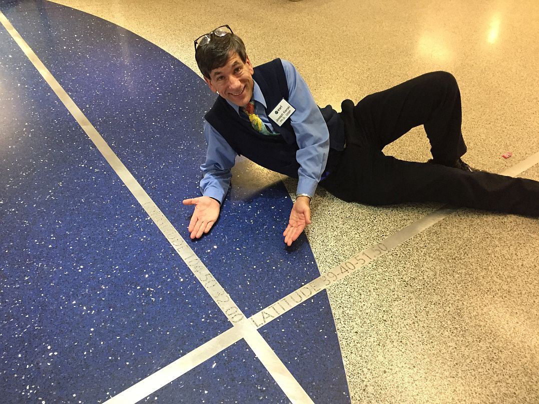
Self portrait at the half-second grid etched into the flooring. Above me are the stars of the Northern Hemisphere in their correct relative positions, represented as LED lights, on the ceiling.
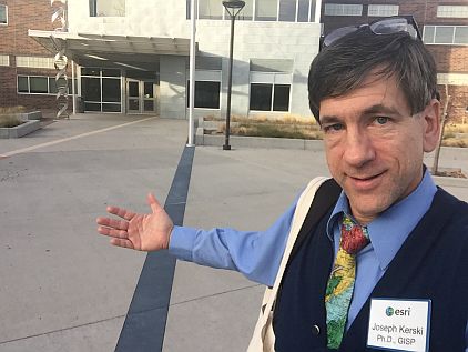
There is even a DNA double-helix statue outside the front door of the building.
How might you promote GIS in STEM education?
-Joseph Kerski, Education Manager
You must be a registered user to add a comment. If you've already registered, sign in. Otherwise, register and sign in.
About the Author
I believe that spatial thinking can transform education and society through the application of Geographic Information Systems for instruction, research, administration, and policy.
I hold 3 degrees in Geography, have served at NOAA, the US Census Bureau, and USGS as a cartographer and geographer, and teach a variety of F2F (Face to Face) (including T3G) and online courses. I have authored a variety of books and textbooks about the environment, STEM, GIS, and education. These include "Interpreting Our World", "Essentials of the Environment", "Tribal GIS", "The GIS Guide to Public Domain Data", "International Perspectives on Teaching and Learning with GIS In Secondary Education", "Spatial Mathematics" and others. I write for 2 blogs, 2 monthly podcasts, and a variety of journals, and have created over 6,500 videos on my Our Earth YouTube channel.
Yet, as time passes, the more I realize my own limitations and that this is a lifelong learning endeavor: Thus I actively seek mentors and collaborators.
Labels
-
Administration
77 -
Announcements
80 -
Career & Tech Ed
1 -
Curriculum-Learning Resources
257 -
Education Facilities
24 -
Events
72 -
GeoInquiries
1 -
Higher Education
594 -
Informal Education
281 -
Licensing Best Practices
90 -
National Geographic MapMaker
33 -
Pedagogy and Education Theory
224 -
Schools (K - 12)
282 -
Schools (K-12)
272 -
Spatial data
35 -
STEM
3 -
Students - Higher Education
245 -
Students - K-12 Schools
128 -
Success Stories
36 -
TeacherDesk
1 -
Tech Tips
117
- « Previous
- Next »

