- Home
- :
- All Communities
- :
- Products
- :
- ArcGIS Pro
- :
- ArcGIS Pro Questions
- :
- How to use the scale tool in Image Georeference?
- Subscribe to RSS Feed
- Mark Topic as New
- Mark Topic as Read
- Float this Topic for Current User
- Bookmark
- Subscribe
- Mute
- Printer Friendly Page
How to use the scale tool in Image Georeference?
- Mark as New
- Bookmark
- Subscribe
- Mute
- Subscribe to RSS Feed
- Permalink
- Report Inappropriate Content
Can someone please explain how to use the Scale function in the Image Georeference panel in ArcGIS Pro?
When I select scale, the image goes transparent a bit and a yellow dot appears at the center of the image:
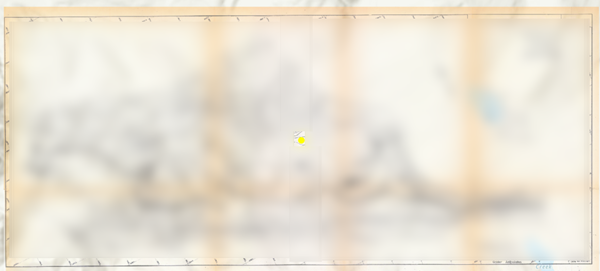
If you hover the mouse over this yellow dot you can see what appear to be 'grips' at the corners and mid-edge point on the image, but as soon as you move off the yellow dot these disappear:
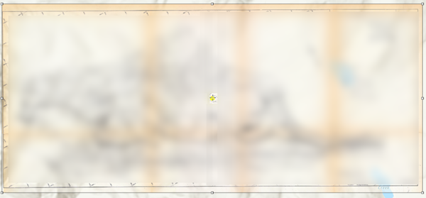
I've tried clicking the yellow dot and dragging, but this just causes the image to again disappear off screen?
What am I missing?!?
- Mark as New
- Bookmark
- Subscribe
- Mute
- Subscribe to RSS Feed
- Permalink
- Report Inappropriate Content
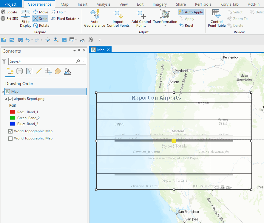
You should just be able to grab the handles and drag to scale the image:
If that isn't working, try in a new map or project, see what happens and report back.
- Mark as New
- Bookmark
- Subscribe
- Mute
- Subscribe to RSS Feed
- Permalink
- Report Inappropriate Content
Thanks Kory, it does work if I try it in another project...
I was thinking it should have been that easy, but the grab handles kept disappearing whenever the cursor left the Yellow anchor dot in the original project.
Thanks again.
- Mark as New
- Bookmark
- Subscribe
- Mute
- Subscribe to RSS Feed
- Permalink
- Report Inappropriate Content
This was also buggy for me with the grab handles disappearing. I opened a new project and have also found it working again.
- Mark as New
- Bookmark
- Subscribe
- Mute
- Subscribe to RSS Feed
- Permalink
- Report Inappropriate Content
This is still a problem for me as described by Warren. I hate to have to open a whole new project just to get this tool to work when it worked fine yesterday in my old project. Any updates of fixing this bug?
- Mark as New
- Bookmark
- Subscribe
- Mute
- Subscribe to RSS Feed
- Permalink
- Report Inappropriate Content
I have been having the same issue and did not want to start a new project to georeference. I went to the "add commands" ribbon and added scale (search by name or under the georeference prepare tool options) and it added it to the ribbon. I selected the new tool from the ribbon and then also went back to the georeference tab and selected the scale tool; and the scale tool worked. I zoomed out to the whole raster and was able to grab the corners finally. This solution is not logical but it worked for me.
- Mark as New
- Bookmark
- Subscribe
- Mute
- Subscribe to RSS Feed
- Permalink
- Report Inappropriate Content
I had the same issue and worked around it by manually entering the scale factor by pressing the A-key after select "Scale". The upscaling worked somewhat but I had to add a new control point after scaling.
https://pro.arcgis.com/en/pro-app/latest/help/data/imagery/georeferencing-tools.html