- Home
- :
- All Communities
- :
- Products
- :
- Geoprocessing
- :
- Geoprocessing Questions
- :
- Data does not display on the map, but present in t...
- Subscribe to RSS Feed
- Mark Topic as New
- Mark Topic as Read
- Float this Topic for Current User
- Bookmark
- Subscribe
- Mute
- Printer Friendly Page
Data does not display on the map, but present in the attribute table
- Mark as New
- Bookmark
- Subscribe
- Mute
- Subscribe to RSS Feed
- Permalink
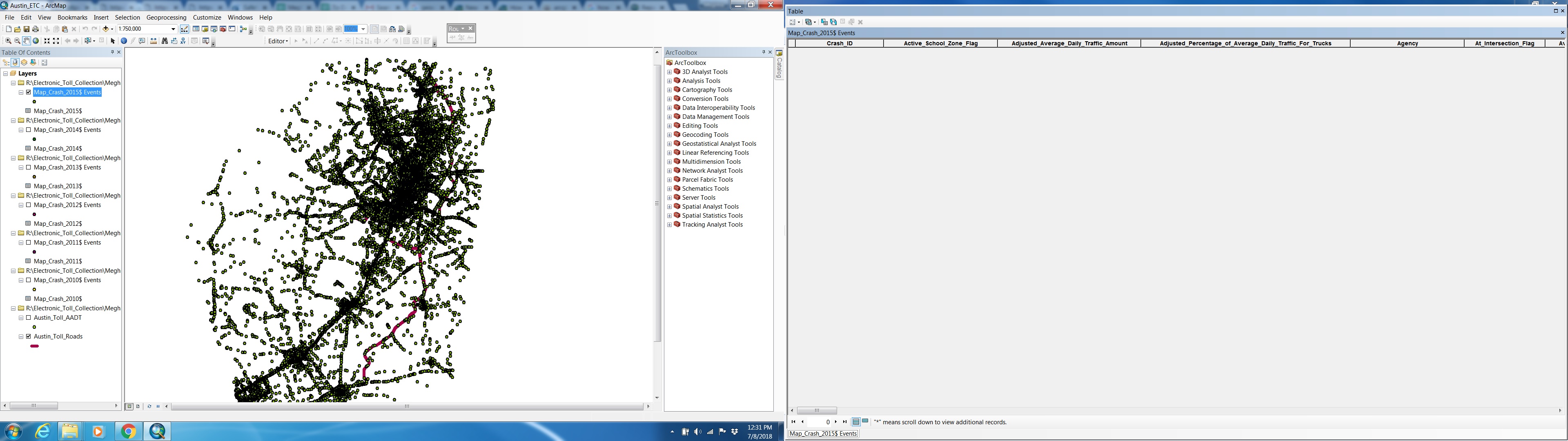
I am facing issues with geocoding point features from an excel sheet that contains the X and Y coordinates. I am successfully able to create the event layer from the spreadsheet. However, whenever I am trying to save the event layer (that is temporarily created while geocoding the points) as a shapefile, it does not display on the map. However, the attribute table shows that the data has correctly been exported to the shapefile. If it is so, then why am I not able to see the points in shapefile on the map? Please help. Thanks!
- Mark as New
- Bookmark
- Subscribe
- Mute
- Subscribe to RSS Feed
- Permalink
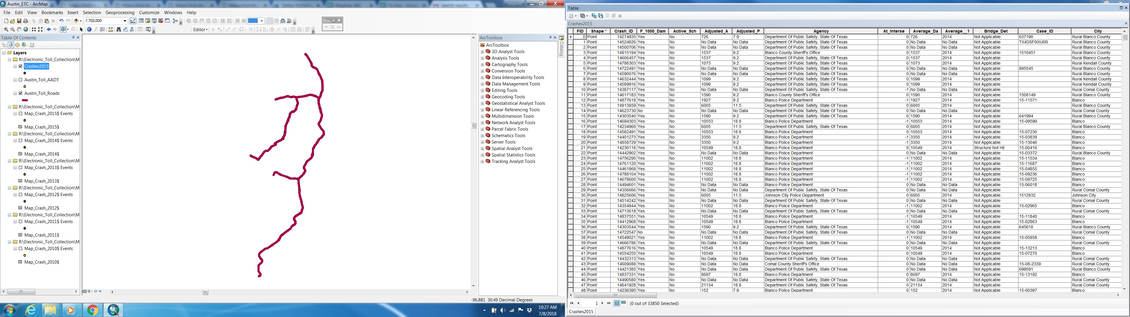
Your event points are overlaying some of the roads in the 2nd image.
Are you sure your roads (1st image) are complete?
Also... You should examine each layer in their own data frame without other data incase it is a matter of coordinate system differences. ie. are your roads and your event data in decimal degrees? An event layer should be converted to a featureclass/shapefile as soon as possible before making any further analysis
- Mark as New
- Bookmark
- Subscribe
- Mute
- Subscribe to RSS Feed
- Permalink
Yes, the events points are shown correctly, they will be overlapping with the roads layer and more. And all layers are in WGS 1984 coordinate system.
I absolutely agree with your last suggestion. And that was exactly what I was trying to do with the events layer. The events layer got created when i use "display X and Y" option. And the newly created events points show on the map but do not have any information in the attribute table. On the contrary, when I save the events layer to a shapefile it does not show anything on the map but has data in the attribute table. Attached the screenshots.
- Mark as New
- Bookmark
- Subscribe
- Mute
- Subscribe to RSS Feed
- Permalink
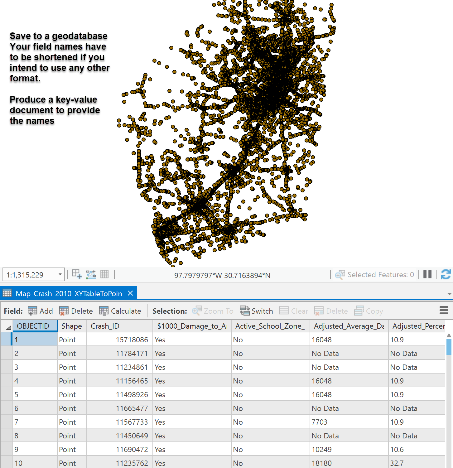
Xy to Point... save to a file geodatabase... everything is there... won't be a shapefile given the field names
- Mark as New
- Bookmark
- Subscribe
- Mute
- Subscribe to RSS Feed
- Permalink
This was helpful. Thank you very much. I tried another way out and it worked too. So wanted to share the method as well. I used "Display X and Y data" tool to create the event layer. Then I used the Features to Points tool with the events layer to create the final shapefile.