- Home
- :
- All Communities
- :
- Industries
- :
- Water Resources
- :
- Water Resources Questions
- :
- Re: watershed
- Subscribe to RSS Feed
- Mark Topic as New
- Mark Topic as Read
- Float this Topic for Current User
- Bookmark
- Subscribe
- Mute
- Printer Friendly Page
watershed
- Mark as New
- Bookmark
- Subscribe
- Mute
- Subscribe to RSS Feed
- Permalink
i'm using arcGIS 10.1 ,i'm working on a watershed to find the water path ,i arrives to flow accumulation ,in this step i should have
the path visible but this is what i got
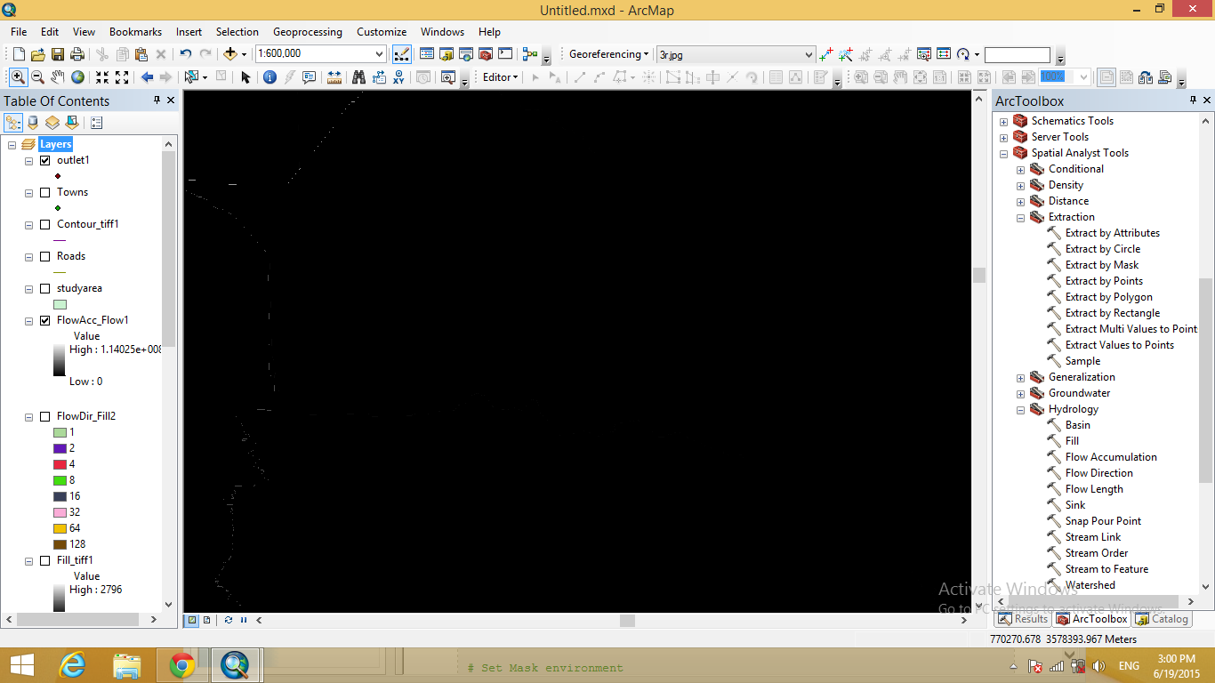
how to make the water path clear ??
- Mark as New
- Bookmark
- Subscribe
- Mute
- Subscribe to RSS Feed
- Permalink
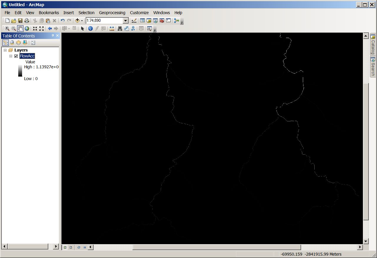
As a raster, this is not surprising, especially if you have a very high resolution DEM. Each flow path is only 1 pixel wide, which doesn't show up at high zoom levels. Once you zoom in, the flow paths look more correct.
For better symbolizing of your stream, you need to use a raster calculator, to set the minimum number of pixels to be considered a stream, then you can use the Stream to Feature Tool to Convert them to a polyline feature class.
ArcGIS Help 10.1 Deriving runoff characteristics
ArcGIS Desktop Stream to Feature
- Mark as New
- Bookmark
- Subscribe
- Mute
- Subscribe to RSS Feed
- Permalink
Yes, this looks like a normal flow accumulation result. As Ian says, it's just that you are zoomed out to 1:600K. Try using the zoom tool to zoom in to those lighter looking pixels on the left of the screen, perhaps 1:40K, and I think you'll see your flow accumulation is fine.
- Mark as New
- Bookmark
- Subscribe
- Mute
- Subscribe to RSS Feed
- Permalink
thank you sephe fox
that's right when you zoom in on the pixels on the lift of the screen i can see the flow accumulation but there must be more flow like in the middle of the screen which i can't find even when i use the zoom in tool
- Mark as New
- Bookmark
- Subscribe
- Mute
- Subscribe to RSS Feed
- Permalink
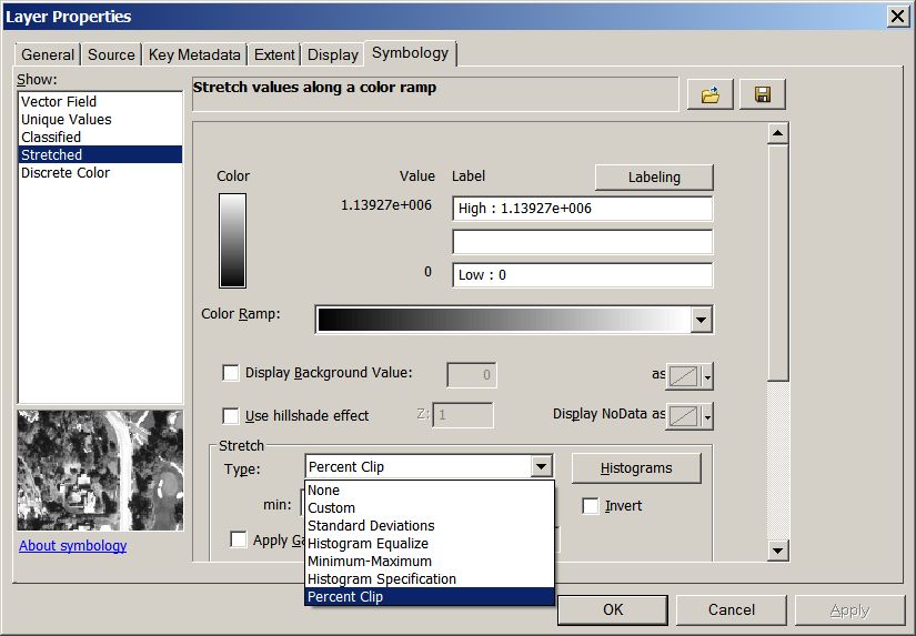
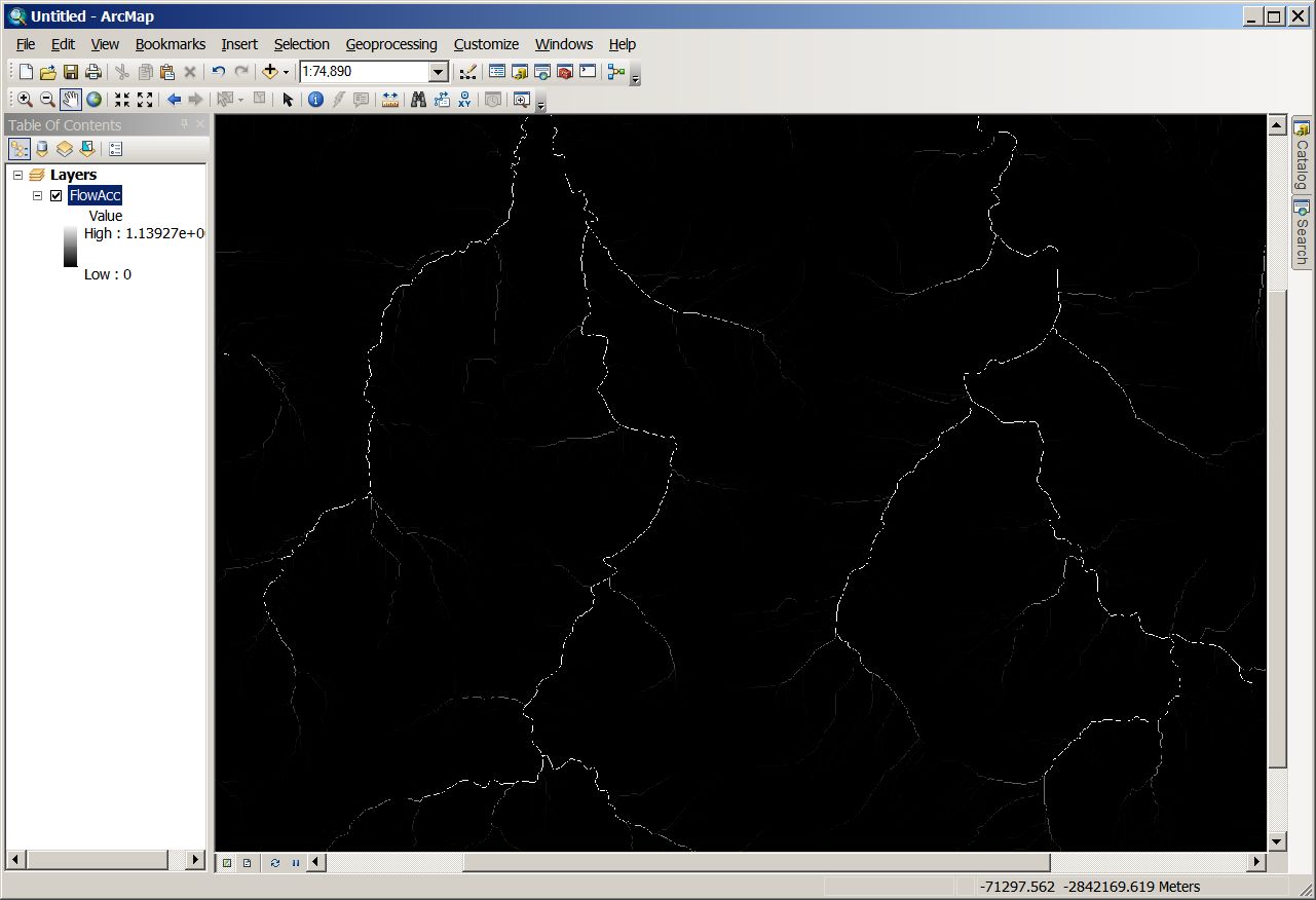
Apart rom zooming in to something reasonable given your pixel size, it also helps to play with the raster stretch options in the symbolgy tab. Mine always defaults to percent clip, here changed to standard dev.
- Mark as New
- Bookmark
- Subscribe
- Mute
- Subscribe to RSS Feed
- Permalink
thank you for the fast reply ian murry
when i zoom in, nothing changes in the middle of the picture above (which is the area i need)
what i think i need to do is the "raster calculator" you mentioned ,can you help in how to do that??
thank you
- Mark as New
- Bookmark
- Subscribe
- Mute
- Subscribe to RSS Feed
- Permalink
Mahmod,
Take a look at this help thread, it go through all the steps you need for hydrologic analysis.
The step I described was #6 in that help, where you will need to determine for yourself, what the minimum flow accumulation value is that you want to consider a stream. You can use the Con(Spatial Analyst) Tool, to determine what values will be considered stream or not stream. There is a link for the help with the Con Tool in the link I posted, but the goal is to set the minimum flow accumulation values, then turn the flow accumulation raster into a binary raster, either the pixel meets the threshold value and is turned into a 1(so is a stream) or does not meet the threshold value and is a 0 (not a stream). You may want to test with several values as the threshold until it fits how you feel the watershed should be characterized.
- Mark as New
- Bookmark
- Subscribe
- Mute
- Subscribe to RSS Feed
- Permalink
You need to reclassify the "flowAcc" between 0 and 1 with the raster math and you will se the flow accumulation line "1".
- Mark as New
- Bookmark
- Subscribe
- Mute
- Subscribe to RSS Feed
- Permalink
thank you nicola peddis but how i can do that ?
- Mark as New
- Bookmark
- Subscribe
- Mute
- Subscribe to RSS Feed
- Permalink
With the raster reclass tool you need to reclassify the low vault to zero and the high vault to 1.
Then with the tool Stream to Feature Tool(or the raster to feature class) you can convert the single pixel 1 to a polyline or polylineM feature class to store also the the length of each portion of the river .
But to understand every single step use the raster math help: It will guide you through the whole the job.
ArcGIS Help 10.1 raster reclass tool
using reclassification tables