- Home
- :
- All Communities
- :
- Industries
- :
- Water Resources
- :
- Water Resources Questions
- :
- Re: ArcHydro - Batch Watershed Delineation output ...
- Subscribe to RSS Feed
- Mark Topic as New
- Mark Topic as Read
- Float this Topic for Current User
- Bookmark
- Subscribe
- Mute
- Printer Friendly Page
ArcHydro - Batch Watershed Delineation output error.
- Mark as New
- Bookmark
- Subscribe
- Mute
- Subscribe to RSS Feed
- Permalink
Hi. When running the Batch Watershed Delineation tool, the output feature class is always slightly "shifted" when overlaid on the Catchment, Adjoint Catchment, and Batch SubWatershed Delineation output. Meaning it is not coincident and topologically correct compared to the 3 above mentioned feature classes. Anyone else experience this or have any idea how to remedy the situation?! We have tried several tactics... re-projecting the base DEM, making sure all input layers are the same projection, etc... all with no success. We are running ArcGIS 10.2.2, ArcHydro Build 10.2.0.85, and Windows 7 64 bit OS. Thanks.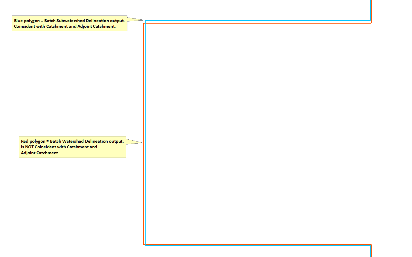
- Mark as New
- Bookmark
- Subscribe
- Mute
- Subscribe to RSS Feed
- Permalink
I haven't had that specific issue with ArcHydro. However, you may want to be sure that the snap raster environment variable is set. I usually set it to the DEM and then all subsequent rasters will be coincident.
http://resources.arcgis.com/en/help/main/10.2/index.html#//001w0000000m000000
- Mark as New
- Bookmark
- Subscribe
- Mute
- Subscribe to RSS Feed
- Permalink
Thomas,
Thanks. We appreciate the reply but we have tried working with the snap
raster environment on several occasions with no success. Our raster data
lines up, its the resulting vector data that does not.
- Mark as New
- Bookmark
- Subscribe
- Mute
- Subscribe to RSS Feed
- Permalink
Thomas,
Thanks. We appreciate the reply but we have tried working with the snap raster environment on several occasions with no success. Our raster data lines up, its the resulting vector data that does not.
- Mark as New
- Bookmark
- Subscribe
- Mute
- Subscribe to RSS Feed
- Permalink
If your image is zoomed all the way into a raster cell, I would suspect you need to set tolerances equal or that you are expecting too much precision.
- Mark as New
- Bookmark
- Subscribe
- Mute
- Subscribe to RSS Feed
- Permalink
Mark,
Thanks for the reply. Yes, my image is zoomed in very tight.
How would I set the tolerances equal?
I don't think I'm expecting too much precision as we used to never experience this issue when using an older DEM,a long with older versions of ArcGIS and ArcHydro. Since using a new DEM as our base, this has been a new issue that we can't resolve. Its not the end of the world but it creates massive headaches when using vector topology to ensure that the watershed polygons are coincident.