- Home
- :
- All Communities
- :
- Developers
- :
- Python
- :
- Python Questions
- :
- Re: Iteration with "For" does not works for Raster...
- Subscribe to RSS Feed
- Mark Topic as New
- Mark Topic as Read
- Float this Topic for Current User
- Bookmark
- Subscribe
- Mute
- Printer Friendly Page
Iteration with "For" does not works for Raster Object in Arcgis Pro 2.5
- Mark as New
- Bookmark
- Subscribe
- Mute
- Subscribe to RSS Feed
- Permalink
Hello,
I was trying to iterate through folder with rasters for some calculations between the bands of each one.
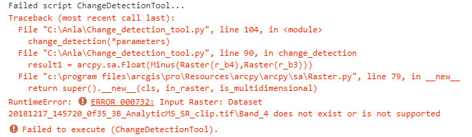
I have a script that is stored in a toolbox and ask for couple of parameters. when I run the script, it makes the process for the first image but after that it does not works for the next one and the following error appears:
I should mention that I tried the same but running the script as stand-alone using the python command promt and it works
Then I tried something easy in the python window in ArcgisPRO:
import arcpy
from arcpy.sa import *
from arcpy import env
import os
arcpy.env.workspace = 'C:\\Imagenes_Satelitales\\2018\\Junio\\Poligono3'
arcpy.env.overwriteOutput = True
LR = arcpy.ListSpatialReferences('*SR_clip*')
LR
['20180607_145218_0f4e_3B_AnalyticMS_SR_clip.tif', '20180607_145219_0f4e_3B_AnalyticMS_SR_clip.tif', '20180607_145220_0f4e_3B_AnalyticMS_SR_clip.tif']
for raster in LR:
#getting bands
Image = Raster(raster)
b3 = Image.getRasterBands()[2]
b4 = Image.getRasterBands()[3]
result = arcpy.sa.Float(b4 - b3)
name = os.path.splitext(raster)[0]
result.save(os.path.join('C:\\Imagenes_Satelitales\\2018\\Junio\\Poligono3', name + 'result.tif')
Traceback (most recent call last):
File "<string>", line 3, in <module>
File "c:\program files\arcgis\pro\Resources\arcpy\arcpy\sa\Raster.py", line 79, in __new__
return super().__new__(cls, in_raster, is_multidimensional)
RuntimeError: ERROR 000732: Input Raster: Dataset 20180607_145218_0f4e_3B_AnalyticMS_SR_clip.tif does not exist or is not supported
That type of error is the same that I got when I run the complete script.
For now, I am going to continue using the python command promt for running the script but I would like to do it from the toolbox that I have for that purpose.
Thanks,
Jhon Eric
Solved! Go to Solution.
Accepted Solutions
- Mark as New
- Bookmark
- Subscribe
- Mute
- Subscribe to RSS Feed
- Permalink
Try passing the full path of the rasters and not relying on behind-the-scenes path concatenation.
- Mark as New
- Bookmark
- Subscribe
- Mute
- Subscribe to RSS Feed
- Permalink
is this line in error?
LR = arcpy.ListSpatialReferences('*SR_clip*')
yet the *.tif files are listed and not the spatial references?
/blogs/dan_patterson/2016/08/14/script-formatting
will provide line numbers.
- Mark as New
- Bookmark
- Subscribe
- Mute
- Subscribe to RSS Feed
- Permalink
Sorry Dan,
yes, it was an error when I pasted
The line was:
LR = arcpy.ListRasters(*SR_clip*)
so, it was the reason just rasters names were listed.
But the error occurs when I try to do any math operation using Raster object, script works for the first image, after that the error occurs.
Thanks
- Mark as New
- Bookmark
- Subscribe
- Mute
- Subscribe to RSS Feed
- Permalink
If you follow the path to the Raster.py script in the C:\...your installation folder... \Resources\ArcPy\arcpy\sa
I am wondering if it doesn't like what it is finding in the files in terms of the number of bands, the band numbers/names. Of course, I am assuming that it isn't a multidimensional raster not to be confused with a multiband raster.
I would suggest that you throw in a few lines to print out some of the raster properties to confirm what is actually in there. There is nothing in the code that would fail unless it was getting something it wasn't expecting (at least at first glance).
- Mark as New
- Bookmark
- Subscribe
- Mute
- Subscribe to RSS Feed
- Permalink
Hi everyone,
Thank you for bringing this up Jhon Eric. I'm having this same issue, trying to iterate through rasters in a geodatabase, in Arc Pro 2.5. I am able to successfully output the first raster in my list, but it fails on the second time around.

# text version
def convert_depth_raster(self, parameters):
arcpy.env.workspace = self.gdb_out
db_rasters = arcpy.ListRasters("*")
print("Converting depth bands: ", db_rasters)
for r in db_rasters:
convert = ((1.4661 * 182329)/(2 * arcpy.sa.Raster(r) * 1.732)) / 1852
lnm_name = r.replace('DepthBand', 'LNM')
lnm_out = self.gdb_out + "\\" + lnm_name
convert.save(lnm_path)
print("Created: ", lnm_out)
Traceback (most recent call last):   File "<string>", line 257, in execute   File "<string>", line 234, in convert_depth_raster   File "c:\users\matt sharr\appdata\local\programs\arcgis\pro\Resources\arcpy\arcpy\sa\Raster.py", line 79, in __new__     return super().__new__(cls, in_raster, is_multidimensional) RuntimeError: ERROR 000732: Input Raster: Dataset DepthBand_21_40 does not exist or is not supported

Are there any known solutions at this time? Are there other workarounds besides model builder and manually iterating?

Thank you,
-Matt
- Mark as New
- Bookmark
- Subscribe
- Mute
- Subscribe to RSS Feed
- Permalink
Try passing the full path of the rasters and not relying on behind-the-scenes path concatenation.
- Mark as New
- Bookmark
- Subscribe
- Mute
- Subscribe to RSS Feed
- Permalink
That did it. Thanks, Joshua.
- Mark as New
- Bookmark
- Subscribe
- Mute
- Subscribe to RSS Feed
- Permalink
Should the approach you originally took work? Probably, but I consider it a best practice to always use full paths with geoprocessing tools. Not only does doing so reduce the risk of running into odd defects like this, it simplifies troubleshooting because there is no guessing what was passed to the geoprocessing tools.