- Home
- :
- All Communities
- :
- Industries
- :
- Public Safety
- :
- Public Safety Questions
- :
- Topology AddIn Guinea Pig wanted
- Subscribe to RSS Feed
- Mark Topic as New
- Mark Topic as Read
- Float this Topic for Current User
- Bookmark
- Subscribe
- Mute
- Printer Friendly Page
Topology AddIn Guinea Pig wanted
- Mark as New
- Bookmark
- Subscribe
- Mute
- Subscribe to RSS Feed
- Permalink
- Report Inappropriate Content
Hey everybody,
On a monthly basis I create a bunch of topologys to make sure that my polygon layers don't overlap or have gaps (ESN). I also run a topology on my street layer to find street segments that aren't snapped. This process consists mostly of models.
Since I always try to help my Public safety brethren, I figured I compile my process in a Python AddIn, that "should be easy to use". I started a day ago and have the skeleton of the AddIn finished and now I am looking for a Guinea Pig (I am looking at you Chris Donohue, GISP & Joe Borgione ) to use it!
Latest Update:
- Created an official document: Topology Check Python AddIn (6/30/17)
- Added Error message when the wrong feature is chosen for certain Checks (i.e. polygon feature is chosen for dangle check)
- Now works with ArcGIS Desktop Standard
- Latest test version that includes a polygon break check. This check make sure that your line features are broken when they intersect with a polygon feature. Just select the line feature and polygon feature in the TOC and run the check.
Dropbox - TopoAddIn.esriaddin 10.3.1 + version
Here is what you need:
ArcGIS Desktop Standard 10.3.1 or later versions
Here is how it works:
1. You would download the add in HERE. (10.1 version HERE )
2. Double click it and install it.
3. Open an MXD and add a polygon layer and a street layer.
4.The toolbar should be there but if it is not click on Customize -> Toolbars -> TopoCheck
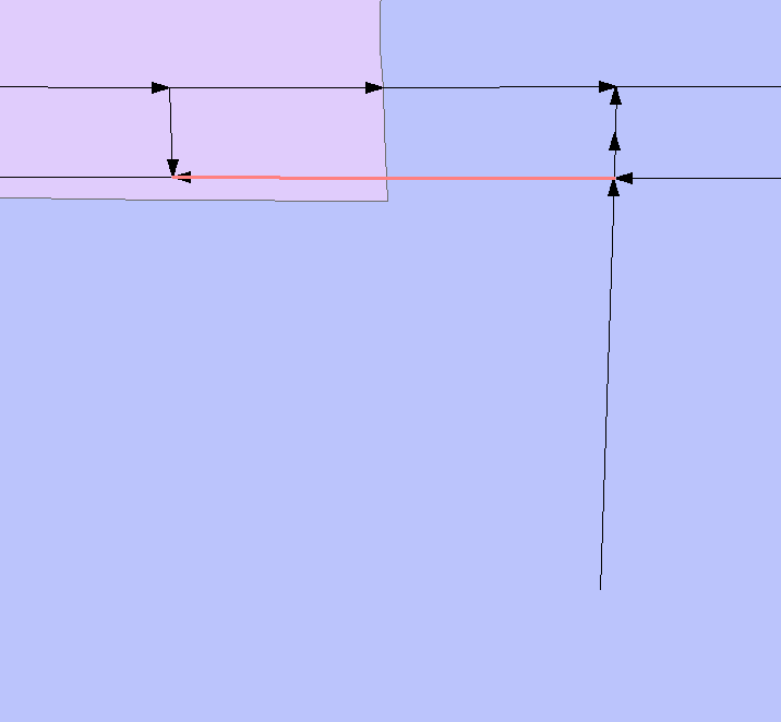
5. Follow the steps in the screenshot!

As I said it is still a work in progress, especially the street dangle check.
Let me know what you think!
Tim
- Mark as New
- Bookmark
- Subscribe
- Mute
- Subscribe to RSS Feed
- Permalink
- Report Inappropriate Content
Tim -
Just a note of thanks for the tool and its updates, from a 9-1-1 GIS cohort of Heather Widlund.
Joe Borgione - it's been a long time since you visited us for Spillman in Montrose, CO. The PD did eventually upgrade to a geobase on our regional GIS data.
- Mark as New
- Bookmark
- Subscribe
- Mute
- Subscribe to RSS Feed
- Permalink
- Report Inappropriate Content
Joe Borgione Chris Donohue, GISP Heather Widlund Thanks for all your input! The addin will be in an article in this years ArcUser summer edition! http://www.esri.com/~/media/Files/Pdfs/news/arcuser/0617/new-ways-to-work.pdf
- Mark as New
- Bookmark
- Subscribe
- Mute
- Subscribe to RSS Feed
- Permalink
- Report Inappropriate Content
If I can suggest it, there is one more bit of functionality that I've seen in other tools that could be added to really make this rock. How about adding an icon to the toolbar with the mouseover of "Buy Tim a drink" and the related functionality to allow users to make that happen. Of course, you would have to make a design choice of your preferred beverage 


Thanks for all the coding and the willingness to share it with the community!
Chris Donohue, GISP
- Mark as New
- Bookmark
- Subscribe
- Mute
- Subscribe to RSS Feed
- Permalink
- Report Inappropriate Content
Haha, thanks Chris! I need to find a way to change the button from coffee to beer depending on the time of day!
- Mark as New
- Bookmark
- Subscribe
- Mute
- Subscribe to RSS Feed
- Permalink
- Report Inappropriate Content
Thoughts on a tool that shows were streets aren't broken at ESZ changes?
- Mark as New
- Bookmark
- Subscribe
- Mute
- Subscribe to RSS Feed
- Permalink
- Report Inappropriate Content
TIm- I don't like to break streets mid-block for ESZs, rather I convince the chiefs that Intersections work best for an ESZ edge. Unless of course you have completely different jurisdictions at mid-block, which around here is rare. The thing about mid-block ESZs is there might be a nice house fire just beyond the boundary for station X and they will complain it should be them and not Station Y. But Station X will complain when some senior citizen falls off the toilet in the middle of night and its just inside thier ESZ; "you should have sent station Y, it's theirs!" (Not that I've ever had either experpience...)
- Mark as New
- Bookmark
- Subscribe
- Mute
- Subscribe to RSS Feed
- Permalink
- Report Inappropriate Content
I agree Joe, I would love to be able to not break up blocks. The issue is that we have 10+ agencies in my county that have their own fire and police department. not to mention cities just like to annex where ever, which means that they will be responsible for fire and police dispatch.
- Mark as New
- Bookmark
- Subscribe
- Mute
- Subscribe to RSS Feed
- Permalink
- Report Inappropriate Content
We have some of the same issues here with Fire and police jurisdictions especially Fire some of these things break in the middle of a field on a particular property. So a tool like that would be helpful for us. BTW where can I snag the latest version of the tool it's been a while since I looked at this thread and I need to do some QC big time.
- Mark as New
- Bookmark
- Subscribe
- Mute
- Subscribe to RSS Feed
- Permalink
- Report Inappropriate Content
You can find the latest version here: https://community.esri.com/docs/DOC-9983-topology-check-python-addin
- Mark as New
- Bookmark
- Subscribe
- Mute
- Subscribe to RSS Feed
- Permalink
- Report Inappropriate Content
Anybody who wants to test out the newest feature? https://www.dropbox.com/s/i6w2e8dg2d9zygt/TopoAddIn.esriaddin?dl=0
I added a check where you can select a line and polygon feature, and make sure that the line segments break at polygon borders.