- Home
- :
- All Communities
- :
- Products
- :
- ModelBuilder
- :
- ModelBuilder Questions
- :
- add file from path in attribute table
- Subscribe to RSS Feed
- Mark Topic as New
- Mark Topic as Read
- Float this Topic for Current User
- Bookmark
- Subscribe
- Mute
- Printer Friendly Page
add file from path in attribute table
- Mark as New
- Bookmark
- Subscribe
- Mute
- Subscribe to RSS Feed
- Permalink
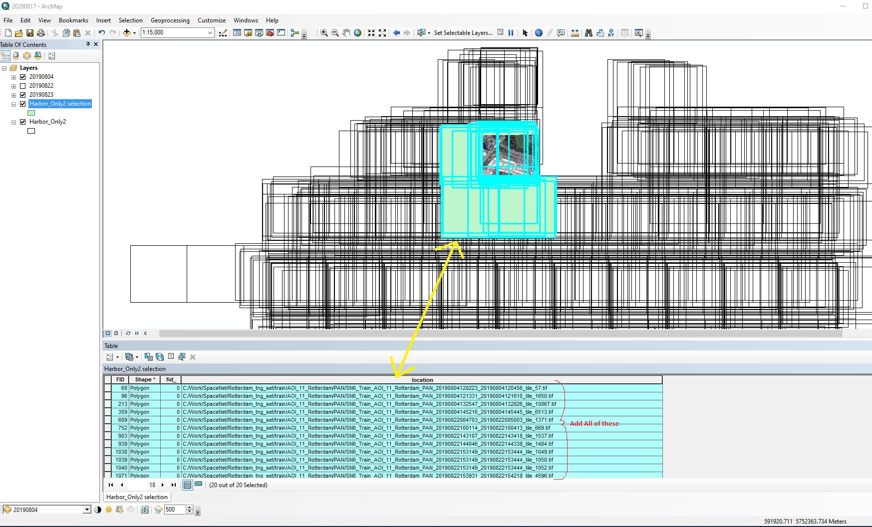
Looking for a way to add several (or a few) tiff file who's full path is listed in a shapefile's attribute table to the data view.
I have a shapefile denoting the coverage of 100's of individual tiffs that I would like to open in the data view after selecting a few based on their location.
The full path to the individual tiff is listed in the attribute table under a field titled "location" in the table. I would like to select a few of the listed tiffs and load them without selecting each one from the normal "Add Data" method.
Basically, have a button that would allow me to add all the selected individual polys associated raster's from the tables listed path.

- Mark as New
- Bookmark
- Subscribe
- Mute
- Subscribe to RSS Feed
- Permalink
This is probably a better question for the ArcMap place or ModelBuilder group.
Conceptually, once you've selected your handful of records from the attribute table, you could iterate through the field that contains the tiff's full paths: Iterate Field Values (ModelBuilder)—ArcMap | Documentation and with each path, add the raster to the map as a layer using Make Raster Layer (Data Management)—ArcMap | Documentation
- Mark as New
- Bookmark
- Subscribe
- Mute
- Subscribe to RSS Feed
- Permalink
Kory suggests a modelbuilder route which would work, but you specifically ask for a button. This could be done by developing either an AddIn (using ArcObjects in say VB .net) or you can create a python addin. The .Net route would require a developer but is very flexible, the python addin could be done by a user with a strong knowledge of python/gis system. Either way if you want a custom button that would significantly reduce your work load and speed up your analysis then you need to call upon an ArcMap developer, boils down to how much you are prepared to spend. I'm a developer in the UK but you may find someone more local?