- Home
- :
- All Communities
- :
- Products
- :
- Mapping
- :
- Mapping Questions
- :
- How to stretch layer elements?
- Subscribe to RSS Feed
- Mark Topic as New
- Mark Topic as Read
- Float this Topic for Current User
- Bookmark
- Subscribe
- Mute
- Printer Friendly Page
- Mark as New
- Bookmark
- Subscribe
- Mute
- Subscribe to RSS Feed
- Permalink
Hello,
My map of British Columbia (attached) is too squished for my liking. I realize that's how the province actually is, but for visualization purposes, I'd like it stretched taller. Problem is, in layer view I cannot seem to distort the frame to what I want. Checking/unchecking preserve aspect ratio makes no difference.
Solved! Go to Solution.
Accepted Solutions
- Mark as New
- Bookmark
- Subscribe
- Mute
- Subscribe to RSS Feed
- Permalink
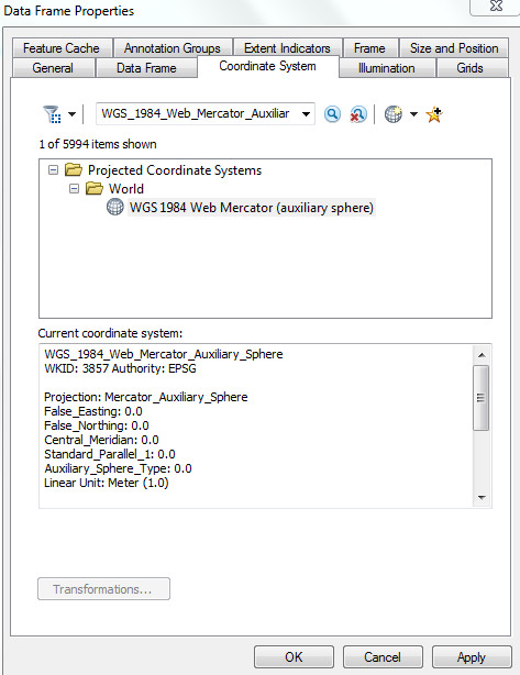
What is the coordinate system of the map? Try changing the coordinate system of the data-frame to WGS_1984_Web_Mercator_Auxiliary_Sphere (WKID: 3857).
Think Location
- Mark as New
- Bookmark
- Subscribe
- Mute
- Subscribe to RSS Feed
- Permalink
What is the coordinate system of the map? Try changing the coordinate system of the data-frame to WGS_1984_Web_Mercator_Auxiliary_Sphere (WKID: 3857).
Think Location
- Mark as New
- Bookmark
- Subscribe
- Mute
- Subscribe to RSS Feed
- Permalink
You have no projection set... BC has a couple of nice projections, you should use one to restore it's appearance to the grandure it deserves. Go to Projected Coordinates, National Grids, Canada...
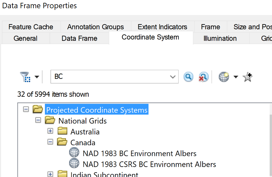
Then of course there are a whole load of non-BC names ones, which would also be appropriate. I would check to see what other data you might be using from the province. If you are using data from the Feds, then you may wish to adopt one of those projections as well.