- Home
- :
- All Communities
- :
- User Groups
- :
- LIDAR Resources
- :
- Questions
- :
- Re: LIDAR - I need a 'selectable' LAS Dataset
- Subscribe to RSS Feed
- Mark Topic as New
- Mark Topic as Read
- Float this Topic for Current User
- Bookmark
- Subscribe
- Mute
- Printer Friendly Page
LIDAR - I need a 'selectable' LAS Dataset
- Mark as New
- Bookmark
- Subscribe
- Mute
- Subscribe to RSS Feed
- Permalink
Hello
I have a few years GIS experience but this is my first time working with LIDAR data.
I don't need to be able to 'process' the data itself. I only intend to be the keeper of the data and enable people to request data from me in small batches. So I need a way of indexing the data.
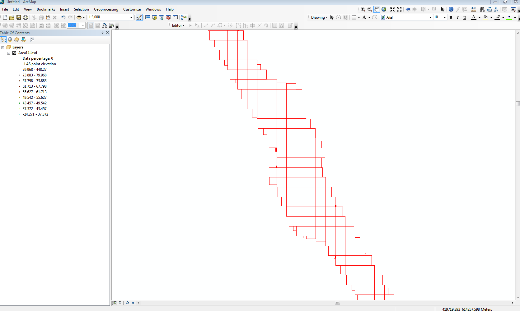
So far I have used the 'Create LAS Dataset' tool which has given me a 'grid' showing the extend of the individual LAS files. Great!
However I am not able to select / export this layer.
I want to be able to drag a box around a 'search area' and obtain a list of the LAS files within.
This list would be used in a batch file which would select and package the selected files for distribution.
Can the LAS Dataset i have created be converted to a shape file? If not... how can I make the layer query-able?
I am aware of the multipoint tool and it has been suggested that this may hold the answer, but I do not have 3D analyst. So any solution must work with my Standard 10.1 license.
Any help appreicated!
Chris : )
- Mark as New
- Bookmark
- Subscribe
- Mute
- Subscribe to RSS Feed
- Permalink
LAS datasets have a footprint. Load it into arcmap then on the TOC, right click on the footprint then choose export data.
- Mark as New
- Bookmark
- Subscribe
- Mute
- Subscribe to RSS Feed
- Permalink
Hi Mike, thanks for your reply.
By footprint, do you mean the 'blocks' that are visible on the map?
After creating the LAS dataset I selected the option in the properties to "always show LAS file extents".
Is this the 'footprint' ?
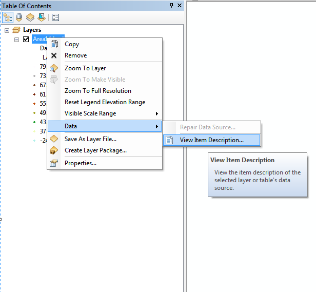
I have right clicked on the layer in the TOC and can't see an option to export.
Under 'data' where you would usually see an export option (if the layer was a shp) I only have an option to 'view item description'.
I expect I'm doing something fundamentally wrong here. Perhaps the footprint you mention is a separate file I need to load into the map?
thanks!!!
Chris
- Mark as New
- Bookmark
- Subscribe
- Mute
- Subscribe to RSS Feed
- Permalink
Maybe this can help http://www.arcgis.com/home/item.html?id=d8782286e3c9442bb5c244bf39da5966
- Mark as New
- Bookmark
- Subscribe
- Mute
- Subscribe to RSS Feed
- Permalink
When working with las files, LASTOOLS has been most useful for me.
- Mark as New
- Bookmark
- Subscribe
- Mute
- Subscribe to RSS Feed
- Permalink
Mike and Xander, thanks for your replies.
I stumbled across LASTOOLS and got quite excited about it until I saw the cost.
Unfortunately it is highly unlikely my company will pay for it, or for 3D analyst.
However I have made some progress.
Rather than simply creating the LAS Dataset, I have created a Mosaic Dataset then added the LAS files to it.
I initially followed a step by step guide I found but the footprint created was the 'overall' footprint.
This was due to an option being ticked to 'treat folders as files' (or something along those lines).
I unchecked that option and ran it again. It took MUCH longer but the footprint is now for the individual LAS files.
I included only half of the 49,000 LAS files I have. I will run the rest later then merge the footprints.
So for now.... my query has been solved (although I would really like to be able to do more!)
thanks : )
- Mark as New
- Bookmark
- Subscribe
- Mute
- Subscribe to RSS Feed
- Permalink
Great that you have advanced on the matter, but it sounds a little strange a company is not willing to invest in some tools that you will need to process 49000 LAS file... The additional time you will have to invest to do things in a less optimal way (since you lack the proper tools) is costly too.