- Home
- :
- All Communities
- :
- Products
- :
- Imagery and Remote Sensing
- :
- Imagery Questions
- :
- Re: Raster smoothing from Image Analysis in arcpy
- Subscribe to RSS Feed
- Mark Topic as New
- Mark Topic as Read
- Float this Topic for Current User
- Bookmark
- Subscribe
- Mute
- Printer Friendly Page
Raster smoothing from Image Analysis in arcpy
- Mark as New
- Bookmark
- Subscribe
- Mute
- Subscribe to RSS Feed
- Permalink
- Report Inappropriate Content
Hi,
I would like to apply a smoothing function on multiple rasters using arcpy. How can I achieve that? The function is shown below:
I suspect it should be in the "Add Function" menu and then I could export it, but I couldn't really find anything related.
- Mark as New
- Bookmark
- Subscribe
- Mute
- Subscribe to RSS Feed
- Permalink
- Report Inappropriate Content
There are convolution filters available in the spatial analyst ....filters....
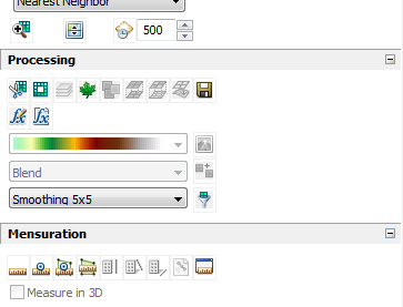
but I think you are referring to these .... convolution function filters 5x5 smoothing
- Mark as New
- Bookmark
- Subscribe
- Mute
- Subscribe to RSS Feed
- Permalink
- Report Inappropriate Content
I moved the post to Imagery and Remote Sensing since GeoNet Help is about getting help on how to use GeoNet... The GeoNet community structure document may help to filter your questions
- Mark as New
- Bookmark
- Subscribe
- Mute
- Subscribe to RSS Feed
- Permalink
- Report Inappropriate Content
Hi,
(if I am not wrong), there is no direct way to apply a (single stand-alone) raster function by arcpy - and thats what the convolution filters are. But this doesnt mean there is no way to do it. What you will have to do is "wrap" this raster function into a function template file (see here how to generically create one or here on how to export them) and then use the gp-tool "Edit Raster Function" to apply the function to a raster.
If you want to maintain this outside an mxd/layer you better put your rasters into mosaic dataset(s). There you can apply function chains on a single raster basis, by default for all or provide many different ones (Raster Function Templates) for the user to choose from.
- Mark as New
- Bookmark
- Subscribe
- Mute
- Subscribe to RSS Feed
- Permalink
- Report Inappropriate Content