- Home
- :
- All Communities
- :
- Products
- :
- Geoprocessing
- :
- Geoprocessing Questions
- :
- TIN to Raster
- Subscribe to RSS Feed
- Mark Topic as New
- Mark Topic as Read
- Float this Topic for Current User
- Bookmark
- Subscribe
- Mute
- Printer Friendly Page
TIN to Raster
- Mark as New
- Bookmark
- Subscribe
- Mute
- Subscribe to RSS Feed
- Permalink
Hi, I want to use 3 different series of Data in the form of TIN for a viewshed analysis. I thought to convert them to raster because as I saw, I cannot do a viewshed in the form of TIN. My problem is that when I convert TIN to Raster from the 3D Analysis toolbox, although the resolution in TIN is 10meters, in Raster is almost 30meters. Why is that? Can't i convert it to raster and to have the same resolution? The analysis at my raster is being made for 30 meters resolution or for 10 meters at last?
Thank you very much
- Mark as New
- Bookmark
- Subscribe
- Mute
- Subscribe to RSS Feed
- Permalink
Yes as I stated earlier. The link to the help topic is in your viewshed thread.
- Mark as New
- Bookmark
- Subscribe
- Mute
- Subscribe to RSS Feed
- Permalink
Hi Kon,
Did you try changing the environment setting of the tool?
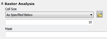
Think Location
- Mark as New
- Bookmark
- Subscribe
- Mute
- Subscribe to RSS Feed
- Permalink
Yes, the default were the numbers I wrote above
- Mark as New
- Bookmark
- Subscribe
- Mute
- Subscribe to RSS Feed
- Permalink
Kon,
If you are still having this issue, maybe you would consider uploading one of your tins so that we can better understand what is happening here.
- Mark as New
- Bookmark
- Subscribe
- Mute
- Subscribe to RSS Feed
- Permalink
Luke thanks for your interest. I don't have that issue, i just put the resolution i wanted at the cell size. My wonderies are just when I have a TIN from 10 meters resolution elevation data, and I create a raster from that TIN with resolution bigger than 10 meters, for example 1meter resolution (that I define every time), what are the restrictions of that step, you know the theory. This is mainly my problem, the theory beyond that. Thanks a lot.
- Mark as New
- Bookmark
- Subscribe
- Mute
- Subscribe to RSS Feed
- Permalink
Tin to raster How TIN To Raster works—Help | ArcGIS for Desktop
raster to TIN How Raster To TIN works—Help | ArcGIS for Desktop
In either case, either data structure is only as good as your input data, and that includes considerations of accuracy and in the case of precision you also need to look at spacing between the intervening point (if variable), the type of interpolator or aggregator in the case of rasters.
- « Previous
-
- 1
- 2
- Next »
- « Previous
-
- 1
- 2
- Next »