- Home
- :
- All Communities
- :
- Products
- :
- Geoprocessing
- :
- Geoprocessing Questions
- :
- Re: Thiessen Polygons Not Generating Continuous Te...
- Subscribe to RSS Feed
- Mark Topic as New
- Mark Topic as Read
- Float this Topic for Current User
- Bookmark
- Subscribe
- Mute
- Printer Friendly Page
Thiessen Polygons Not Generating Continuous Tessellations in 10.3
- Mark as New
- Bookmark
- Subscribe
- Mute
- Subscribe to RSS Feed
- Permalink
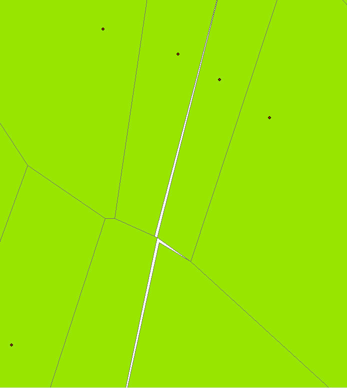
I noticed that the Create Thiessen Polygon Tool in ArcGIS 10.3 is not producing a continuous irregular tessellation across the analysis area.
The resulting polygons have gaps and overlaps as confirmed by topology! I have not noticed this on other versions of ArcGIS.
Can anyone confirm that this is happening on their installation of ArcGIS 10.3? Is there a fix, or does anyone have a script to replace Create Thiessen Polygons that works correctly?
Solved! Go to Solution.
- Mark as New
- Bookmark
- Subscribe
- Mute
- Subscribe to RSS Feed
- Permalink
Clam Art
Well, you are going to have one H of a time trying to do that point distribution all at once.
In short, my toolbox didn't generate errors...don't know why yours did.
Shapefile in ... shapefile out as indicated in the tool help (for a litany of reasons)
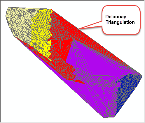
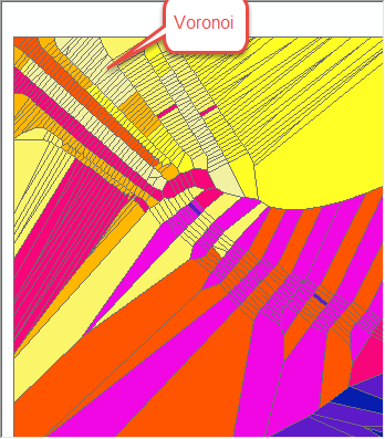
The algorithm is Steve Fortune's original in case Ghislain is interested....I kept it old school without modern data structures, since it is a thing of beauty.
I just did one portion and had no issues except for the fact that
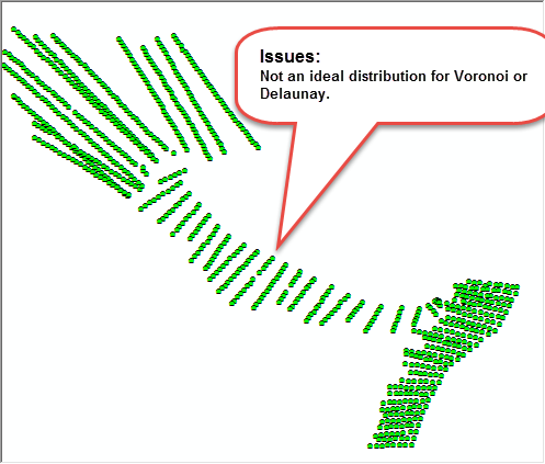
- the distribution is hardly ideal for Voronoi or Delaunay triangulations
- the coordinates are Geographic making the results essentially useless since the triangles etc are not geodesic
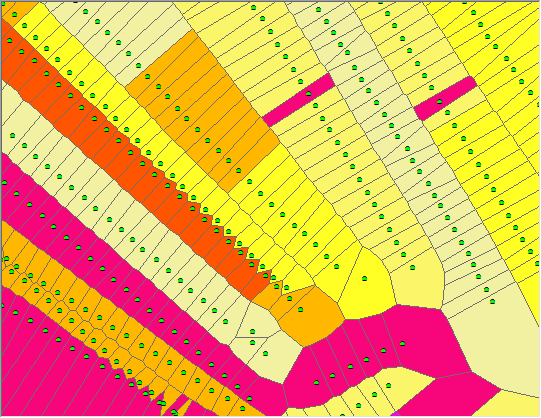
having said that, here are a few images and a package for you to examine. If you can play with the data and show me where you were getting the gaps, I can examine further (hope the mpk works... if not, I will zip and ship)
ADDENDUM
I am also guessing that is the coordinate system aka Geographic that is causing the problem
- Mark as New
- Bookmark
- Subscribe
- Mute
- Subscribe to RSS Feed
- Permalink
Thanks for your help, Dan. Rest assured, I have a polygon layer that represents the bounding area of the survey that I will use to clip the Voronoi polygons with.
Projected - Geographic coordinate system? I had no idea this would make such a big difference in the resulting polygons. I have projected the data and re-created the Voronoi polygons and the gap and overlap problems went away. Best to read the fine print!

Problem Solved.
- « Previous
-
- 1
- 2
- Next »
- « Previous
-
- 1
- 2
- Next »