- Home
- :
- All Communities
- :
- Products
- :
- Geoprocessing
- :
- Geoprocessing Questions
- :
- Thiessen Polygons Not Generating Continuous Tessel...
- Subscribe to RSS Feed
- Mark Topic as New
- Mark Topic as Read
- Float this Topic for Current User
- Bookmark
- Subscribe
- Mute
- Printer Friendly Page
Thiessen Polygons Not Generating Continuous Tessellations in 10.3
- Mark as New
- Bookmark
- Subscribe
- Mute
- Subscribe to RSS Feed
- Permalink
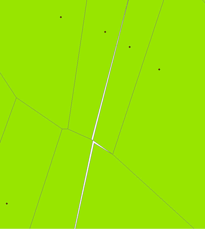
I noticed that the Create Thiessen Polygon Tool in ArcGIS 10.3 is not producing a continuous irregular tessellation across the analysis area.
The resulting polygons have gaps and overlaps as confirmed by topology! I have not noticed this on other versions of ArcGIS.
Can anyone confirm that this is happening on their installation of ArcGIS 10.3? Is there a fix, or does anyone have a script to replace Create Thiessen Polygons that works correctly?
Solved! Go to Solution.
Accepted Solutions
- Mark as New
- Bookmark
- Subscribe
- Mute
- Subscribe to RSS Feed
- Permalink
Clam Art
Well, you are going to have one H of a time trying to do that point distribution all at once.
In short, my toolbox didn't generate errors...don't know why yours did.
Shapefile in ... shapefile out as indicated in the tool help (for a litany of reasons)
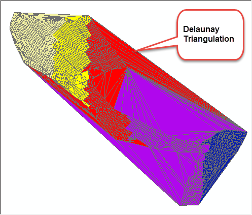
The algorithm is Steve Fortune's original in case Ghislain is interested....I kept it old school without modern data structures, since it is a thing of beauty.
I just did one portion and had no issues except for the fact that
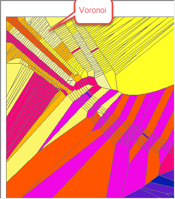
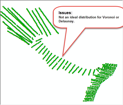
- the distribution is hardly ideal for Voronoi or Delaunay triangulations
- the coordinates are Geographic making the results essentially useless since the triangles etc are not geodesic
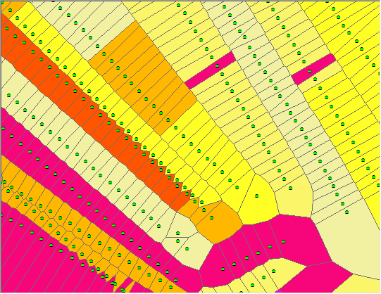
having said that, here are a few images and a package for you to examine. If you can play with the data and show me where you were getting the gaps, I can examine further (hope the mpk works... if not, I will zip and ship)
ADDENDUM
I am also guessing that is the coordinate system aka Geographic that is causing the problem
- Mark as New
- Bookmark
- Subscribe
- Mute
- Subscribe to RSS Feed
- Permalink
Gerry My ArcScripts mirror... Triangulation tools, shapefiles as input and output, should work, let me know if it doesn't
- Mark as New
- Bookmark
- Subscribe
- Mute
- Subscribe to RSS Feed
- Permalink
Thanks, but it threw an error.

- Mark as New
- Bookmark
- Subscribe
- Mute
- Subscribe to RSS Feed
- Permalink
A duplicate point ... I will have to check version numbers since I downloaded it from the beta site and I had corrected that, so if you have duplicate points you will have to wait...sorry
- Mark as New
- Bookmark
- Subscribe
- Mute
- Subscribe to RSS Feed
- Permalink
I see that there are spatially duplicate points but with different attributes! That might be a problem.
I have contacted the data creator to sort out the differences.
Create Thiessen Polygons did not care if there were spatially duplicate points. I guess if you are going to be doing some coding, and want to produce a better tool, let the user know there are spatially duplicate points as a guard against such a thing.
Thanks for throwing the error triangulation tools!
- Mark as New
- Bookmark
- Subscribe
- Mute
- Subscribe to RSS Feed
- Permalink
Gerry, I found that removing the duplicates, although not necessary, greatly improved performance and I have it included in the version (and will find it when I figure out where it went). The duplicates, should however, get dumped...even if silently... so as to avoid division by zero and other computational errors The attributes are not relevant in the implementation and they get dumped immediately.
On a lark...if you can identify the duplicates and remove them, try the inhouse tool on that dataset and see if you misaligned edges magically align. I did find a bug in qgis's implementation a few years ago, but it dealt with funny math beyond the convex hull of the input points.
Anyhow, if I get some time tonight or tomorrow, I will track down my latest and post it (too many machines in several locations)
- Mark as New
- Bookmark
- Subscribe
- Mute
- Subscribe to RSS Feed
- Permalink
How large is the gap?
- Mark as New
- Bookmark
- Subscribe
- Mute
- Subscribe to RSS Feed
- Permalink
Curtis, in this case the gaps and overlaps are a few feet over polygons that are 10 to 12 feet across.
I did get confirmation from ESRI that this is a bug and will be fixed in 10.4.
- Mark as New
- Bookmark
- Subscribe
- Mute
- Subscribe to RSS Feed
- Permalink
Gerry ... coming soon...I am having to port from python 2 to python 3, so it affected anything using "cmp" which was abandoned in version 2 so it can be used in ArcGIS Pro as well.
The duplicate point issue has also been solved regardless of input feature geometry. If duplicates are removed, I have had no problems with all the test cases I have run it on. I am assuming that you are using points as input? If so, just remove duplicates. I am also making it more generic so that it doesn't matter what the input geometry is. All features are converted to points, then all duplicates removed.
So if you are in a pinch, remove your duplicate points. In any event, I will post my version long before 10.4 comes out.
- Mark as New
- Bookmark
- Subscribe
- Mute
- Subscribe to RSS Feed
- Permalink
Hey Gerry,
can you share the gpk of your original case that produces gaps?
Or open a ticket with tech support. We'd like to look at this case.
thanks