- Home
- :
- All Communities
- :
- Products
- :
- Geoprocessing
- :
- Geoprocessing Questions
- :
- Populate point feature with value from underlaying...
- Subscribe to RSS Feed
- Mark Topic as New
- Mark Topic as Read
- Float this Topic for Current User
- Bookmark
- Subscribe
- Mute
- Printer Friendly Page
Populate point feature with value from underlaying polygon layer
- Mark as New
- Bookmark
- Subscribe
- Mute
- Subscribe to RSS Feed
- Permalink
I am creating a task where there are many steps to create and assign an address to a point feature. One of the steps I am trying to automate is to have information taken from some polygons that the point feature falls within. I know I can do a spatial join but the problem is, I don't want to end up with a bunch of extra tables from the join. Does anyone know another way to accomplish this? Maybe a script?
Thanks!
- Mark as New
- Bookmark
- Subscribe
- Mute
- Subscribe to RSS Feed
- Permalink
You can use a spatial intersection in a field calculation. I've done a very similar process to what you describe using Arcade:
var portal = Portal('your portal url')

var polygons = FeatureSetByPortalItem(
    portal,
    'itemid of polygon layer',
    0,
    ['the field you need'],
    true
)

// get first intersecting polygon
var xs = First(Intersects($feature, polygons))

// return value of desired field
return xs['the field you need']
If you're working with local layers as opposed to services, you can still pull in those other features with different FeatureSet functions in Arcade.
Kendall County GIS
- Mark as New
- Bookmark
- Subscribe
- Mute
- Subscribe to RSS Feed
- Permalink
Thanks! I will check this out.
- Mark as New
- Bookmark
- Subscribe
- Mute
- Subscribe to RSS Feed
- Permalink
So my data is not from Portal so I assume I would use FeatureSetbyName()
Below is what I am working with:
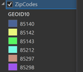
My Zip code layer is named GISMAIN.DBO.qc_ZipCodes
The field I need to grab data from is "GEOID10"
My dataset that needs the Zip Code appended in is called Addressses_TestData
I basically need to make the user be able to click to add the address point, and have it populate the Zip field with the data from the layer under it.

