- Home
- :
- All Communities
- :
- Products
- :
- Geoprocessing
- :
- Geoprocessing Questions
- :
- Re: Near_analysis has planar method. Using Geodesi...
- Subscribe to RSS Feed
- Mark Topic as New
- Mark Topic as Read
- Float this Topic for Current User
- Bookmark
- Subscribe
- Mute
- Printer Friendly Page
Near_analysis has planar method. Using Geodesic method gives very absurd results.
- Mark as New
- Bookmark
- Subscribe
- Mute
- Subscribe to RSS Feed
- Permalink
I have a point and a polygon. I had to draw the shortest distance between the point and polygon. I used near_analysis with planar method to find the shortest point on the nearest point on the polygon. Planar method gave results as expected. Geodesic method is returning extremely strange results. Then XYtoLineManagement (which has Geodesic method as default) draws a straight line to the the nearest point on the polygon. I am very confused here. Its very unfortunate that arc doesnt provide Planar method in all tools. My area of work is very small and planar method is more than sufficient.
- Mark as New
- Bookmark
- Subscribe
- Mute
- Subscribe to RSS Feed
- Permalink
Could you report some results so others can assess whether are absurd or not. And provide information of the coordinate systems of the input data and the data frame... since they may all differ.
- Mark as New
- Bookmark
- Subscribe
- Mute
- Subscribe to RSS Feed
- Permalink
Sir,
Thanks for replying
I will explore the coordinate systems aspect and get back to you shortly.
Thankyou.
- Mark as New
- Bookmark
- Subscribe
- Mute
- Subscribe to RSS Feed
- Permalink
any luck on finding out the coordinate information?
- Mark as New
- Bookmark
- Subscribe
- Mute
- Subscribe to RSS Feed
- Permalink
Sir,
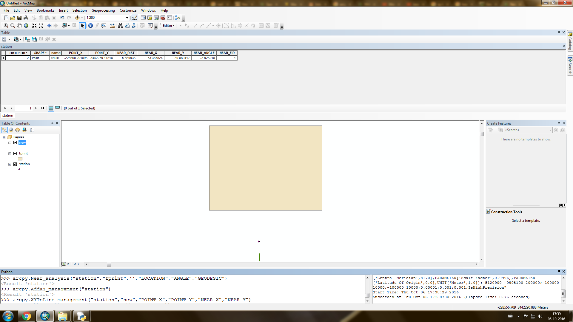
I think it was indeed the coordinate system problem. I created a geodatabase of UTM zone44n projection. And randomly zoomed in and created the features that you see above. But I am still confused exactly what went wrong.
Thankyou
- Mark as New
- Bookmark
- Subscribe
- Mute
- Subscribe to RSS Feed
- Permalink
when you are trying to create features that aren't in the coordinate system expected, I suspect you got the default, perhaps the coordinate system of the data frame rather than of another featureclass, hence the geometry would be totally different. That's why I wanted to see what you had specified for all to confirm what happened rather than go by past experience