- Home
- :
- All Communities
- :
- Products
- :
- Geoprocessing
- :
- Geoprocessing Questions
- :
- Re: Name small census area by larger census area i...
- Subscribe to RSS Feed
- Mark Topic as New
- Mark Topic as Read
- Float this Topic for Current User
- Bookmark
- Subscribe
- Mute
- Printer Friendly Page
Name small census area by larger census area it is in
- Mark as New
- Bookmark
- Subscribe
- Mute
- Subscribe to RSS Feed
- Permalink
Hello,
--I have one layer with combined shapefile outlines for the top 80 (population) metropolitan areas.
--I have a second layer with the Public Use Microdata Areas (PUMAs) that are within these 80 metro areas.
I want to add a field to the second layer that names the metro area each PUMA is located in. So if PUMA 1 is located in NY metro it will say NY in the new field for that PUMA. Thanks, I've looked in a book and online and can't find a reasonable answer!!
Solved! Go to Solution.
Accepted Solutions
- Mark as New
- Bookmark
- Subscribe
- Mute
- Subscribe to RSS Feed
- Permalink
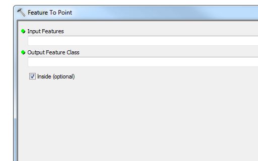
One trick that has worked for me (in ArcGIS Desktop) is to create pseudo-centroids (points, within) from one of the layers (probably the PUMAs) and then perform an identity study to get back points with attributes from PUMAs. You can then join that result to the original (polygon, PUMA) layer to give them the attributes (such as metro area IDs. I call them pseudo-centroids because a horeshoe-shaped polygon will have its centroid located outside the polygon. To address that the ArcToolbox "Feature to Point" tool has an "inside" option that if necessary, arbitrarily keeps the resulting point inside the polygons. This works, if in the aggregate the layers' boundaries match.
The ArcToolbox tools are
"Feature to Point" under ../Data Management Tools/Features, and
"Identity" under "Analysis Tools/Overlay/"
- Mark as New
- Bookmark
- Subscribe
- Mute
- Subscribe to RSS Feed
- Permalink
That worked thanks!!