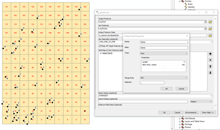
Sorry for the weird title but here's my sample table for further description:
I have a original point layer:
| ID | Name | X(latitude) | Y(longtitude) |
| ID1 | Dog | A | 1 |
| ID2 | Cat | A | 1 |
| ID3 | Bird | B | 1 |
| ID4 | Cat | A | 2 |
| ID5 | Cat | B | 1 |
| ID6 | Dog | A | 1 |
Those points are inside a grid layer, lets say 2x2 for instance, and the points are inside the grid. I'll try my best to demonstrate it in the follow table:
| - | A | B |
| 1 | . . . (Three points, which are ID1, ID2, ID6) | . . (ID3, ID5) |
| 2 | . (ID4) | (NULL) |
Next, I use the count_points_in_polygon functino and create a new layer, which by default adds a column NUM_POINT.
| Grid_ID | NUM_POINT |
| A1 | 3 |
| A2 | 2 |
| B1 | 1 |
| B2 | 0 |
But what I actually want is a table that shows which 'Name's are in each polygon, like the following table shows.
| Grid_ID | NUM_POINT | Name |
| A1 | 3 | Dog, Cat |
| A2 | 1 | Dog |
| B1 | 2 | Bird, Cat |
| B2 | 0 | - |
Any solution or keywords is much appriciated, thank you!


