- Home
- :
- All Communities
- :
- Products
- :
- Geoprocessing
- :
- Geoprocessing Questions
- :
- How to remove a railroad/highway from DEM?
- Subscribe to RSS Feed
- Mark Topic as New
- Mark Topic as Read
- Float this Topic for Current User
- Bookmark
- Subscribe
- Mute
- Printer Friendly Page
- Mark as New
- Bookmark
- Subscribe
- Mute
- Subscribe to RSS Feed
- Permalink
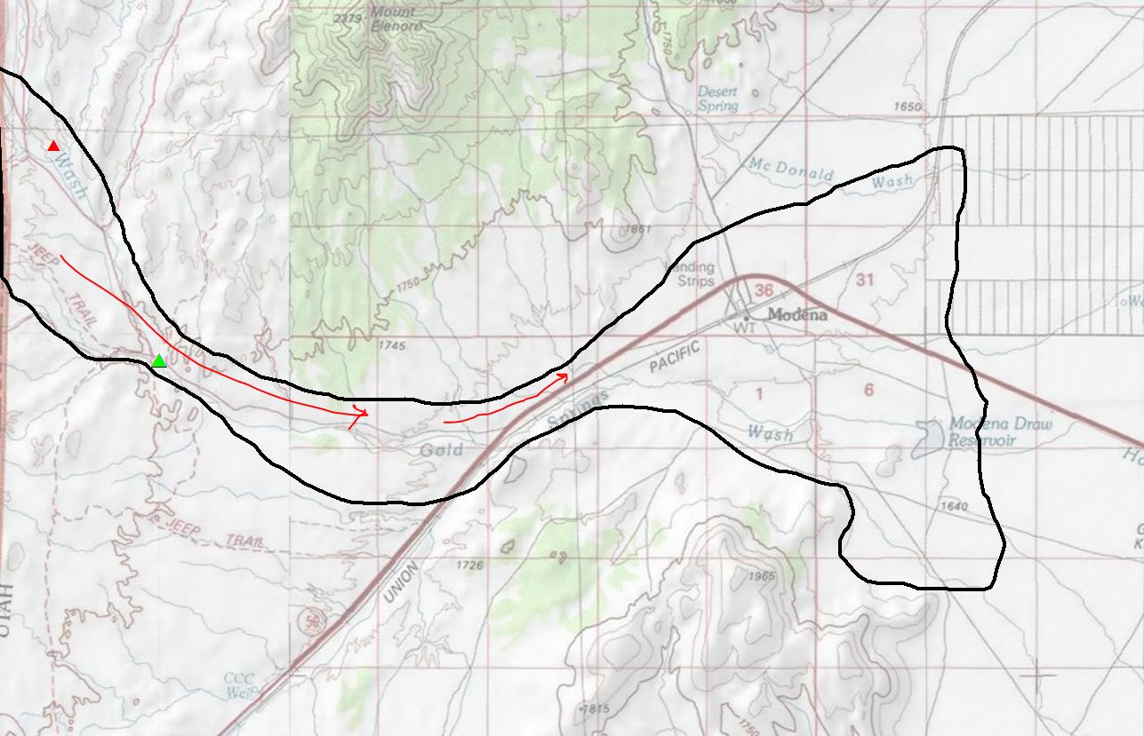
I am working with ArcMap and SAGA to run some hydrology functions on a region in Utah. The area I am looking at has a pretty gentle slope and I realized that a raised railroad bed is effectively "damming" the flow calculations. My interests are prehistoric, looking at alluvial fans in geologic time, so it is blocking the natural flow of sediment off the hill. I am using 30m DEMS and Focal Statistics to smooth the DEM out, before applying some of SAGA's hydrology functions.
I'm looking for advice on how I might "remove" the railroad from the DEM. I can use the Focal Statistics Mean function smooth things out but the railroad is raised so much that the level of smoothing effectively blows out all the remaining terrain. I've attached in image to help get a sense of it. The black outline is the expected alluvial flow. My red hand-written lines are the flow direction and about where things get dammed up by the railroad bed. As you can see, the railroad unfortunately doesn't run in a straight line across the region.
Thanks in advance.
Dave
Solved! Go to Solution.
Accepted Solutions
- Mark as New
- Bookmark
- Subscribe
- Mute
- Subscribe to RSS Feed
- Permalink
One option is found here (pdf download)
Modifying Digital Elevation Models to Develop More Realistic Wetness Index Layers for Soil Survey Applications
By NRCS Soil Scientists Tom D’Avello, Joe Brennan, and Lynn Loomis
- Mark as New
- Bookmark
- Subscribe
- Mute
- Subscribe to RSS Feed
- Permalink
One option is found here (pdf download)
Modifying Digital Elevation Models to Develop More Realistic Wetness Index Layers for Soil Survey Applications
By NRCS Soil Scientists Tom D’Avello, Joe Brennan, and Lynn Loomis