- Home
- :
- All Communities
- :
- Products
- :
- Geoprocessing
- :
- Geoprocessing Questions
- :
- Re: How to batch match polygon edge?
- Subscribe to RSS Feed
- Mark Topic as New
- Mark Topic as Read
- Float this Topic for Current User
- Bookmark
- Subscribe
- Mute
- Printer Friendly Page
How to batch match polygon edge?
- Mark as New
- Bookmark
- Subscribe
- Mute
- Subscribe to RSS Feed
- Permalink
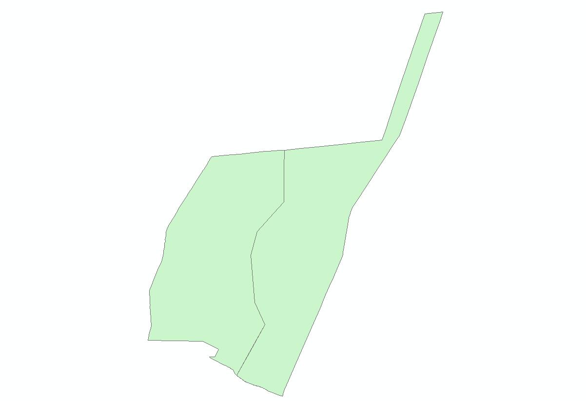
Here's an example, the two polygons below have no gaps or overlaps, but the nodes on the shared edges are not exact the same, how can I make them have same nodes? And I've got like more than 50 thousands polygons in a feature class like that, is there any tools to get it done?

- Mark as New
- Bookmark
- Subscribe
- Mute
- Subscribe to RSS Feed
- Permalink
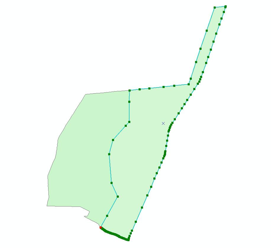
The main problem here that there are many uncritical vertices in most edges.
So I think you can try use Simplify Polygon tool (Arc toolbox > cartography tools > Generalization >Simplify Polygon ). And make Simplification Algorithm is POINT_REMOVE.
POINT_REMOVE—Keeps the so-called critical points that depict the essential shape of a polygon and removes all other points. This is the default.
- Simplification Tolerance
The tolerance that determines the degree of simplification. A tolerance must be specified, and it must be greater than zero. You can choose a preferred unit; the default is the feature unit.
- For POINT_REMOVE algorithm, the tolerance you specify is the maximum allowable offset.
- For BEND_SIMPLIFY algorithm, the tolerance you specify is the length of the reference bend baseline.
Sets the minimum area for a simplified polygon to be retained. The default value is zero, that is, to keep all polygons. You can choose a preferred unit for the specified value; the default is the feature unit.
Specifies how the topological errors (possibly introduced in the process, including line crossing, line overlapping, and collapsed zero-length lines) will be handled.
- NO_CHECK—Specifies not to check topological errors. This is the default.
- FLAG_ERRORS—Specifies to flag topological errors if any are found.
- RESOLVE_ERRORS—Specifies to resolve topological errors if any are found.
Specifies whether to keep collapsed zero-area polygons as points if any are found in the process. This option applies only when NO_CHECK or FLAG_ERRORS is specified.
- Checked—Specifies to keep the collapsed zero-area polygons as points. The endpoints of the collapsed polygons will be stored in a point feature class at the output feature class location, taking the name of the output feature class plus a suffix _Pnt. This is the default.
- Unchecked—Specifies not to keep the collapsed zero-area polygons as points even if they are found in the process; therefore, the point feature class will be empty.
- Mark as New
- Bookmark
- Subscribe
- Mute
- Subscribe to RSS Feed
- Permalink
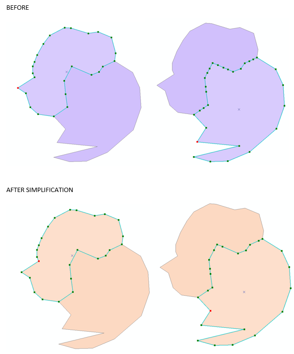
I explored your approach and it does not work, see example below. Whilst keeping the shape and removing some of the vertices it does not remove all of them.
A similar question was asked on GIS SE here. There is a generalize tool on the topology toolbar, you can select up all polygon edges and click on that, it worked very well on my simple test data, but not sure how it would fare with 50,000 polygons?
- Mark as New
- Bookmark
- Subscribe
- Mute
- Subscribe to RSS Feed
- Permalink
Duncan, you find another method good job. But I wondered that you said that Simplify Polygon doesn't work. and your link is approve this tool too. did you read carefully ?. may be that you don't defined Simplification Tolerance well. I think you defined small tolerance so not all vertices deleted.
- Mark as New
- Bookmark
- Subscribe
- Mute
- Subscribe to RSS Feed
- Permalink
Abdullah, I tried setting the tolerance to very small, even what Xingbo used (0.00001 meter) but I still get some vertices left after the Simplify Polygon has been run. The tool on the toolbar seems to work for me, removing all vertices except for the ones that the boundaries share. I was able to select all polygons and run the tool on them, but my sample is much smaller than Xingbo's. Anyway Xingbo seems happy!
- Mark as New
- Bookmark
- Subscribe
- Mute
- Subscribe to RSS Feed
- Permalink
The tool Abdullah Anter mentioned is in the arctoolbox, the tool you mentioned is on the advanced edting toolbar (Arcgis 10.4). And both of them work by setting a very very small tolerance like 0.0001 meter, I got what I wanted. But I prefer the one in the arctoolbox since I've got too much polygons.
- Mark as New
- Bookmark
- Subscribe
- Mute
- Subscribe to RSS Feed
- Permalink
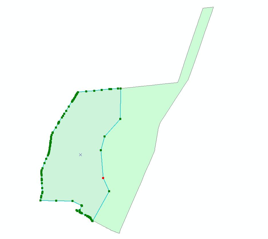
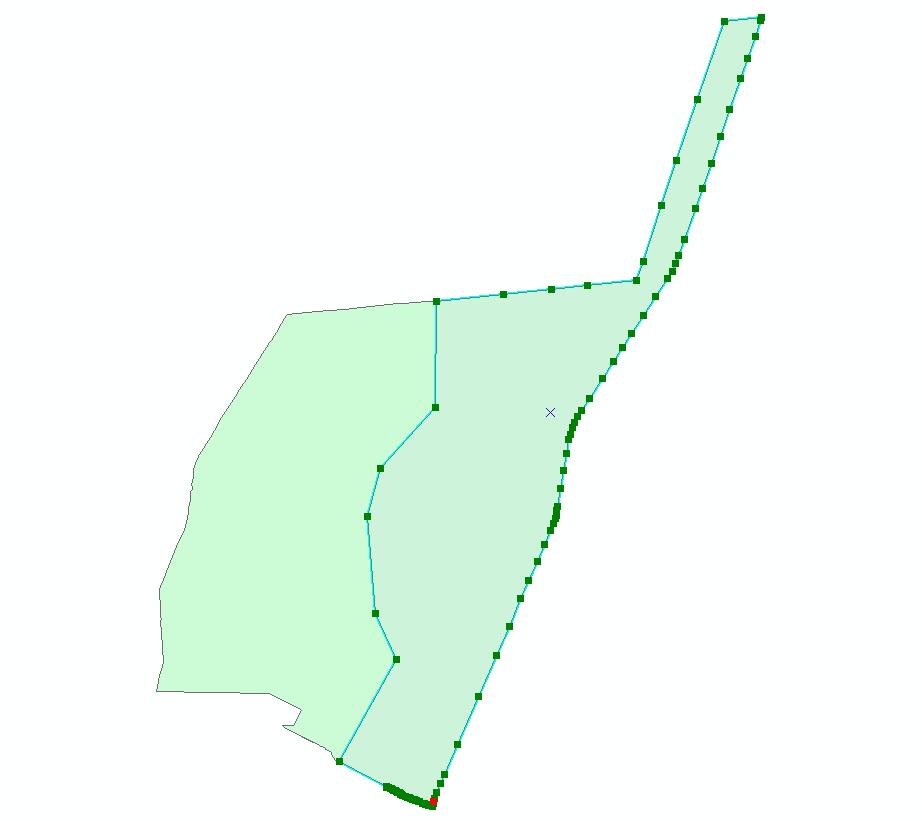
Here's my earlier example after I run the tool.
- Mark as New
- Bookmark
- Subscribe
- Mute
- Subscribe to RSS Feed
- Permalink
Thank you very much, Simplify Polygon works, I set a very very small tolerance like 0.00001 meter.
- Mark as New
- Bookmark
- Subscribe
- Mute
- Subscribe to RSS Feed
- Permalink
Run an experiment... run a Check Geometry on the file that you have shown with your pattern... then export that to a new file and report if there are any differences. What you are seeing is the result of merging polygons from different data sources or not using the 'autocomplete polygon' tool when creating the polygon pair in the first place
- Mark as New
- Bookmark
- Subscribe
- Mute
- Subscribe to RSS Feed
- Permalink
Yes , Dan I agree with you except 'autocomplete polygon' , because it will be the first place if there one , two or three polygons , but Xingbo Chen says :
And I've got like more than 50 thousands polygons in a feature class like that