Turn on suggestions
Auto-suggest helps you quickly narrow down your search results by suggesting possible matches as you type.
Cancel
- Home
- :
- All Communities
- :
- Products
- :
- Geoprocessing
- :
- Geoprocessing Questions
- :
- Re: Find closest line(s) to points, get position o...
Options
- Subscribe to RSS Feed
- Mark Topic as New
- Mark Topic as Read
- Float this Topic for Current User
- Bookmark
- Subscribe
- Mute
- Printer Friendly Page
Find closest line(s) to points, get position on line(s)
Subscribe
933
1
09-16-2019 01:55 PM
09-16-2019
01:55 PM
- Mark as New
- Bookmark
- Subscribe
- Mute
- Subscribe to RSS Feed
- Permalink
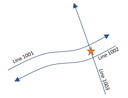
Given a feature class containing point locations another containing polylines, I would like to a) determine which line(s) are within a specified distance of each point, and b) what is the “position” along the line(s) which comes closest to each point.
Working in ArcMap 10.4.1 (upgrading to 10.7 soon) with an Advanced license. Will be coding the solution using ArcPy.
Input Example:
(line 1001 and 1002 are roughly 100 feet apart)

Desired Output:
Thanks for any advice!
1 Reply
09-19-2019
11:31 AM
- Mark as New
- Bookmark
- Subscribe
- Mute
- Subscribe to RSS Feed
- Permalink
Maybe if I ask the question a different way?
I'm trying to build something similar to the Linear Referencing tool "Locate Features along Routes".