Turn on suggestions
Auto-suggest helps you quickly narrow down your search results by suggesting possible matches as you type.
Cancel
- Home
- :
- All Communities
- :
- Products
- :
- Geoprocessing
- :
- Geoprocessing Questions
- :
- Extracting specific roads from raster image using ...
Options
- Subscribe to RSS Feed
- Mark Topic as New
- Mark Topic as Read
- Float this Topic for Current User
- Bookmark
- Subscribe
- Mute
- Printer Friendly Page
Extracting specific roads from raster image using ArcGIS Desktop
Subscribe
5599
10
09-10-2017 02:13 PM
09-10-2017
02:13 PM
- Mark as New
- Bookmark
- Subscribe
- Mute
- Subscribe to RSS Feed
- Permalink
I want to create a line shapefiles of white roads from the raster file (screenshot1) using ArcGIS: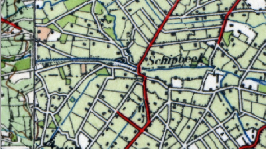
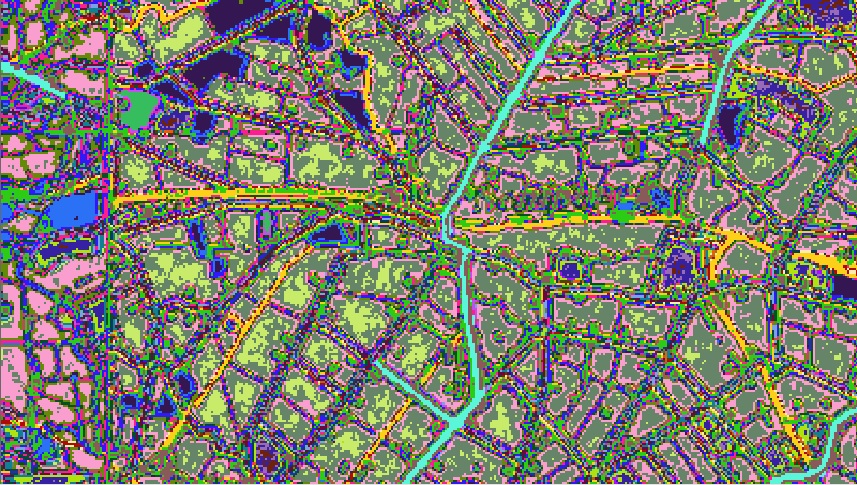
My idea is to use ArcScan toolbar, but first of all I need to classify roads pixels values from raster. For that I have used ISO Unsupervised classification tool with a number of 30 classes. The results are not good for me because I got the unclear pixel values which are unusable for ArcScan vectorisation (screenshot2):
Of course, if I have a clear pixels defining the roads I will use Reclassify tool to filter get just two pixel values (one which I need and one which don`t). Now I need to know is there any way to solve my problem?
10 Replies
- « Previous
-
- 1
- 2
- Next »
- « Previous
-
- 1
- 2
- Next »