- Home
- :
- All Communities
- :
- Products
- :
- Geoprocessing
- :
- Geoprocessing Questions
- :
- editing shape file
- Subscribe to RSS Feed
- Mark Topic as New
- Mark Topic as Read
- Float this Topic for Current User
- Bookmark
- Subscribe
- Mute
- Printer Friendly Page
editing shape file
- Mark as New
- Bookmark
- Subscribe
- Mute
- Subscribe to RSS Feed
- Permalink
Hi everyone
i was wondering if anyone has som ideas about my question below. What i have is a series of shapefile which which are snapped to one another. The represent the different areas of a region on a maps. As seen in the first picture below.

There are a series of control points which define the boundary bewteen the two shapes. The act as validation points , so points which are red , should be in the peach colour shape and one points which are blue should be in the blue shape. As seen below.
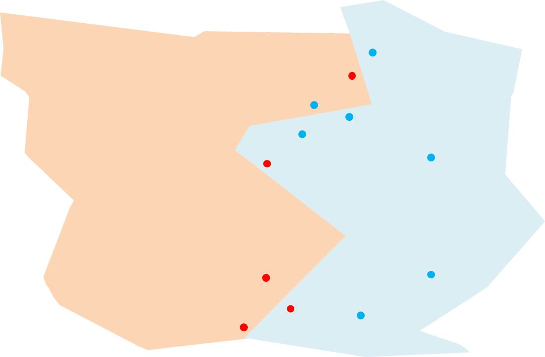
So in some cases the red points are inside the blue shape and there are blue points inside the peachy shape. As a QC measure i want to edit the shapes so the red and blue points are in the correct point. So i get an end product like something below

i have started to carry this out . The process i have been doing this by going into the shape file and manually , editing the shape and then going into the shape it previsously had a boundary with and then cutting out the shape and making sure the shapes snap to one another using the trace feature . i was wondering if there is an automated way of doing this . Ideally i like too be able to edit the shape and relationships and snapping is updated , anyone ideas , on making this more automatically i ahve a lot of control point which mioght need to be, thanks a lot
- Mark as New
- Bookmark
- Subscribe
- Mute
- Subscribe to RSS Feed
- Permalink
It appears that your polygon data is very generalized, causing misalignment. Is there no other, more detailed, less generalized source for this boundary data?
- Mark as New
- Bookmark
- Subscribe
- Mute
- Subscribe to RSS Feed
- Permalink
Hi Jim , the only relationship that the booundary bewteen the data is that it should be snapped to one another . i am not sure what you mean by it being generilized . Jack
- Mark as New
- Bookmark
- Subscribe
- Mute
- Subscribe to RSS Feed
- Permalink
Apologies for being unclear.
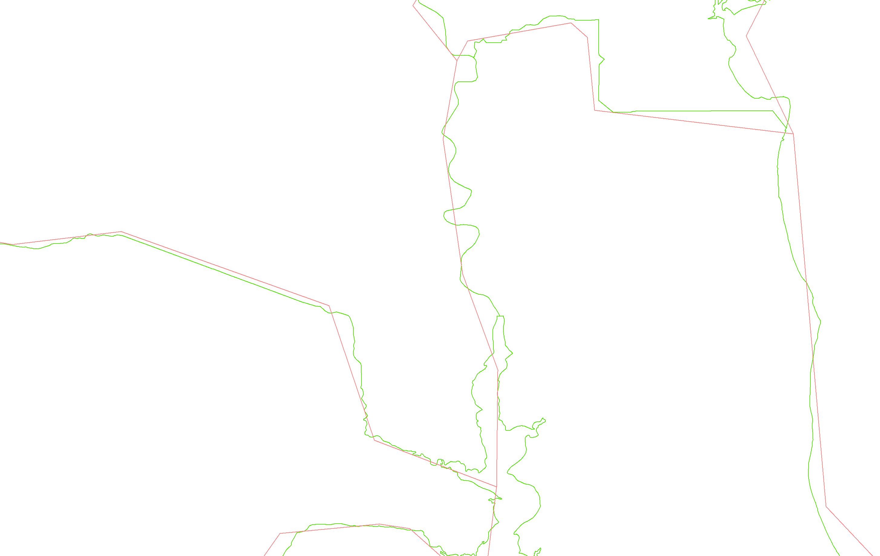
I was asking more about the source of the boundary data. The image below has a detailed (green) and a generalized (red) county boundary shown. You can see where points located near the green boundary have the potential to be shown on the incorrect side using the generalized line.
So, (not knowing what these boundaries represent or where they came from), is there another source for their delineation that may be a better representation?