Turn on suggestions
Auto-suggest helps you quickly narrow down your search results by suggesting possible matches as you type.
Cancel
- Home
- :
- All Communities
- :
- Products
- :
- Geoprocessing
- :
- Geoprocessing Questions
- :
- Re: Create a line connecting closest parts or segm...
Options
- Subscribe to RSS Feed
- Mark Topic as New
- Mark Topic as Read
- Float this Topic for Current User
- Bookmark
- Subscribe
- Mute
- Printer Friendly Page
Create a line connecting closest parts or segments and not thru centroids
Subscribe
1158
2
11-30-2016 10:29 PM
11-30-2016
10:29 PM
- Mark as New
- Bookmark
- Subscribe
- Mute
- Subscribe to RSS Feed
- Permalink
Hi Everyone,
I have a question. How can I generate a line like the blue line, connecting closest parts or segments of features closest to each other. The XY to line tool in ArcGIS uses the centroid of both features to generate the line. That is not what I want to achieve but rather the blue line. is it possible to do in ArcGIS without scripting. or maybe someone has a script that they can share 
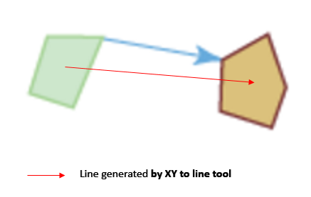
thanks,
Charlemagne
2 Replies
12-01-2016
08:11 AM
- Mark as New
- Bookmark
- Subscribe
- Mute
- Subscribe to RSS Feed
- Permalink
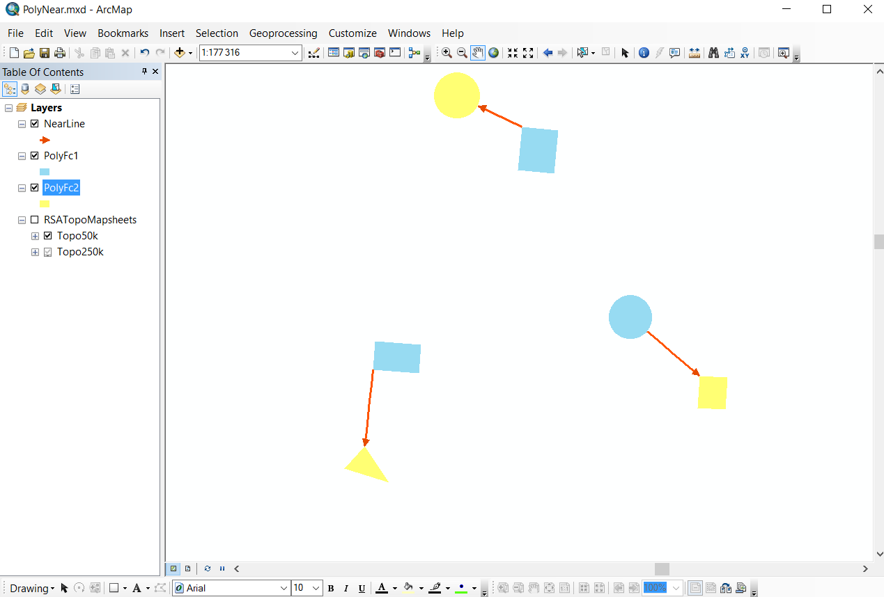
I moved this thread to Geoprocessing (was in User Conference).