- Home
- :
- All Communities
- :
- Products
- :
- Geoprocessing
- :
- Geoprocessing Questions
- :
- Re: convert raster to polygon (model builder - ite...
- Subscribe to RSS Feed
- Mark Topic as New
- Mark Topic as Read
- Float this Topic for Current User
- Bookmark
- Subscribe
- Mute
- Printer Friendly Page
convert raster to polygon (model builder - iterate)
- Mark as New
- Bookmark
- Subscribe
- Mute
- Subscribe to RSS Feed
- Permalink
I'm trying to convert multiple rasters to polygon and then vertices of those polygons convert to point and finally add XY coordinates. So my main tools for this process are:
- raster calculator (multiply raster with 0 to get just one band)
- raster to polygon
- feature vertices to points
- add xy coordinates
I'm trying to do this in model builder. If I use raster to polygon directly (without raster calculator), I get error that shp is bigger than 2GB. So far I manage to apply raster calculator which stores result in folder "raster_calculator". When I add raster to polygon I get error "ERROR 010157: Unable to open feature class..." (see picture "error.png").
I tried to use Calculate Value and Parse Path but I didn't succeed. Most likely because I don't know how to used them properly.
Can anyone please help me or give me an advice how to solve this in model builder.
P.S.: I know that in python this could be easier but I would like to do this in model builder because i don't understand python.
- Mark as New
- Bookmark
- Subscribe
- Mute
- Subscribe to RSS Feed
- Permalink
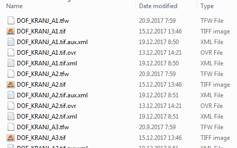
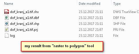
My original files are DOF (digital ortofoto image) in "tiff" format but my original files also have "tif" in the name (look the first picture). When I run "raster to polygon" tool I create shapefile from raster file. I that process I use parse path, so that I take just the name but I also get "tif" in that name. So my shapefile looks like "DOF_KRANJ_A3.tif.shp". So now I need to delete somehow my extension or (better) define how many characters should my next output have (I would like to take just "DOF_KRANJ_A1") but I just can't do it correctly. If I set parameter to the output of "raster to polygon" tool will it be any diferent?
- Mark as New
- Bookmark
- Subscribe
- Mute
- Subscribe to RSS Feed
- Permalink
I already provided many suggestions, none of which seemed to be of any help apparently.
You could slice of the last 4 characters and append .shp as an alternative if you can't get 'replace' to work
new name => oldname.tif[:-4] + ".shp"
- « Previous
-
- 1
- 2
- Next »
- « Previous
-
- 1
- 2
- Next »