- Home
- :
- All Communities
- :
- Products
- :
- Geoprocessing
- :
- Geoprocessing Questions
- :
- Re: Calculate total area of polygons within polygo...
- Subscribe to RSS Feed
- Mark Topic as New
- Mark Topic as Read
- Float this Topic for Current User
- Bookmark
- Subscribe
- Mute
- Printer Friendly Page
Calculate total area of polygons within polygons
- Mark as New
- Bookmark
- Subscribe
- Mute
- Subscribe to RSS Feed
- Permalink
Hi. I have a somewhat convoluted questions that hopefully will be aided by my screenshots. I have land cover data (polygons) available for a small city I'm working with. In the example I'm showing the land cover feature is tree canopy cover. I have the area for the whole city, but I would like to break it down into smaller areas, and I am using block groups since we have other data with those boundaries. The first pic (below) shows the canopy cover (in green) and the block group divisions.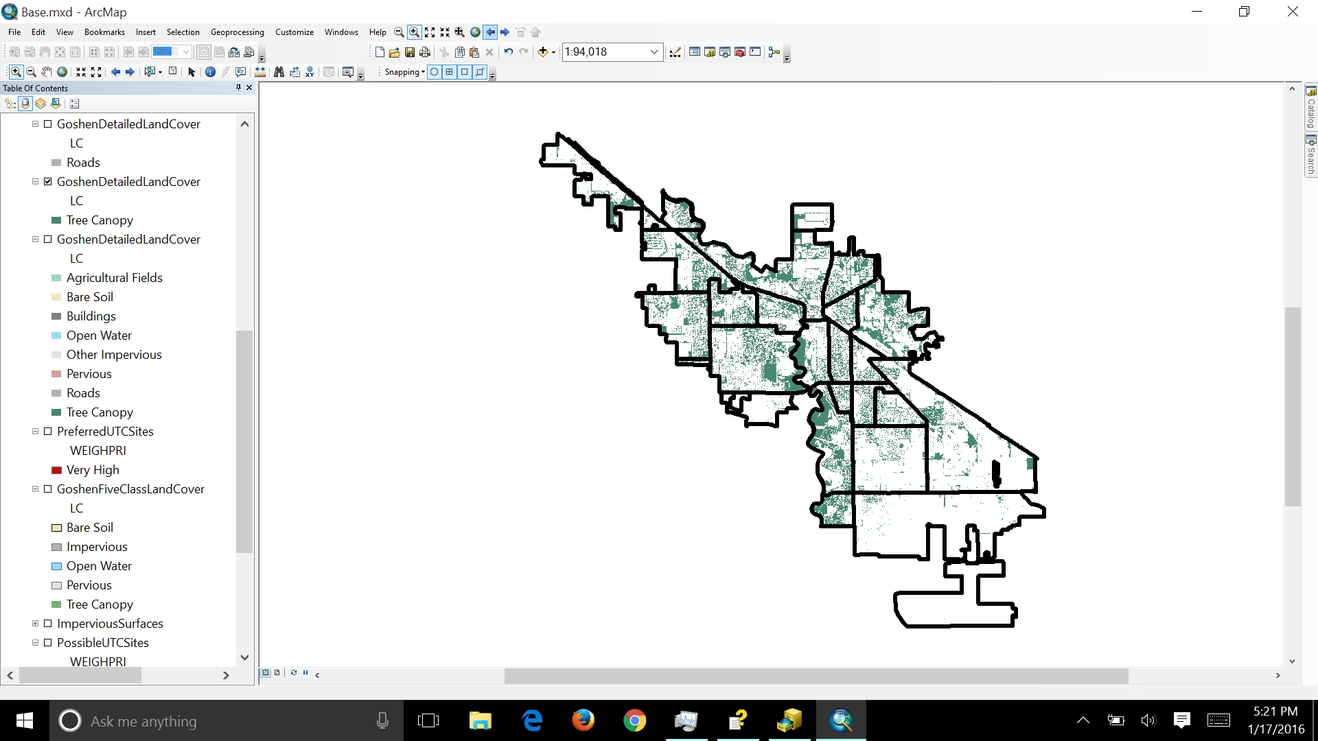
The boundaries for the land cover don't match up exactly with the block group boundaries: 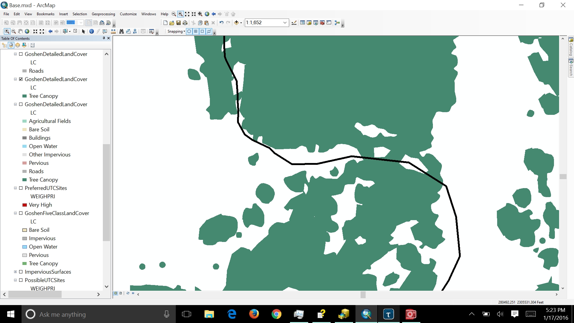
So I'm trying to find out the best way to calculate the area of land cover info within each block group. I'd rather not do a simple clip because there are 24 block groups and I'd rather not have that many separate feature classes. I've looked into maybe doing a split, but my noobishness stops me where it talks about a workspace (part of the syntax).
So, does anybody have any ideas on how best to go about this? Or is there a solution to my problem with the split command?
thanks in advance!
- Mark as New
- Bookmark
- Subscribe
- Mute
- Subscribe to RSS Feed
- Permalink
Union should do the trick for splitting the canopy at the block group...then you just need to summarize the total area for each block group.
- Mark as New
- Bookmark
- Subscribe
- Mute
- Subscribe to RSS Feed
- Permalink
Thank you, that seems to have done the trick. I was so stuck in thinking about dividing them I wasn't even thinking about combining.
Anyway, that problem's solved. Next one: units. The source data for the land cover are in US_feet. The block groups? Not so much. I don't even see any linear units listed in their properties, and that same lack is in the new union-ed data:
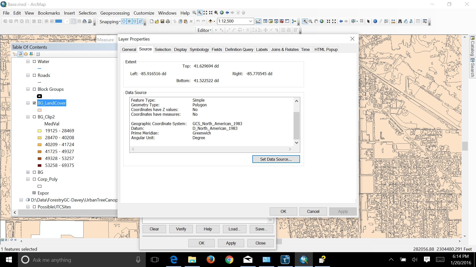
As you can see, all that is listed is angular units. And the numeric values are extremely tiny, which is consistent with the block group data but not land cover. I guess I should have checked this beforehand. Any idea what I can do to get the needed measurements?
- Mark as New
- Bookmark
- Subscribe
- Mute
- Subscribe to RSS Feed
- Permalink
Use the Project tool to convert your decimal degree data to a projected coordinate system. It will then have the unit of the coordinate reference system (feet or meters or other, depending on which coordinate reference system you choose).
- Mark as New
- Bookmark
- Subscribe
- Mute
- Subscribe to RSS Feed
- Permalink
You can calculate the area of each polygon in the units you prefer using the field calculator. Create a field to hold the values, select Python as the parser at the top of the field calculator, and enter !shape.area@acres! as the expression. You can use any of the following in place of 'acres'.
Areal unit of measure keywords: ACRES | ARES | HECTARES | SQUARECENTIMETERS | SQUAREDECIMETERS | SQUAREINCHES | SQUAREFEET | SQUAREKILOMETERS | SQUAREMETERS | SQUAREMILES | SQUAREMILLIMETERS | SQUAREYARDS | SQUAREMAPUNITS