- Home
- :
- All Communities
- :
- Products
- :
- Geoprocessing
- :
- Geoprocessing Questions
- :
- ArcMap - Adding XY data problem
- Subscribe to RSS Feed
- Mark Topic as New
- Mark Topic as Read
- Float this Topic for Current User
- Bookmark
- Subscribe
- Mute
- Printer Friendly Page
ArcMap - Adding XY data problem
- Mark as New
- Bookmark
- Subscribe
- Mute
- Subscribe to RSS Feed
- Permalink
Hello.
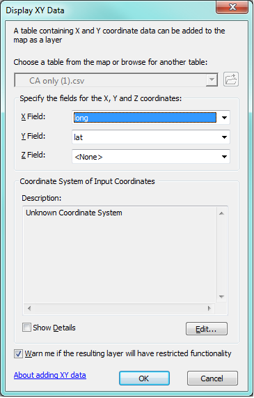
I have created a csv file containing latitude and longitude.
The length of field name is below 10.
I link latitude to Y field, and longitude to X field.
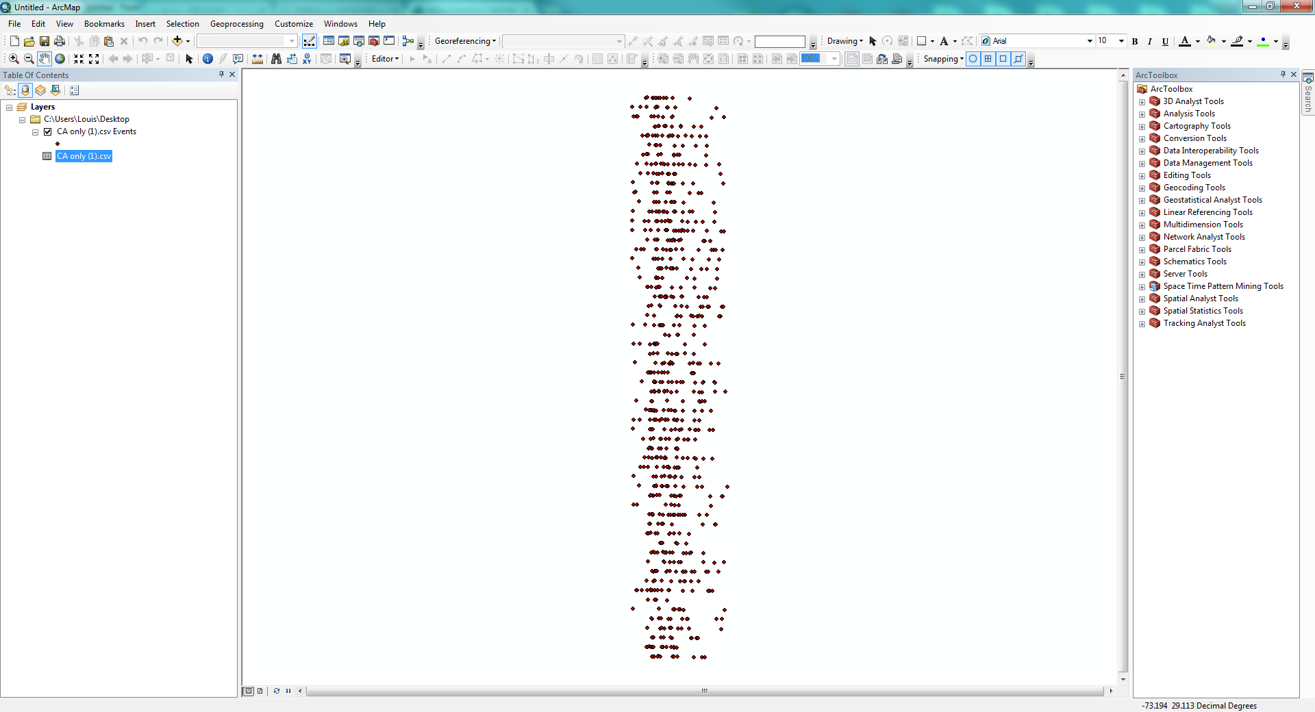
I have tried using ArcMap and ArcCatolog to import the data but the result is still the same: the points are located vertically.
Thank you!
- Mark as New
- Bookmark
- Subscribe
- Mute
- Subscribe to RSS Feed
- Permalink
well your table name is terrible so I am suprised it loaded at all. (no spaces, no punctuation other than underscores).
So your latitudes go from about the equator to about 60 degrees and your longitudes are within a 3-4 degree range. Looks like you got it right, unless your data conversion to longitude and latitude are off, especially since this is supposed to be california I take it?
- Mark as New
- Bookmark
- Subscribe
- Mute
- Subscribe to RSS Feed
- Permalink
In addition to what Dan mentioned, you need to specify the Coordinate System even f it is lat/long.

- Mark as New
- Bookmark
- Subscribe
- Mute
- Subscribe to RSS Feed
- Permalink
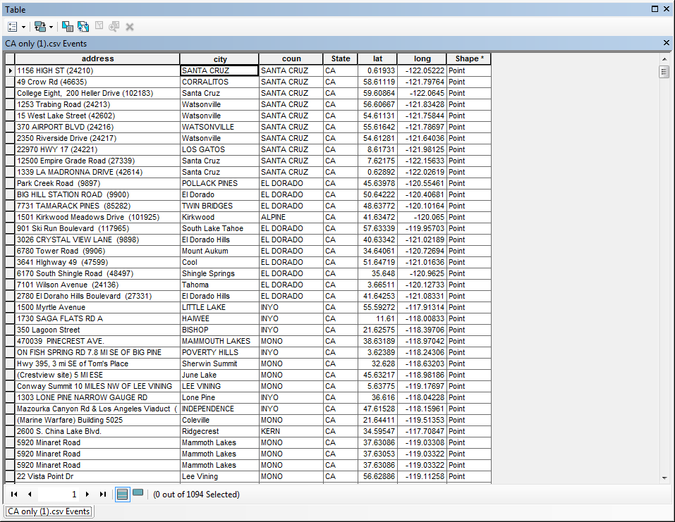
I am able to see latitude and longitude fields clearly.
And I have tried specifying the coordinate system before importing the csv.
But the result is still the same.
On the other hand, this csv file is successfully imported into QGIS. That's why I wonder if I can't make it in ArcMap.
- Mark as New
- Bookmark
- Subscribe
- Mute
- Subscribe to RSS Feed
- Permalink
try changing the 'long' field name on a lark. .... or better still, I have never used that tool with assigning a field to 'Z field' so just select 'State' and I assume given your values, that not all of the points are in California, so perhaps that field is a misnomer and contains data towards the equator in other countries