- Home
- :
- All Communities
- :
- Products
- :
- Geoprocessing
- :
- Geoprocessing Questions
- :
- Adding coordinates into ArcMap - Help needed
- Subscribe to RSS Feed
- Mark Topic as New
- Mark Topic as Read
- Float this Topic for Current User
- Bookmark
- Subscribe
- Mute
- Printer Friendly Page
Adding coordinates into ArcMap - Help needed
- Mark as New
- Bookmark
- Subscribe
- Mute
- Subscribe to RSS Feed
- Permalink
Im working with a DEM downloaded from Digimap of the Orkney islands to asses the visibility impacts of wind turbines using a view shed analysis. I've complied a document of the wind turbines in Excel to use for the analysis, with their locations in British national grid - Eastings and Northings. However, the problem that I'm having is that I can get this to import into ArcMap and work. If i import with the BNG from a tab delimited file or normal workbook then Arc doesn't reconise any data is present and lists everything as a column - if i have 30 rows of data then there will be 30 columns all labelled fields 1-30.
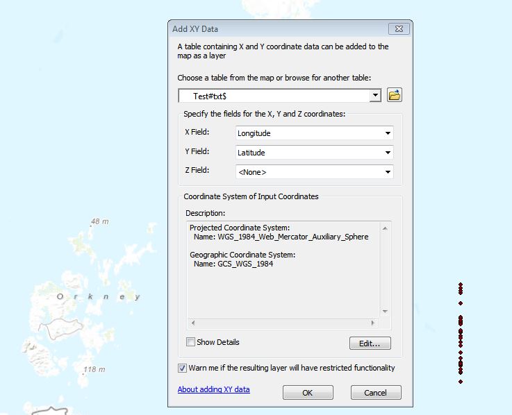
If i convert to decimal degrees as I read online this might be easier, then the longitude value is a Negative, but this won't display either the fields just display as 'Null'. I have tried adding the compass bearings on to the end of each number to see if this helps but no luck and I have then removed this and made sure the cells are formatted to 'Number' but again it still displays as 'Null'. I have spent hours looking online and cannot find a reasonable solution..
Any help would be much appreciated
- Mark as New
- Bookmark
- Subscribe
- Mute
- Subscribe to RSS Feed
- Permalink
copy the fieldnames and the first couple of rows of the data so we can look at it.
If you are still working in a spreadsheet, you need to explicitly format the column to an appropriate decimal type, if you just remove the N from the cell entry, it is still text even though it looks like a number. Also, by default text is left justified and numbers are right justified.
ps there is no attachment
- Mark as New
- Bookmark
- Subscribe
- Mute
- Subscribe to RSS Feed
- Permalink
I'm using ArcMap 10.2.1 and brought the xls file directly into ArcMap with no problems.
- Mark as New
- Bookmark
- Subscribe
- Mute
- Subscribe to RSS Feed
- Permalink
You may also want to look at this toolbox which has conversion tools but I am not sure what ArcGIS version you are running. This is for 10+.
http://www.arcgis.com/home/item.html?id=f3d91b8f852042e289e09a7ec8342431
- « Previous
-
- 1
- 2
- Next »
- « Previous
-
- 1
- 2
- Next »