GeoMentors Blog - Page 5

cancel
Showing results for 
Show  only  | Search instead for 
Did you mean: 

Latest Activity

(125 Posts)
JoleneKeen1
Frequent Contributor

The December GeoMentors newsletter is out!  View the full issue online.

more
1 0 236
JoleneKeen1
Frequent Contributor

February 2018 GeoMentor Spotlight:

Will Chong, Geospatial Analyst at Tesla Government Inc.

What was your favorite class in K-12? I always enjoyed math, mainly because I was decent at it. But I was most interested in any classes that had to do with geography in any way.

How did you first learn about and/or use GIS? I first learned about it during a required Intro to GIS course at Virginia Tech. I immediately was drawn to it and the processes and have been using it ever since.

Name one thing you love about GIS and/or geography (I know, just one!): I love how universal it is. Everything has a spatial component in one way or another and it can be used in countless disciplines.

Why did you want to volunteer as a GeoMentor? I wanted to share my experiences and have kids learn more about GIS and geography to realize how important it is. I remember when I was a kid, I looked forward to it in school but wished we spent more time on it.

What kind of GeoMentor volunteer opportunity and experience are you looking for? I’ve only done one with elementary school students but would be open to helping middle and high school kids as well.

If someone asked you why they should learn about GIS and/or geography, how would you respond in one sentence? GIS and geography can be used everywhere and with everything to help understand the world.

Email address: wchong25@gmail.com

Websites:
Tesla Government Inc. - https://teslagov.com/
Linkedin - https://www.linkedin.com/in/will-chong/
Twitter username: @willchong25

Read about our latest featured GeoMentor here!
If you are interested in being featured, visit here for more information.

Questions? Email geomentors@aag.org.

more
0 0 231
JoleneKeen1
Frequent Contributor

Thurs., Feb. 8th at 8 pm (EST)

Focus: The Impact of Water- both above and below ground- on the Environment
Spotlight on Landslides!
To Join: https://zoom.us/j/7578241037
 

Students and their families are welcome to join from their homes as well.

Tonight, we will focus on landslides and take a closer look at the recent landslides that have occurred in California. Dr. Dalia Kirschbaum, a NASA scientist who is an expert on landslides, will explain how and why we study them from space. We will also hear from some GLOBE folks in CA about how they were impacted by the recent landslides. During our collaboration time, we will talk about some of the GLOBE protocol that can be used to predict these natural disasters and to describe their impact on the environment.

Learn more about the ENSO Student Research Campaign Phase III

more
0 0 310
JoleneKeen1
Frequent Contributor

January 2018 GeoMentor Spotlight:

Rebecca Theobald - Assistant Research Professor at the University of Colorado, Colorado Springs and Coordinator at Colorado Geographic Alliance

What was your favorite class in K-12? French language. I studied French for six years in junior high and high school. We not only learned to read, write, and speak, but also about culture, literature, and history. I recall that we were required to memorize the maps of Paris and of France, which came in very handy when my family lived in Paris several decades later. While I am not a fantastic linguist, I learned how important language is to understanding different parts of the world.

How did you first learn about and/or use GIS? In graduate school, I examined the impact of geography on pre-collegiate school choice. Maps were an important part of how I illustrated the results of my study, but I had not yet taken a geospatial technology class so was creating maps by hand. Following my defense, when one of my committee members remarked “your maps are a bit dodgy”, I knew I needed to learn about this important tool, so I enrolled in the introductory GIS class with Babs Buttenfield the next semester. We not only learned techniques, but also the theory behind the techniques. Like a language, though, if you don’t use GIS regularly, the ability to navigate within the software is hard to maintain.

Name one thing you love about GIS and/or geography: Sharing information visually enables people to understand details in a new way. I enjoy watching the “ah ha” moments take place when students or community members examine what seems to be familiar from a new perspective.

Why did you want to volunteer as a GeoMentor? I want to support continued connections between academic and professional geographers and educators, as well as set an example for mentoring in Colorado as part of my work with the Colorado Geographic Alliance, which has supported professional development for K-12 teachers for thirty years. As I am not a GIS expert, I also have some credibility with individuals who might feel intimated by this amazing tool, which supports instruction, analysis, and presentation.

What kind of GeoMentor volunteer opportunity and experience are you looking for? Over the past year and a half, I have been traveling throughout Colorado sharing National Geographic’s Giant State Map in elementary and secondary classrooms. At each school I inquired as to who would be the best person to speak with about geospatial technology. Sometimes it was a teacher, sometimes a librarian, and sometimes a technology teacher. I introduced them to Esri’s GeoInquiries and the Colorado Digital Atlas, with the intention of developing a community of educators who feel comfortable incorporating these resources into their classrooms, and with guiding their colleagues in the use of these tools.

If someone asked you why they should learn about GIS and/or geography, how would you respond in one sentence? “The science of government it is my duty to study, more than all other sciences; the arts of legislation and administration and negotiation ought to take the place of, indeed exclude, in a manner, all other arts. I must study politics and war that my sons may have liberty to study mathematics and philosophy. My sons ought to study mathematics and philosophy, geography, natural history, naval architecture, navigation, commerce, and agriculture, in order to give their children a right to study painting, poetry, music, architecture, statuary, tapestry, and porcelain.” – John Adams, 1780

Email address: rtheobal@uccs.edu

Websites:
https://www.uccs.edu/geography/rebecca_theobald.html
https://www.uccs.edu/~coga/

Interested in being featured? Go here for more information.

We are excited to learn more about you! 

Questions? Email geomentors@aag.org.

more
3 0 690
JoleneKeen1
Frequent Contributor

GeoMentor Case Study:

Casey Finedell

City/State of School, School District, or Group: Port Townsend, WA, Port Townsend School District

Grade level of students you or your educator collaborator work/worked with: Jen Manning teaches middle school science. The class in which I have been volunteering is a 7th grade STEAM (Science, Technology, Engineering, Arts, and Math).

Subject/topic of class/group you assisted your collaborator with: Introduction to maps - from basic mapping concepts to real world examples. Discussed everything from Lat/Long and Great Circles to map generalization and visualization of demographics through chloropleth maps.

Approximately how many students were engaged in GIS activities through this collaboration: There are about 20 students in this class each week

How did you connect with your collaborator? I was asked to participate in an outreach program rooted in a ConnectED initiative. At a teacher training this summer, many teachers were excited by the possibilities of GIS in the classroom, but were a bit intimidated by the software. One teacher (Jen Manning) latched on to the GIS concepts and how they could enhance her classroom.

Describe your collaboration process. Jen Manning and I immediately started working on what we call the "BioCollector" app. With her 8th grade class, she has been collecting biological indicator information, such as pH levels, in local aquatic environments for about five years. She had the students collecting by hand, but the possibility of collecting on a phone or iPad was very interesting to her. To help with her comfort level with the software, we decided to introduce GIS to her 7th grade class.

Describe the tasks you assisted your collaborator with. For the first five sessions, we had discussions about mapping in general and GIS specifically. We focused these courses around the 5x5 exercise that ESRI put out for k12. (https://esri.app.box.com/v/ago5x5). These exercises were a great way to wade into GIS with this age level students.

After we concluded our 5x5 exercise list, we moved on to creation of our very own story map. We had the students group up into teams and each student was responsible for creation of a single location in a story map. We allowed the students quite a bit of freedom with the topic of these maps, focusing more on the creation as the lesson. We used the Story Map Shortlist template as our webapp. Most students chose to pin places they have been or desire to go, but a few chose topics such as site where the Loch Ness Monster and other borderline mythical/real creatures have been spotted.

This was a learning experience for both the students and the teachers. Some basic computer skills were covered such as saving an image from the internet and consuming it in a Story Map. Teachers learned how to better assess student preparedness for tasks and students pushed their comfort zone with computer skills, internet searching, and mapping.

What available resources, if any, did you use or help your collaborator use to implement GIS in K-12 education? In addition to the 5x5 linked above, we did review some of the materials ESRI put out for GIS day. We did review a few local examples of the Story map that we created. One such real world example of a Story Map is: https://jeffcowa.maps.arcgis.com/apps/Shortlist/index.html?appid=dfda8e56b8be4679a3516bd3e262cc9c
We will be bringing GeoInquries in during future sessions. We were made aware of this resource after we were committed to our lesson.

Did you develop any new educational material or GIS activities through your collaboration? We did not document any new educational materials, but we did create this GeoForm for their collection use. We hope that this will project will see students creating many maps with the data collected. https://ptschools.maps.arcgis.com/apps/GeoForm/index.html?appid=29e75361fb204f4cb8aa8260fa5a2ab2

What did you gain from the experience? What do you think your educator collaborator and/or the students gained? This was an incredibly rewarding and reassuring experience. It was refreshing to see how quickly some of these kids stepped up and ran with these concepts. I personally gained a better understanding of student capabilities and, more importantly, my own teaching techniques. I learned how to explain topic from numerous angles to reach students with different learning styles. I also learned that some pop culture topic have fallen out of favor much quicker than I thought. FYI - Pokeman Go is sooooo last year.

If your GeoMentoring engagement activities were documented through a classroom blog, school website, group’s social media post, newspaper or other media, please provide the websites of those posts. No documentation yet. We are looking to document this with a 1 minute recap video and submit to ESRI for outreach in schools.

Any additional comments about your experience? As I said in my email, if GeoMentors is an organization that an individual could make a career out of, I am very interested. I feel that my career will move towards community involvement and GIS education. I am not sure of the path forward, but do know that I love being involved in this type of efforts.


Check out more case studies here!

 If you're interested in submitting your GeoMentor experience for a case study, we would appreciate you doing so through this survey. The collected information will only be accessible to and used by AAG and Esri program staff and will not be further distributed or posted online unless you indicate your permission to do so.

Questions? Email geomentors@aag.org.

more
0 0 379
CandiceLuebbering
Frequent Contributor

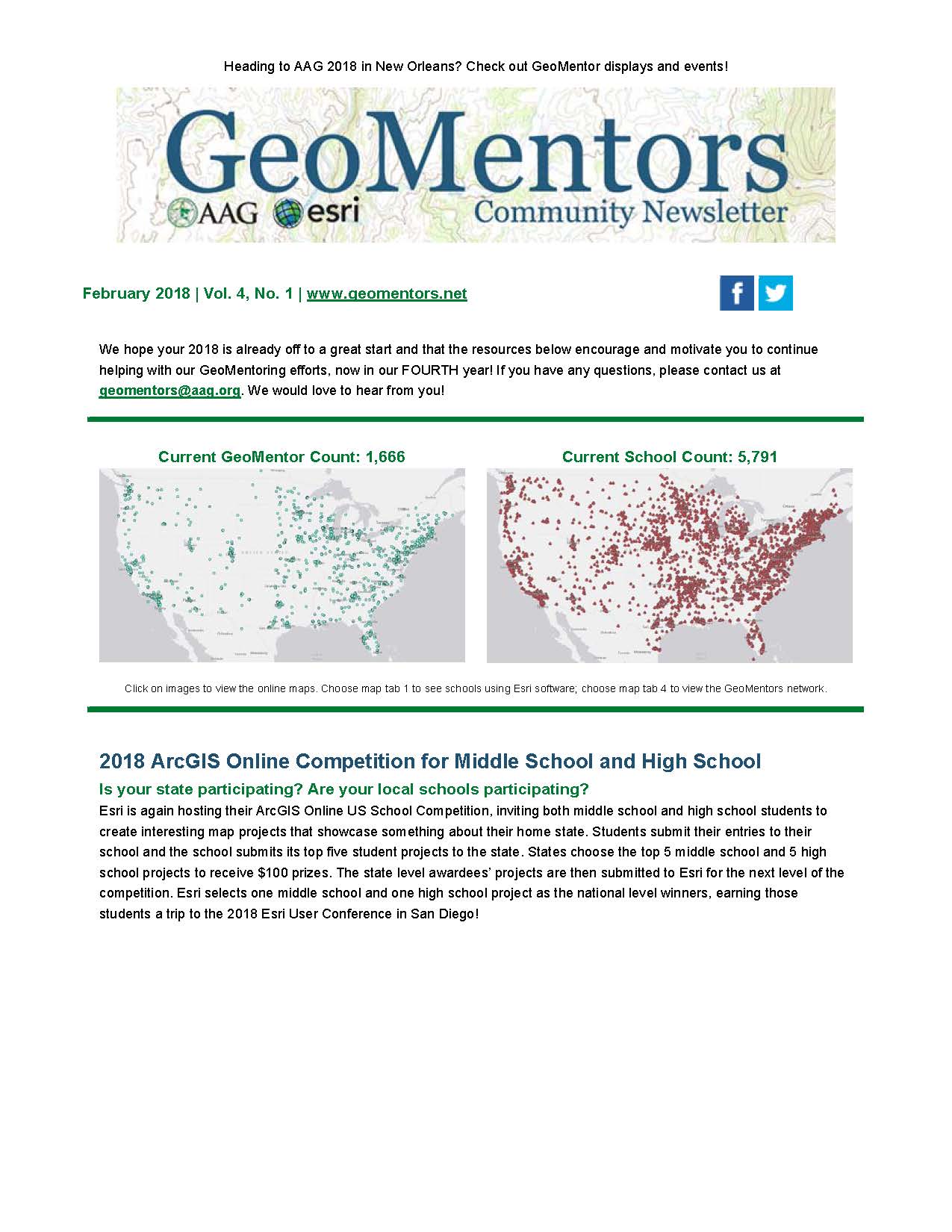
The December GeoMentors newsletter is out!  This issue features 2017 GIS Day and Geography Awareness Week wrap up, 3 year program stats, Santa Trackers, 2 new GeoMentor Spotlights, Animaniacs, USGS map downloads, and more!  View the full issue online.

more
0 0 296
JoleneKeen1
Frequent Contributor

GeoMentor Case Study:

Lixin Huang

City/State of School, School District, or Group: Viera, FL

Grade level of students you or your educator collaborator work/worked with: Grade 8

Subject/topic of class/group you assisted your collaborator with: Brevard Public Schools Sales Surtax

Approximately how many students were engaged in GIS activities through this collaboration: 1

How did you connect with your collaborator? Scheduled a regular meeting with the collaborator and communicated with the collaborator with emails.

Describe your collaboration process. I scheduled a meeting with the collaborator once a month during the school semester. The project lasted a year. Before the meeting, I told the student to prepared for it, such as what the student did and any ideas the student want to bring up. During the meeting, I encouraged the student to interact with the collaborator.

Describe the tasks you assisted your collaborator with. I assisted the collaborator with my expertise in GIS on how to process the data.

What available resources, if any, did you use or help your collaborator use to implement GIS in K-12 education? Used ArcGIS Resources website to solve the issues we encountered.

What did you gain from the experience? What do you think your educator collaborator and/or the students gained? While I was working with the student, I learned something new or enhanced my current knowledge in GIS. The student not only built the knowledge in GIS but also learned how to do a project from the beginning to the end. The educator collaborator has the project done, which provides the county residents with information on how Brevard Public Schools use the tax dollars in a intuitive way.

Any additional comments about your experience? I actually worked with my son, an 8th grader, to help Brevard Public Schools to do a project on Schools Sales Surtax. I encouraged him to get involved in the whole process of the project, which includes proposing the plan, preparing for the meeting, interacting with the collaborator, and so on. I am the person who backs him up. It really comes up well. Here is the link to the project http://arcg.is/2xnCmmA.

Check out more case studies here!

If you're interested in submitting your GeoMentor experience for a case study, we would appreciate you doing so through this survey. The collected information will only be accessible to and used by AAG and Esri program staff and will not be further distributed or posted online unless you indicate your permission to do so.

Questions? Email geomentors@aag.org.
more
0 0 295
JoleneKeen1
Frequent Contributor

December 2017 GeoMentor Spotlight:

Dan Seidensticker, GIS Specialist with the Madison Area Transportation Planning Board (MATPB) in Madison, Wisconsin

What was your favorite class in K-12: Art 

How did you first learn about and/or use GIS?: The first time I had heard of GIS was in a class I took as an undergraduate at UW-Stevens Point in 1989 where we studied the concept of spatial analysis. We did exercises where we typed grids of data into a rasters representing land use, soils, etc. and then overlaid them to do map algebra for site selection analysis. I was blown away by the possibilities this opened.

Name one thing you love about GIS and/or geography: I like the challenge of solving a spatial problem using GIS and displaying the result as a map.

Why did you want to volunteer as a GeoMentor? I have made visits to elementary schools where I demonstrated GIS and enjoyed seeing the excitement in the kids eyes when they saw what could be done. I’d like to think that I influenced some of them to pursue a career in GIS.

What kind of GeoMentor volunteer opportunity and experience are you looking for? I had the opportunity to teach Introductory Cartography at the undergraduate level and found I like introducing people to the world of GIS and showing how it can be used for more than just making a great map.

If someone asked you why they should learn about GIS and/or geography, how would you respond in one sentence? Everything in this world (and beyond) has a spatial component and GIS allows us to study their relationships.

Email address: dseidensticker@cityofmadison.com

Websites:
Department: http://www.madisonareampo.org/
LinkedIn: https://www.linkedin.com/in/danseidensticker/
Twitter: https://twitter.com/DSeidensticker?lang=en
Hobby: https://www.bestbloodymary.com/

Read about our latest featured GeoMentor here!
If you are interested in being featured, visit here for more information.


Questions? Email geomentors@aag.org.

more
2 0 623
JoleneKeen1
Frequent Contributor

The Globe Program's 4th Webinar, "Monitoring Earth's Water from Space", will be held Thursday December 7th at 8pm EST. Find more information here: http://ow.ly/5HG530gXkpO

more
0 0 267
21 Subscribers