- Home
- :
- All Communities
- :
- Products
- :
- Data Management
- :
- Geodatabase Questions
- :
- Converting Road Outline (Polyline) to Polygon
- Subscribe to RSS Feed
- Mark Topic as New
- Mark Topic as Read
- Float this Topic for Current User
- Bookmark
- Subscribe
- Mute
- Printer Friendly Page
Converting Road Outline (Polyline) to Polygon
- Mark as New
- Bookmark
- Subscribe
- Mute
- Subscribe to RSS Feed
- Permalink
Hey,
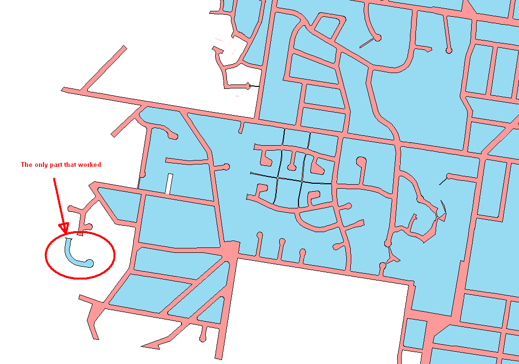
I have got our road network outlines drawn with a Polyline feature class, made up of several thousand features. They are shown as the thin black line on the attached drawing.
I would like to convert this feature class into a (single??) polygon type, the area I would expect to be correct is highlighted pink in the attached screenshot.
I have tried using the construct polygons tool on the road outline polyline feature class, which has created the blue features in the below screenshot.
In the sample area, you can see there is a single feature that actually looks correct, all the rest it has constructed on the 'wrong side' of the polyline, so I think there must be a better way to do what I am trying to do.
Any pointers to get me started?
Thanks
- Mark as New
- Bookmark
- Subscribe
- Mute
- Subscribe to RSS Feed
- Permalink
Check the overlay tools... if you had a big pink/red polygon covering the area that your blue polygons are located, you basically want to cookie-cut out the pink with the blue... like erase perhaps... but I am not quite sure what you actually have
- Mark as New
- Bookmark
- Subscribe
- Mute
- Subscribe to RSS Feed
- Permalink
Yeah I originally thought to use the properties (parcel) feature class, but it is not geographically perfect, so there are thousands of slivers and areas which are dirty data. The only clean data we have is the polyline feature class (black lines in original screenshot).
- Mark as New
- Bookmark
- Subscribe
- Mute
- Subscribe to RSS Feed
- Permalink
and you want to fill in between those lines, which might work with a one-sided buffer, dissolving the buffers, but I suspect that the directionality of the lines won't work in all cases and it won't work. And I also suspect that your lines don't form closed loops so Feature to Polygon probably won't work