- Home
- :
- All Communities
- :
- Products
- :
- Data Management
- :
- Data Management Questions
- :
- Re: Why What3Words?
- Subscribe to RSS Feed
- Mark Topic as New
- Mark Topic as Read
- Float this Topic for Current User
- Bookmark
- Subscribe
- Mute
- Printer Friendly Page
Why What3Words?
- Mark as New
- Bookmark
- Subscribe
- Mute
- Subscribe to RSS Feed
- Permalink
Have you found a business use case for What3Words in the Esri ecosystem? If yes, would you mind sharing a brief overview?
I found this discussion on Geonet and had similar thoughts. I also found some re-tweets re-presented in Geonet, but nothing that sounded like a non-novelty use.
thanks!
tim
- Mark as New
- Bookmark
- Subscribe
- Mute
- Subscribe to RSS Feed
- Permalink
The reason that probably there have been no answers is that this system is a very poor idea for addressing. It takes the spatial context out of addressing. Go to a place you know; I went to my house. I have at least nine different, totally unrelated what3words for my house. In order to do anything useful like finding distances, calculating buffer zones or neighborhoods, even finding the address of anything, you have to use a proprietary system for easy access to locations and spatial context.
- Mark as New
- Bookmark
- Subscribe
- Mute
- Subscribe to RSS Feed
- Permalink
Well Denis White, you make a point where a small area like your home having multiple W3W's. I would suggest to choose the one by your door or driveway and stick with it. You happen to live in a wonderful 81m2 home (9 3x3m tiles, you mention), but how many people in the whole world have this opportunity? not many. This is where W3W becomes useful, the idea behind it is quite revolutionary: it is easy to communicate, it is not tied to a postal address, it can be used anywhere in the world in any language.
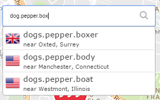
For example, emergency responders in Miami can get to the precise location easily, for example a heart attack in a golf course. You can say I'm at dog.pepper.box instead of Miami municipal golf course, hole 7, right about the second sand trap on the left Community Weekly Discussion: Mapping uncharted areas for emergency responders
One clear business case is the Mongolian post using it as their national addressing system. Partner: Mongolian Post adopts what3words as national addressing system | what3words where postal addresses are unreliable or non-existent. You can translate a W3W into a coordiante in WGS84 and do all sorts of calculations (and contextualize it). And the fact that the words are not related to to its neighbors make sense as it creates a unique point in the globe without any error.
Saying that I live in (19.448909, -99.216400) says nothing, as well as trace.reclaim.workshop does not. It is the use and context you give this information that is really useful: Rodolfo Gaona st #50, Lomas de Sotelo Neighborhood, Mexico City, Mexico. Which in order to do any sort of calculations as you mention I would need to convert it to am X,Y point in a map...
Cheers!
PS. dog.pepper.box does not exist, and the system can make corrections automatically:
- Mark as New
- Bookmark
- Subscribe
- Mute
- Subscribe to RSS Feed
- Permalink
There are many, many ways to create unique addresses that don't require commercial software to have coordinates from which you can measure distances to things, find neighbors, and do all the many other kinds of spatial analysis.
As an example of a spatially rational system of addressing check out Dubai's Makani system of 10 digit addresses with 1 meter precision.
- Mark as New
- Bookmark
- Subscribe
- Mute
- Subscribe to RSS Feed
- Permalink
ah! I did not know about Makani before. Would be interesting to see it deployed in a global scale, but then, remembering a long string of numbers would be much more difficult than just 3 words.
I agree that having to rely on a commercial system for addressing is not nice, but someone has to develop it and maintain the system, but best of all is that " what3words will always be free for individuals to use on our own site and apps. If or when we do charge for access to our web API or offline SDK, there will always be ways to use them for free." Pricing | what3words So, unless you are a commercial entity making commercial use of the system, it will be free. Remember that GPS satellites were initially developed as a military application and then made available to the public many,many, many years later. Someone paid for it; it was the taxpayer...
I have no affiliation with W3W, but I really see a practical use for it. Yes, it can be better, free for all, easier to use and other things...
How would you enrich it? or better yet, how would you create unique addresses to do all sorts of spatial analysis?
- Mark as New
- Bookmark
- Subscribe
- Mute
- Subscribe to RSS Feed
- Permalink
How about a three-word system that varies systematically on a global hexagonal grid, or a four-word system that varies with easting and northing on a global map projection (a projection like what3words uses).
A systematic three-word system would have words varying in alphabetic order along each of three axes of the hexagonal grid. Some locations would have duplicates or triplicates (e.g., at the origin of the addressing) of words. You need just the alphabetized list of words to find neighborhoods of a given hexagon (of whatever size the system uses), and therefore spatial analysis in hexagon space, or coordinate space after simple, free, conversion to coordinates. Global hexagon systems exist, see http://www.discreteglobalgrids.org/
A four-word system could have a lower and higher order address in both easting and northing using an alphabetic ordering of words.
Either of these would be easily adopted if the word lists were freely available, in various languages of course.
- Mark as New
- Bookmark
- Subscribe
- Mute
- Subscribe to RSS Feed
- Permalink
I also see many practical uses for w3w. And in an"apples-to-apples" sense - within the standard addressing system here in Anytown, USA; knowing you are at '123 Main Street' and need to travel to '567 First Avenue' also has no intrinsic spatial context.
If you live in Anytown and know the street network you may have a sense of distance and direction and path to travel - but anyone not familiar has no such context. (Not to mention there are hundreds if not thousands of unique geographic locations labelled "123 Main Street" across the USA, and elsewhere.) what three words find address or place addresses address geocoding# #w3w
- Mark as New
- Bookmark
- Subscribe
- Mute
- Subscribe to RSS Feed
- Permalink
If you are at (random1, random2, random3) you will have even less idea how to get to (random314, random42, random7) without accessing a commercial site on a computer of some kind. In a small town it's not so hard to figure out from street addresses, or you could ask someone (something that would surely be difficult with what3words). In larger places there are paper maps, and free digital maps from google and openstreetmap and bing and so on. If a digital map provider has a default address in the middle of the ocean (like lat 0, lon 0, for example) then they have surely gotten enough complaints to provide a better solution from address matching technology. Multiple locations in different places with the same address are a problem when no more information is known; routine address finding in a specific place would not have that problem.
- Mark as New
- Bookmark
- Subscribe
- Mute
- Subscribe to RSS Feed
- Permalink
Of course there are lots of reasons not to use a particular addressing/coordinate system. It's not bad or good, it's just another way to go and you need to weigh what's important to you and your project.
Advantages over street address:
- all locations have coordinates
- close together coordinates don't sound alike
- no repeats
- can be more specific than building
- more
Advantages over numerical coordinates:
- can communicate location quickly
- can remember coordinates easily
- more