- Home
- :
- All Communities
- :
- Products
- :
- Data Management
- :
- Data Management Questions
- :
- Same Data, Different DEM's - Why?
- Subscribe to RSS Feed
- Mark Topic as New
- Mark Topic as Read
- Float this Topic for Current User
- Bookmark
- Subscribe
- Mute
- Printer Friendly Page
Same Data, Different DEM's - Why?
- Mark as New
- Bookmark
- Subscribe
- Mute
- Subscribe to RSS Feed
- Permalink
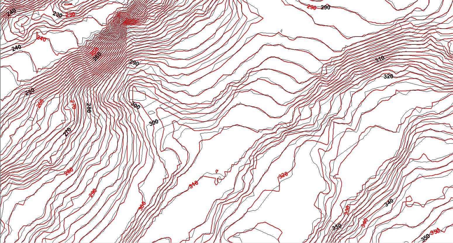
I'm working with a lidar dataset (.las file). I created a DEM of the data by first extracting a portion of lidar file using Extract LAS, and selecting an extraction boundary (polygon shapefile), then using LAS Dataset to Raster. I then created a contour map from the DEM.
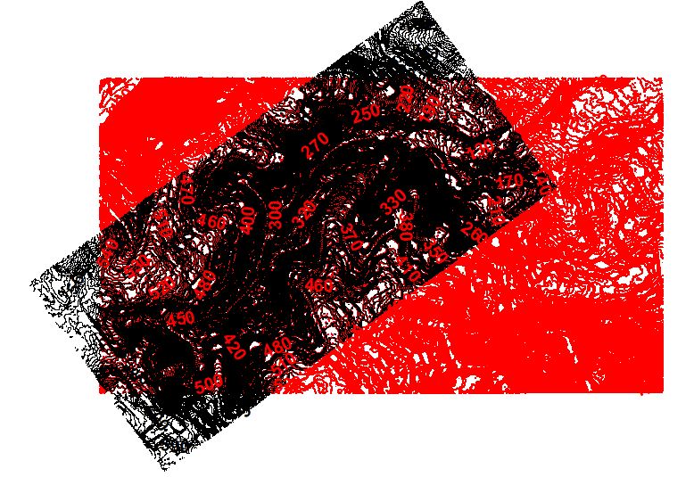
I later needed to expand the AOI to include a portion of the original clipped lidar data and areas beyond. Since the lidar data that I had originally downloaded was in four large tiles, I had enough coverage to use the same - original - dataset.
Going through the same process to create a new DEM as I had done with the original clipped lidar data, I produced a new DEM and contour map. I was able to verify that I had used the same geoprocessing by reviewing the Item Description of the original processed DEM.
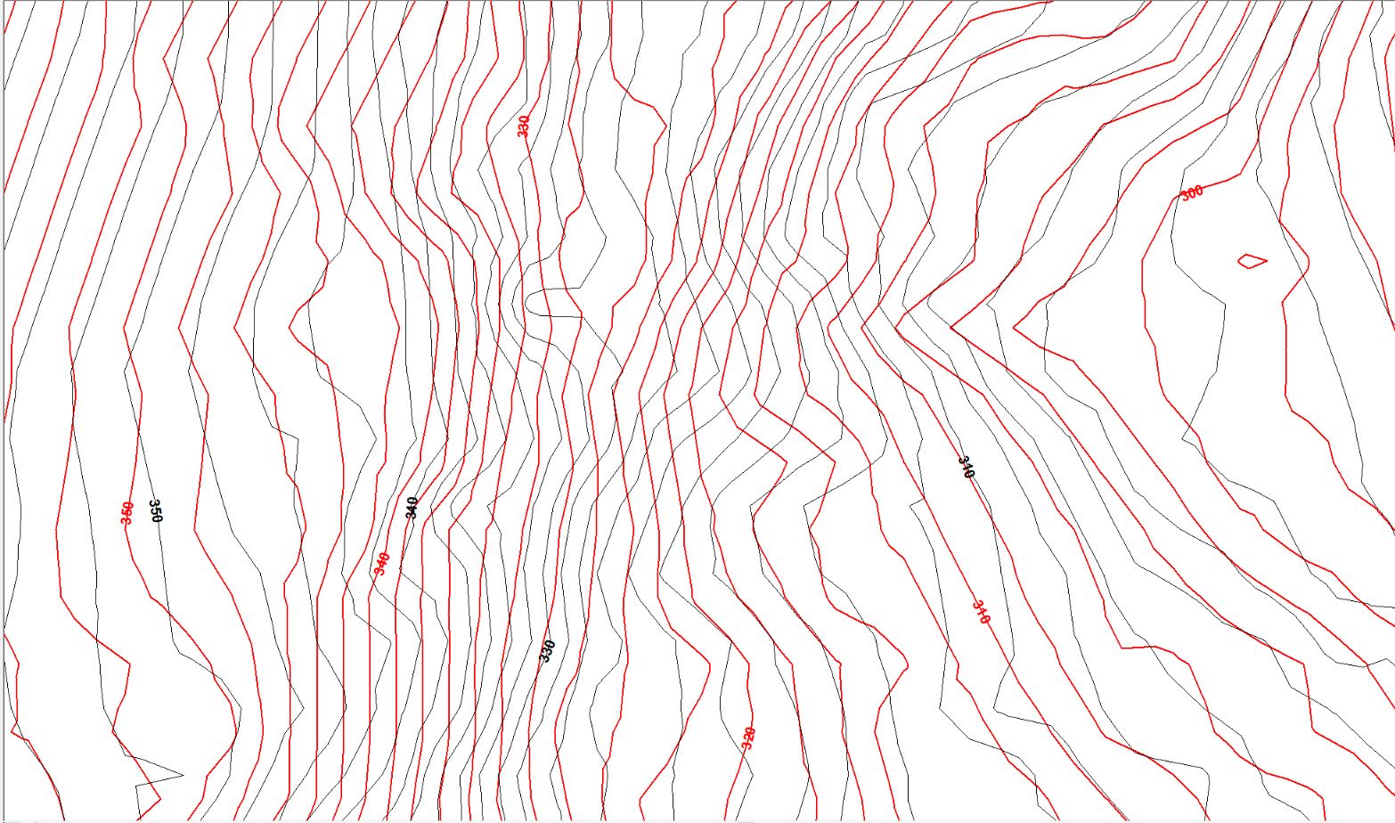
The problem is and the reason for this post, is that the overlapping portions of the DEM (and subsequent contour models) are not the same, i.e., the elevations are different. For the most part the differences are minor, but locally they are as much as 8 feet different.
I could imagine that there could and likely would be differences in the two DEM's at the margins of where the two DEM's intersect, however many of the most significant differences are well within the boundary of the original DEM.
I have run and rerun all of the original work described above (with the same anomalous result), and ran another test by processing the entire set of tiled .las files. This last DEM synced (matched elevations) with the second DEM, but was still off when compared to the original DEM I produced.
My question is; Why are the two DEM's not showing the exact same elevations?
- Mark as New
- Bookmark
- Subscribe
- Mute
- Subscribe to RSS Feed
- Permalink
Well I am not sure what you have done since the point locations aren't shown. But I would expect a potentially different result because it would depend on the interpolation being used, whether or not the points were exactly the same or more points were added/removed during the steps and a variety or other reasons... leaving aside the margins question for now
- Mark as New
- Bookmark
- Subscribe
- Mute
- Subscribe to RSS Feed
- Permalink
The tool LAS Dataset To Raster—Conversion toolbox | ArcGIS Desktop has many different options as interpolation methods (BINNING with Cell Assignment Methods and Void Fill Methods or TRIANGULATION with Triangulation Methods and Window Size Selection Methods).
Also if you have applied any filtering to the LAS Dataset when running the tool, only the values that are not filtered out will be used. The output cell size is also influencing the precision of the results, so there can be many reasons for the results to be different.
I would probably determine the difference between the DEM's (as a side note; DEM / DTM should only consider the last returns or values classified as ground) using the Minus—Help | ArcGIS Desktop tool and see where the difference is big and check values from the original LAS file to see which DEM represents a better result.
- Mark as New
- Bookmark
- Subscribe
- Mute
- Subscribe to RSS Feed
- Permalink
Thanks Dan and Xander.
I reviewed the point distributions since I did clip out several different areas from the original las tiles (with overlap on each), but the point distributions are exactly the same on each where there is overlap. Which is what I would have expected since I used the same las data and the same geoprocessing methods on all attempts.
I looked hard at the possibility that I used different processing methods, as that was my first instinct. And as a check, I reran all of my original work, looking for the outputs to differ. But nope, the results were the same, and the elevation discrepancies were still present.
I guess the question for me is: All else being equal, or in this case all data processed in the same manner from the same original set of las data, is there any reason to expect the outcome of the processed lidar data to have variable elevation outputs? My thinking is no, with the possible exception along the margins of the clipped data where the interpolation process would access cells in one of the files not present in the other.
Again, thanks for your input.