- Home
- :
- All Communities
- :
- Products
- :
- Data Management
- :
- Data Management Questions
- :
- Re: 'extract multi values to points' or 'sample' n...
- Subscribe to RSS Feed
- Mark Topic as New
- Mark Topic as Read
- Float this Topic for Current User
- Bookmark
- Subscribe
- Mute
- Printer Friendly Page
'extract multi values to points' or 'sample' not work if the raster is in a geodatabase?
- Mark as New
- Bookmark
- Subscribe
- Mute
- Subscribe to RSS Feed
- Permalink
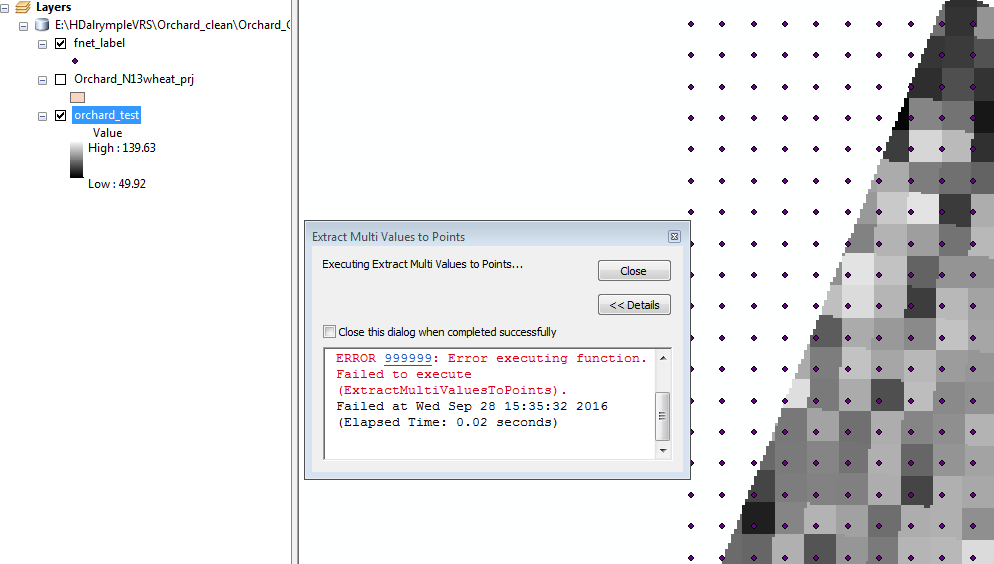
I used 'extract multi values to points' or 'sample' to extract values from several rasters but I kept getting error 999999.
They work fine if I save the rasters under a folder rather than geodatabase.
'Extract values to points' can work even the raster is in geodatabase.
Just to confirm is that a tool bug or something?
Solved! Go to Solution.
Accepted Solutions
- Mark as New
- Bookmark
- Subscribe
- Mute
- Subscribe to RSS Feed
- Permalink
the previous screen shot with the cell size of 0.62 decimal degrees, (obviously unprojected data in a geographic coordinate system) seems reasonable and it comes as no surprise that it works. The second screen shot with the cell size of about 5 micrometers .... since it is apparently in a projected coordinate system... is wrong. Yes, glad you can confirm that. So I suspect that the Define Projection was used and the file was not actually physically projected and given the cell size and extent... a geodatabase won't let it in to be with the other files, since it by no means fits within the realm possible acceptable values. This may account for the reason that it can be saved to a folder, but isn't allowed into the geodatabase to reside with the other layers.
- Mark as New
- Bookmark
- Subscribe
- Mute
- Subscribe to RSS Feed
- Permalink
I have used the Extract Multi Values to Points tool many times using rasters stored in a File Geodatabase without any problems. Are you sure the coordinate systems of the points and raster are the same? What version of ArcGIS are you using?
- Mark as New
- Bookmark
- Subscribe
- Mute
- Subscribe to RSS Feed
- Permalink
Yes, I checked the coordinate system and they were the same. I use ArcGIS 10.4.
- Mark as New
- Bookmark
- Subscribe
- Mute
- Subscribe to RSS Feed
- Permalink
Is it possible to share some of your data to see what is happening?
- Mark as New
- Bookmark
- Subscribe
- Mute
- Subscribe to RSS Feed
- Permalink
I uploaded one data file in Dropbox - ExtractValuesProblem This problem happens to every dataset of mine.
- Mark as New
- Bookmark
- Subscribe
- Mute
- Subscribe to RSS Feed
- Permalink
You are missing some files. There is no .shx file for the shapefile. If these are the only files you have, then this would be the reason for the processes to fail. If you have additional files you can zip them and simply attach them to this thread. To do this simply use the advanced editor, see link upper right corner when you are replying:

This will reveal the "Attach" link in the lower left corner:

It would also be better to include a raster as example, since if I have to generate them myself, they will be different from the ones you are using and I will likely not be able to reproduce the problem.
- Mark as New
- Bookmark
- Subscribe
- Mute
- Subscribe to RSS Feed
- Permalink
Thanks, see if you can open them this time. Please let me know what you need further.
- Mark as New
- Bookmark
- Subscribe
- Mute
- Subscribe to RSS Feed
- Permalink
I can confirm that the reason for this problem is the fact that the point featureclass "fnet_label" does not have any coordinate system defined. Please always try to have the same projection for the data that will be used in a spatial analysis to avoid problems.
You should use the Define Projection tool to set the correct projection:

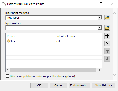
After that you can use the Extract Values or Extract Multi Values tools to extract the values from the raster:
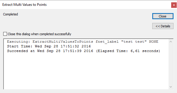
... and it will run without problems:
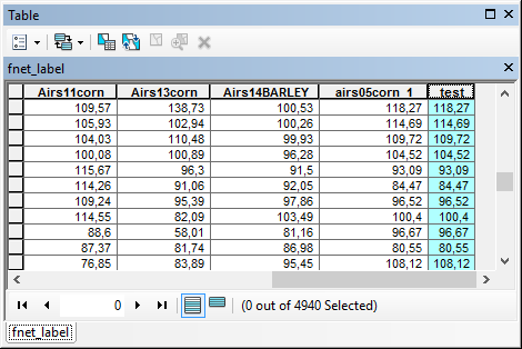
And where the points are located on a pixel value that value will be extracted:
- Mark as New
- Bookmark
- Subscribe
- Mute
- Subscribe to RSS Feed
- Permalink
Thanks, since the fishnet label are generated on a projected layer, I thought it must be projected as the same projection too.
- Mark as New
- Bookmark
- Subscribe
- Mute
- Subscribe to RSS Feed
- Permalink
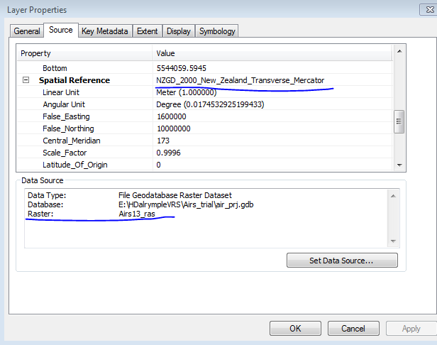
Sorry I am not sure if this is the correct answer. I do it again today but it turns out the same issue.
'fnet_label' has the same coordinate system as my raster. Here are screen shots:


Extract values to points works fine though ... ...