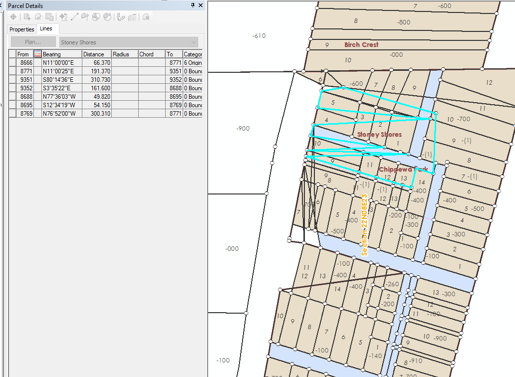
I have been having some issues with subdivision and condo boundaries displaying improperly in my parcel fabric. After inputting the boundary, a series of extra lines will display. You can see from the table that the polygon is not described this way:

Also, if I un-join and re-join the number and arrangement of extra lines will occasionally change. Additionally, sometimes if I work in another area and go back, the lines will look better. I have saved and closed out as well as added the fabric into a new map document with no luck. Has anyone seen this before?