- Home
- :
- All Communities
- :
- Products
- :
- Data Management
- :
- Data Management Questions
- :
- Re: Divide Irregular Polygon into 730 parts
- Subscribe to RSS Feed
- Mark Topic as New
- Mark Topic as Read
- Float this Topic for Current User
- Bookmark
- Subscribe
- Mute
- Printer Friendly Page
- Mark as New
- Bookmark
- Subscribe
- Mute
- Subscribe to RSS Feed
- Permalink
Is there a utility or something that I could use to divide an irregularly shaped polygon into 730 pieces, preferably of equal area? For example, take any given state polygon in the US and divide it into 730 pieces.
Thank you!!
Solved! Go to Solution.
Accepted Solutions
- Mark as New
- Bookmark
- Subscribe
- Mute
- Subscribe to RSS Feed
- Permalink
I think this might work (sorry if the code is a little messy):
import arcpy arcpy.env.overwriteOutput = True #set number of desired cells: x=730 #set feature classes: inFC=r'C:\Path\To\Poly.shp' tempGrid=r'C:\Path\To\tempGrid.shp' #just a temporary file outFC=r'C:\Path\To\grid.shp' #final grid #set default grid variables: extent = arcpy.Describe(inFC).extent origin_coord=str(extent.XMin)+" "+str(extent.YMin) oppositeCoorner=str(extent.XMax)+" "+str(extent.YMax) y_axis_coord=str(extent.XMin)+" "+str(extent.YMin+10) number_rows=number_columns=0 geometryType = 'POLYGON' #set starting cellSize and increment: cellSize=max(float(extent.width),float(extent.height)) inc=cellSize countOutFC=0.0 #needed to start while loop #Find an appropriate cell size: while countOutFC!=x: if cellSize==inc: inc=inc/2.0 continue cell_width=cell_height=cellSize arcpy.CreateFishnet_management(tempGrid,origin_coord,y_axis_coord,cell_width,cell_height,number_rows,number_columns,oppositeCoorner,"LABELS","#",geometryType) arcpy.MakeFeatureLayer_management(tempGrid, "temp_lyr") arcpy.SelectLayerByLocation_management("temp_lyr", "INTERSECT", inFC) countOutFC=float(arcpy.GetCount_management("temp_lyr").getOutput(0)) print "Cell size: "+str(cellSize)+" Count: "+str(countOutFC) if countOutFC>x: print "Overshot..." cellSize=prevCellSize inc=inc/2.0 else: prevCellSize=cellSize cellSize-=inc cellSize=prevCellSize print '\nFound an appropriate cell size: '+str(cellSize) #Find a simplified cell size: print "\nTrying to simplify..." for i in range(len(str(cellSize))): simpCellSize=round(cellSize,i) if simpCellSize==0: continue cell_width=cell_height=simpCellSize arcpy.CreateFishnet_management(tempGrid,origin_coord,y_axis_coord,cell_width,cell_height,number_rows,number_columns,oppositeCoorner,"LABELS","#",geometryType) arcpy.MakeFeatureLayer_management(tempGrid, "temp_lyr") arcpy.SelectLayerByLocation_management("temp_lyr", "INTERSECT", inFC) countOutFC=float(arcpy.GetCount_management("temp_lyr").getOutput(0)) print "Cell size: "+str(simpCellSize)+" Count: "+str(countOutFC) if countOutFC==x: break if simpCellSize==cellSize: print "Could not easily find a simplified cell size." #rerun for last good cellsize (not simplified): cell_width=cell_height=cellSize arcpy.CreateFishnet_management(tempGrid,origin_coord,y_axis_coord,cell_width,cell_height,number_rows,number_columns,oppositeCoorner,"LABELS","#",geometryType) arcpy.MakeFeatureLayer_management(tempGrid, "temp_lyr") arcpy.SelectLayerByLocation_management("temp_lyr", "INTERSECT", inFC) else: print "A simplified cell size: "+str(simpCellSize) arcpy.Select_analysis("temp_lyr",outFC) print "Done!!!"The code is a little slow (it took 35 seconds on my fast machine). Let me know how it goes!
- Mark as New
- Bookmark
- Subscribe
- Mute
- Subscribe to RSS Feed
- Permalink
How do you want to split the polygon? By a road network? Do you want the polygon split into little squares, long slivers or something else?
Let me know, and we might be able to figure something out.
- Mark as New
- Bookmark
- Subscribe
- Mute
- Subscribe to RSS Feed
- Permalink
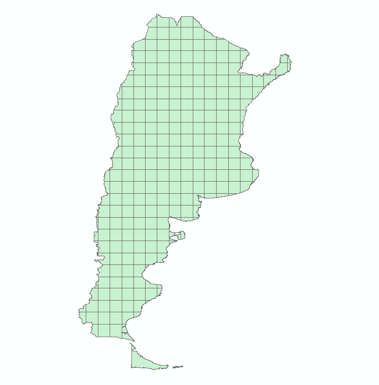
[ATTACH=CONFIG]33624[/ATTACH]
- Mark as New
- Bookmark
- Subscribe
- Mute
- Subscribe to RSS Feed
- Permalink
- Mark as New
- Bookmark
- Subscribe
- Mute
- Subscribe to RSS Feed
- Permalink
- Mark as New
- Bookmark
- Subscribe
- Mute
- Subscribe to RSS Feed
- Permalink
I think this might work (sorry if the code is a little messy):
import arcpy arcpy.env.overwriteOutput = True #set number of desired cells: x=730 #set feature classes: inFC=r'C:\Path\To\Poly.shp' tempGrid=r'C:\Path\To\tempGrid.shp' #just a temporary file outFC=r'C:\Path\To\grid.shp' #final grid #set default grid variables: extent = arcpy.Describe(inFC).extent origin_coord=str(extent.XMin)+" "+str(extent.YMin) oppositeCoorner=str(extent.XMax)+" "+str(extent.YMax) y_axis_coord=str(extent.XMin)+" "+str(extent.YMin+10) number_rows=number_columns=0 geometryType = 'POLYGON' #set starting cellSize and increment: cellSize=max(float(extent.width),float(extent.height)) inc=cellSize countOutFC=0.0 #needed to start while loop #Find an appropriate cell size: while countOutFC!=x: if cellSize==inc: inc=inc/2.0 continue cell_width=cell_height=cellSize arcpy.CreateFishnet_management(tempGrid,origin_coord,y_axis_coord,cell_width,cell_height,number_rows,number_columns,oppositeCoorner,"LABELS","#",geometryType) arcpy.MakeFeatureLayer_management(tempGrid, "temp_lyr") arcpy.SelectLayerByLocation_management("temp_lyr", "INTERSECT", inFC) countOutFC=float(arcpy.GetCount_management("temp_lyr").getOutput(0)) print "Cell size: "+str(cellSize)+" Count: "+str(countOutFC) if countOutFC>x: print "Overshot..." cellSize=prevCellSize inc=inc/2.0 else: prevCellSize=cellSize cellSize-=inc cellSize=prevCellSize print '\nFound an appropriate cell size: '+str(cellSize) #Find a simplified cell size: print "\nTrying to simplify..." for i in range(len(str(cellSize))): simpCellSize=round(cellSize,i) if simpCellSize==0: continue cell_width=cell_height=simpCellSize arcpy.CreateFishnet_management(tempGrid,origin_coord,y_axis_coord,cell_width,cell_height,number_rows,number_columns,oppositeCoorner,"LABELS","#",geometryType) arcpy.MakeFeatureLayer_management(tempGrid, "temp_lyr") arcpy.SelectLayerByLocation_management("temp_lyr", "INTERSECT", inFC) countOutFC=float(arcpy.GetCount_management("temp_lyr").getOutput(0)) print "Cell size: "+str(simpCellSize)+" Count: "+str(countOutFC) if countOutFC==x: break if simpCellSize==cellSize: print "Could not easily find a simplified cell size." #rerun for last good cellsize (not simplified): cell_width=cell_height=cellSize arcpy.CreateFishnet_management(tempGrid,origin_coord,y_axis_coord,cell_width,cell_height,number_rows,number_columns,oppositeCoorner,"LABELS","#",geometryType) arcpy.MakeFeatureLayer_management(tempGrid, "temp_lyr") arcpy.SelectLayerByLocation_management("temp_lyr", "INTERSECT", inFC) else: print "A simplified cell size: "+str(simpCellSize) arcpy.Select_analysis("temp_lyr",outFC) print "Done!!!"The code is a little slow (it took 35 seconds on my fast machine). Let me know how it goes!
- Mark as New
- Bookmark
- Subscribe
- Mute
- Subscribe to RSS Feed
- Permalink
Hi Joshua,
Do you think it would be possible to modify your script to operate on individual polygons inside of a map instead of the map extents? I'm struggling a bit trying to figure out how to divide a map of many ~ 1 mi sections into 100 ~.1 mi sub-sections with labels in each.
Thanks,
Jack
- Mark as New
- Bookmark
- Subscribe
- Mute
- Subscribe to RSS Feed
- Permalink
Hello Jack,
I think this should work (but I didn't have a chance to test).
Let me know how it does. Good luck!
import arcpy
arcpy.env.overwriteOutput = True


targetLayers=['farm fields','Municipalities'] #specify all the layers you want (they must have unique names)
mxdpath=r'C:\Path\To\MapDoc.mxd' #point to your mxd


mxd=arcpy.mapping.MapDocument("CURRENT")
lyrs=arcpy.mapping.ListLayers(mxd)
dfName='Layers' #name of the data frame you want to add the new grids to


for lyr in lyrs:
  if not lyr.name in targetLayers:
    continue #Skip all non-target layers
  #set number of desired cells:
  x=730

  #set feature classes:
  inFC=lyr
  tempGrid=r'C:\Path\To\tempGrid.shp' #just a temporary file
  outFC=r'C:\Path\To\grid_'+lyr.name+'.shp' #final grid

  #delete tempGrid if exists:
  if arcpy.Exists(tempGrid):
    arcpy.Delete_management(tempGrid)


  #set default grid variables:
  extent = arcpy.Describe(inFC).extent
  origin_coord=str(extent.XMin)+" "+str(extent.YMin)
  oppositeCoorner=str(extent.XMax)+" "+str(extent.YMax)
  y_axis_coord=str(extent.XMin)+" "+str(extent.YMin+10)
  number_rows=number_columns=0
  geometryType = 'POLYGON'

  #set starting cellSize and increment:
  cellSize=max(float(extent.width),float(extent.height))
  inc=cellSize

  countOutFC=0.0 #needed to start while loop

  #Find an appropriate cell size:
  while countOutFC!=x:
    if cellSize==inc:
      inc=inc/2.0
      continue
    cell_width=cell_height=cellSize
    arcpy.CreateFishnet_management(tempGrid,origin_coord,y_axis_coord,cell_width,cell_height,number_rows,number_columns,oppositeCoorner,"LABELS","#",geometryType)

    arcpy.MakeFeatureLayer_management(tempGrid, "temp_lyr")
    arcpy.SelectLayerByLocation_management("temp_lyr", "INTERSECT", inFC)

    countOutFC=float(arcpy.GetCount_management("temp_lyr").getOutput(0))

    print "Cell size: "+str(cellSize)+"  Count: "+str(countOutFC)
    if countOutFC>x:
      print "Overshot..."
      cellSize=prevCellSize
      inc=inc/2.0
    else:
      prevCellSize=cellSize
      cellSize-=inc

  cellSize=prevCellSize
  print '\nFound an appropriate cell size: '+str(cellSize)

  #Find a simplified cell size:
  print "\nTrying to simplify..."
  for i in range(len(str(cellSize))):
    simpCellSize=round(cellSize,i)
    if simpCellSize==0:
      continue
    cell_width=cell_height=simpCellSize
    arcpy.CreateFishnet_management(tempGrid,origin_coord,y_axis_coord,cell_width,cell_height,number_rows,number_columns,oppositeCoorner,"LABELS","#",geometryType)
    arcpy.MakeFeatureLayer_management(tempGrid, "temp_lyr")
    arcpy.SelectLayerByLocation_management("temp_lyr", "INTERSECT", inFC)

    countOutFC=float(arcpy.GetCount_management("temp_lyr").getOutput(0))
    print "Cell size: "+str(simpCellSize)+"  Count: "+str(countOutFC)
    if countOutFC==x:
      break

  if simpCellSize==cellSize:
    print "Could not easily find a simplified cell size."
    #rerun for last good cellsize (not simplified):
    cell_width=cell_height=cellSize
    arcpy.CreateFishnet_management(tempGrid,origin_coord,y_axis_coord,cell_width,cell_height,number_rows,number_columns,oppositeCoorner,"LABELS","#",geometryType)
    arcpy.MakeFeatureLayer_management(tempGrid, "temp_lyr")
    arcpy.SelectLayerByLocation_management("temp_lyr", "INTERSECT", inFC)
    else:
      print "A simplified cell size: "+str(simpCellSize)

    arcpy.Select_analysis("temp_lyr",outFC)
    #add new data to mxd
    df = arcpy.mapping.ListDataFrames(mxd, dfName)[0]
    newlayer = arcpy.mapping.Layer(outFC)
    arcpy.mapping.AddLayer(df, newlayer, "AUTO_ARRANGE")

print "Done!!!"
Edit (July 14, 2014): Added lines 25-27
- Mark as New
- Bookmark
- Subscribe
- Mute
- Subscribe to RSS Feed
- Permalink
Thanks for the reply Joshua! I didn't have much time to try this out Friday before I left the office, but on initial run, I got an error on the AddLayer call on line 94. The second argument 'addLayer' was undefined. I'll read through it again Monday morning and see if I can figure it out...I may have left something out.
Thanks again,
Jack
- Mark as New
- Bookmark
- Subscribe
- Mute
- Subscribe to RSS Feed
- Permalink
Hello Jack,
I had made an edit to my code shortly after posting. You must have grabbed the wrong code. Line 94 should read: arcpy.mapping.AddLayer(df, newlayer, "AUTO_ARRANGE")
Let me know if that works for you!