- Home
- :
- All Communities
- :
- Products
- :
- Data Management
- :
- Data Management Questions
- :
- Re: Define source raster in mosaic dataset
- Subscribe to RSS Feed
- Mark Topic as New
- Mark Topic as Read
- Float this Topic for Current User
- Bookmark
- Subscribe
- Mute
- Printer Friendly Page
Define source raster in mosaic dataset
- Mark as New
- Bookmark
- Subscribe
- Mute
- Subscribe to RSS Feed
- Permalink
I have a problem with source rasters in my mosaic dataset which is updated by python script.
I've noticed that some older mosaic records lost reference to source rasters and the Raster field is empty:
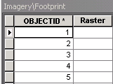
When I click in Raster column, empty properties are displayed.
I've already checked with Repair tool if the data sources are correct - rasters are in the same place and I can access folder with UNC path.
I've also run Analyze Mosaic Dataset and got already known error: The RASTER field of the mosaic dataset item is empty.
The suggested solution is running Synchronize Mosic Dataset tool. When I run it, it says: "0 items synchronized", no matter what I select with options.
Is there any other way to reconnect source rasters to mosaic?
If there's no automatic way to update raster - how to do this manually. Is it possible to update source of the raster just like source of layer?
Mosaic resides in file geodatabase, version 10.3.1.
- Mark as New
- Bookmark
- Subscribe
- Mute
- Subscribe to RSS Feed
- Permalink
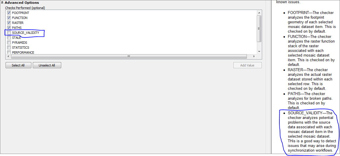
Have you tried analysing the Dataset? and see what errors come up by checking the "source_validity", see image below:
Baba
- Mark as New
- Bookmark
- Subscribe
- Mute
- Subscribe to RSS Feed
- Permalink
Yes. I've already analyzed the mosaic with this option selected. And I got the error: "The RASTER field of the mosaic dataset item is empty."
- Mark as New
- Bookmark
- Subscribe
- Mute
- Subscribe to RSS Feed
- Permalink
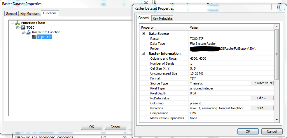
I don't know how you build your "Mosaic Dataset" using ArcPy but if you can identify those "Rasters" causing error then right click on them (each one) and check the raster property > Functions > RasterInfo Function (Right click on the image) > Properties, and see what the Data Source says. See Image below:
Baba
- Mark as New
- Bookmark
- Subscribe
- Mute
- Subscribe to RSS Feed
- Permalink
I can't access raster properties at all, because the reference is totally lost:
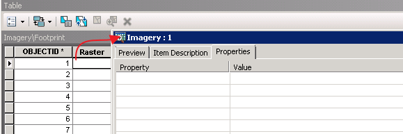
In ArcCatalog application when I click Properties, I get error: "Failed to Open Dataset".
And I don't see any other way to access properties of individual raster within mosaic.
- Mark as New
- Bookmark
- Subscribe
- Mute
- Subscribe to RSS Feed
- Permalink
Can I see a screenshot of the tool you used in your arcpy? cos I only ran my mosaic dataset once and whenever I want to update or add I simple add the rasters to the "origin" folder and do a synchronisation. except you are using a "Referenced" Mosaic rather than Mosaic Dataset?
Baba
- Mark as New
- Bookmark
- Subscribe
- Mute
- Subscribe to RSS Feed
- Permalink
This may be too obvious Repairing paths in a mosaic dataset—Help | ArcGIS for Desktop
but I will throw it out anyway.
- Mark as New
- Bookmark
- Subscribe
- Mute
- Subscribe to RSS Feed
- Permalink
You Can try to use Export Mosaic Dataset Paths—Help | ArcGIS for Desktop to create a table with all paths. You will have to check what you get for the problem rasters but it should help to identify them.
I do not know a way to fix paths in Python. It should be easy to remove the bad rasters and add them again using Python. You must check that the overviews are still ok.
- Mark as New
- Bookmark
- Subscribe
- Mute
- Subscribe to RSS Feed
- Permalink
This didn't help. The exported table didn't contain raster paths where Raster field was empty.
Eventually I took last working backup, added all new images and copied all custom attributes from the current mosaic.
Thank all of you for the interest.