- Home
- :
- All Communities
- :
- Products
- :
- Data Management
- :
- Data Management Questions
- :
- Re: Automating Geodatabase Replication with Differ...
- Subscribe to RSS Feed
- Mark Topic as New
- Mark Topic as Read
- Float this Topic for Current User
- Bookmark
- Subscribe
- Mute
- Printer Friendly Page
Automating Geodatabase Replication with Different Spatial References
- Mark as New
- Bookmark
- Subscribe
- Mute
- Subscribe to RSS Feed
- Permalink
I really like the idea of geodatabase replication, and one idea we've had recently is to replicate our production data to a separate geodatabase specifically used for web services. Our production data is in a local State Plane coordinate and we'd like our web environment to be in Web Mercator so that no projection has to be done on the data in order to overlay on Esri standard base maps.
I am aware of this Esri technical article that provides a workflow for initially creating the replica, and it works as expected.
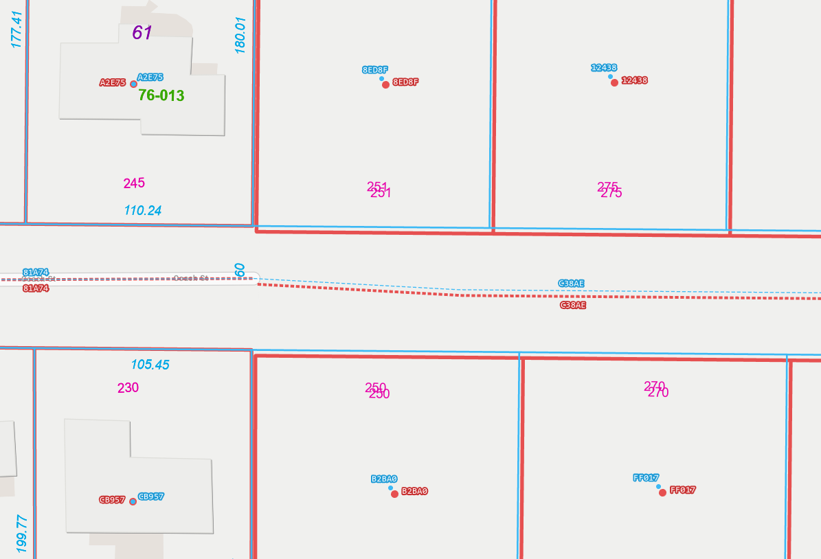
However, I'd like to automate the process of synchronizing our replicas using Python. When I test this workflow, edits pushed from production to the web replica do not seem to take into account any type of transformation, and when the web replica is overlaid with the production data, you can see the NAD83 and WGS84 datum shift (screenshot below).
Is there any way to account for the datum transformation when automating the replica synchronization? Having to manually sync the replica using tools within ArcMap really isn't a feasible option for us.
Blue features = production data in NAD83 State Plane
Red features = replicated data in WGS84 Web Mercator
The shifted red features are those that were added AFTER the replica was created and then synchronized.
Solved! Go to Solution.
Accepted Solutions
- Mark as New
- Bookmark
- Subscribe
- Mute
- Subscribe to RSS Feed
- Permalink
Review the following article on applying a geographic transformation when synchronizing a replica to determine if it helps with the behavior.
Add the following environment in the python script.
eg:
arcpy.env.geographicTransformations = "WGS_1984_(ITRF00)_To_NAD_1983"
- Mark as New
- Bookmark
- Subscribe
- Mute
- Subscribe to RSS Feed
- Permalink
Nana Dei,
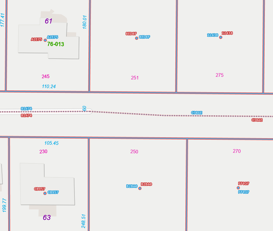
This is exactly what I was looking for, thank you so much! Edited the test features (blue) in the screenshot above, added the environment variable for the transformation to my python script, and synchronized edits. Everything lines up now 
As a follow-up, I see that the Create Replica tool has an environment variable for geographic transformations as well. Instead of doing the manual create replica method in ArcMap mentioned in this article, can I just add the same environment variable when creating the replica via a python script using arcpy.CreateReplica?
Thanks again!!!
- Mark as New
- Bookmark
- Subscribe
- Mute
- Subscribe to RSS Feed
- Permalink
The 'Create Replica' gp tool doesn't support projecting feature classes into another coordinate system. The following idea is related to the requested functionality.