- Home
- :
- All Communities
- :
- Products
- :
- ArcMap (Retired)
- :
- ArcMap Questions
- :
- Re: NARR netCDF file.
- Subscribe to RSS Feed
- Mark Topic as New
- Mark Topic as Read
- Float this Topic for Current User
- Bookmark
- Subscribe
- Mute
- Printer Friendly Page
NARR netCDF file.
- Mark as New
- Bookmark
- Subscribe
- Mute
- Subscribe to RSS Feed
- Permalink
I am working with netCDF files from NARR. When I export the file into ARCMAP the projection is unknown. The projection of the original file should be WGS_1984_ Lambert_Conformal_Conic. I fixed the projection so many times but it gives me a check-mark indicating that it's fixed but remains unknown when I click the properties. Please let me know what can be done to fix the projection. I tried fixing it in the catalog but no luck.
I have attached the sample file from NARR.
Your help is appreciated!
- Mark as New
- Bookmark
- Subscribe
- Mute
- Subscribe to RSS Feed
- Permalink
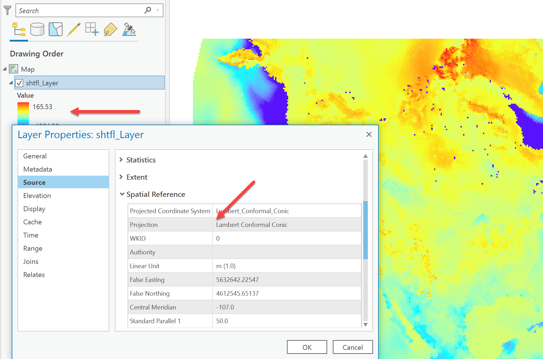
It works in ArcGIS Pro, just used X, Y for the X and Y dimensions and shftl as the variable. The coordinate system is as noted in the image
- Mark as New
- Bookmark
- Subscribe
- Mute
- Subscribe to RSS Feed
- Permalink
Can this be done on ArcGIS??
- Mark as New
- Bookmark
- Subscribe
- Mute
- Subscribe to RSS Feed
- Permalink
If you mean ArcMap, I don't know, I haven't used it in a couple of years and no longer have it installed.
- Mark as New
- Bookmark
- Subscribe
- Mute
- Subscribe to RSS Feed
- Permalink
I tried opening-up the file on Arcgis pro. It works for the shtfl layer but for lat and lon layer the projection still remains unknown.
- Mark as New
- Bookmark
- Subscribe
- Mute
- Subscribe to RSS Feed
- Permalink
As you have noted, for some reason ArcGIS Desktop (ArcMap) cannot properly interpret the coordinate system from this file. However, ArcGIS Pro is able to interpret and georeference the 'shtfl' variable in this file. This is possible because the file contains CF-compliant metadata (CF Conventions Home Page ), with a coordinate system variable ("Lambert_Conformal") and the 'shtfl' variable contains a "grid_mapping" attribute that points to the coordinate system variable.
If you would like to visualize the 2D latitude and longitude variables ("lat" and "lon", respectively), you can simply add a variable attribute 'grid_mapping = "Lambert_Conformal"' to each variable. You can do this easily with the NetCDF Operators (NCO, NCO Homepage ) command-line tool 'ncatted', specifying to append ("a") the character ("c") attribute named "grid_mapping_name" to the "lat" and "lon" variables in an existing file. Example below:
> C:\nco\ncatted.exe -a grid_mapping_name,lat,a,c,"Lambert_Conformal" .\shtfl.2000.nc
> C:\nco\ncatted.exe -a grid_mapping_name,lon,a,c,"Lambert_Conformal" .\shtfl.2000.nc
Once this is completed, you will be able to bring those variables into ArcGIS Pro using the Make NetCDF Raster Layer tool, just as you did with the 'shtfl' variable.