- Home
- :
- All Communities
- :
- Products
- :
- ArcGIS Web AppBuilder
- :
- ArcGIS Web AppBuilder Questions
- :
- WAB Directions widget shows coordinates instead of...
- Subscribe to RSS Feed
- Mark Topic as New
- Mark Topic as Read
- Float this Topic for Current User
- Bookmark
- Subscribe
- Mute
- Printer Friendly Page
WAB Directions widget shows coordinates instead of address
- Mark as New
- Bookmark
- Subscribe
- Mute
- Subscribe to RSS Feed
- Permalink
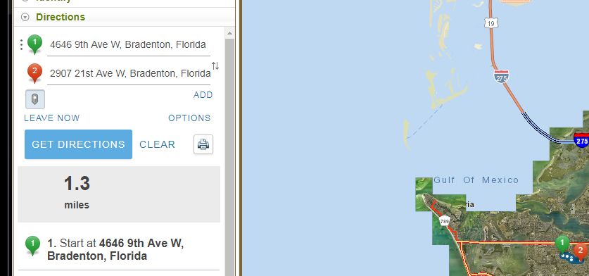
WAB in Portal 10.5.1 is still showing coordinates instead of addresses in 10.5.1 (10.5.1 server routing service also) when using a local geocode service

It also displays mixed coordinates, web mercator sometimes, lat/long other times
The actual reversegeocode results for these two points contained a valid address.
{"address":{"Street":"611 13TH AVE E","City":"BRADENTON","ZIP":"34208","Match_addr":"611 13TH AVE E, BRADENTON, 34208"},"location":{"x":-9190285.6009550039,"y":3184609.8380619353,"spatialReference":{"wkid":102100,"latestWkid":3857}}}

The app is publicly facing
ArcGIS Web Application

any ideas?
dlaw-esristaff
Solved! Go to Solution.
- Mark as New
- Bookmark
- Subscribe
- Mute
- Subscribe to RSS Feed
- Permalink
But it should show the address, not the coordinates
- Mark as New
- Bookmark
- Subscribe
- Mute
- Subscribe to RSS Feed
- Permalink
Hi Jeff,
The Map Viewer Directions functionality works the same as the Web AppBuilder Directions widget - both are based on the ArcGIS API for JavaScript. Since they are both yielding the same result, we think that something's not configured correctly with the locator service.
Hope this helps,
- Mark as New
- Bookmark
- Subscribe
- Mute
- Subscribe to RSS Feed
- Permalink
Sorry Jeff, I'm not sure what the issue is.
Can you please open an issue with Esri Tech Support so they can investigate further?
- Mark as New
- Bookmark
- Subscribe
- Mute
- Subscribe to RSS Feed
- Permalink
Derek Law I believe it is a problem with the Directions widget itself, or a new parameter it requires. Here is a jsbin
JS Bin - Collaborative JavaScript Debugging
If you toggle the locators, you can see that the ESRI locator produces addresses, the local locator produces coordinates
- Mark as New
- Bookmark
- Subscribe
- Mute
- Subscribe to RSS Feed
- Permalink
So this is what i notice. When I use the ESRI geocoder, the result is of the reverse geocode is
{ "address": { "Match_addr": "1301 6th Ave W, Bradenton, Florida, 34205", "LongLabel": "1301 6th Ave W, Bradenton, FL, 34205, USA", "ShortLabel": "1301 6th Ave W", "Addr_type": "PointAddress", "Type": "", "PlaceName": "", "AddNum": "1301", "Address": "1301 6th Ave W", "Block": "", "Sector": "", "Neighborhood": "Downtown Bradenton", "District": "", "City": "Bradenton", "MetroArea": "", "Subregion": "Manatee", "Region": "Florida", "Territory": "", "Postal": "34205", "PostalExt": "", "CountryCode": "USA" }, "location": { "x": -9192178.327651022, "y": 3185346.6512340987, "spatialReference": { "wkid": 102100, "latestWkid": 3857 } } }But the result of the reverse geocode from my local geocoder is{ "address": { "Street": "410 8TH ST W", "City": "BRADENTON", "ZIP": "34205", "Match_addr": "410 8TH ST W, BRADENTON, 34205" }, "location": { "x": -9191661.5173121095, "y": 3185587.8277426539, "spatialReference": { "wkid": 102100, "latestWkid": 3857 } } }Since the Match_Addr is what is listed in the geocode results using ESRII would expect the same from a local geocoder.
- Mark as New
- Bookmark
- Subscribe
- Mute
- Subscribe to RSS Feed
- Permalink
I can confirm I get the same results:
{ "address": { "Street": "5504 ASHTON RD", "City": "NCTY", "ZIP": "34233", "Match_addr": "5504 ASHTON RD, NCTY, 34233" }, "location": { "x": -9179416.6356466208, "y": 3158060.4914356801, "spatialReference": { "wkid": 102100, "latestWkid": 3857 } } }I can also confirm that this has been an issue in the api going back to at least 3.14 for the standard US Dual Range Addresses style address locator. I had thought for sure I had posted about this earlier but alas the issue does not show up in anything I have posted....
- Mark as New
- Bookmark
- Subscribe
- Mute
- Subscribe to RSS Feed
- Permalink
Yep here is the old thread
https://community.esri.com/thread/183568-web-appbuilder-directions-not-working-with-local-geocoder
However the JSBin sample shows the problem is back
- Mark as New
- Bookmark
- Subscribe
- Mute
- Subscribe to RSS Feed
- Permalink
dlaw-esristaff can you tell me which team to address the support call to?
- Mark as New
- Bookmark
- Subscribe
- Mute
- Subscribe to RSS Feed
- Permalink
Hi Jeff,
Please note in the tech support issue that it should be routed to the Web AppBuilder Dev team. This might be a bug or a needed enhancement in the Directions widget.
Thanks,
Derek