- Home
- :
- All Communities
- :
- Products
- :
- ArcGIS Web AppBuilder
- :
- ArcGIS Web AppBuilder Questions
- :
- Re: Parcel Drafter Questions
- Subscribe to RSS Feed
- Mark Topic as New
- Mark Topic as Read
- Float this Topic for Current User
- Bookmark
- Subscribe
- Mute
- Printer Friendly Page
Parcel Drafter Questions
- Mark as New
- Bookmark
- Subscribe
- Mute
- Subscribe to RSS Feed
- Permalink
Hi-
I am trying to set up the Parcel Drafter widget. I am using it for something a little different from what it was originally created for, but when I tested the demo, it looked to be a possible solution.
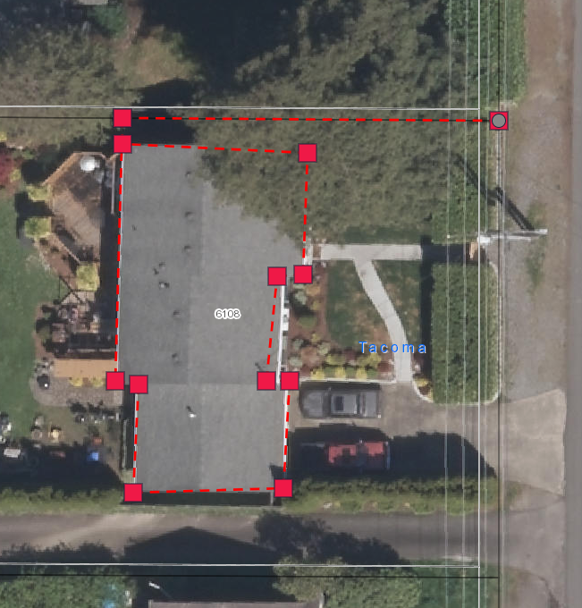
Staff needs to be able to create a legal description of a building foot print within a parcel. This is then used to create an assessment fee. When I found the parcel drafter widget, it looked like it might be the answer to what I was searching for. Staff could snap to the corner of a parcel and draw the outline, then be given the list of the traverse for the legal description.
I can draw in the lines, but once I click the "Save" button, the lines disappear (unlike when I played with the demo app, so maybe I have something set up wrong behind the scenes??). Does anyone know how to keep the lines on the map, even if the polygon isn't complete? I can get the demo app to do this, and label the lines? (see second screen shot)
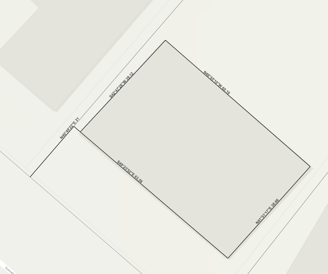
what am I missing in the configuration or set up? Even having the labels help solve the problem I am working out for staff.
Thank you in advance,
Vanessa
- Mark as New
- Bookmark
- Subscribe
- Mute
- Subscribe to RSS Feed
- Permalink
Hello Vanessa,
There could be a number of things wrong with the configuration. Please contact support so that we can triage it more effectively.
One simple way to address this issue is to use our "one-click" deployment option, which will stand up the application in your environment ready to use.
Install add-in - Parcel Drafter | ArcGIS Solutions for Local Government
Chris
Government Solutions