- Home
- :
- All Communities
- :
- Products
- :
- ArcGIS Web AppBuilder
- :
- ArcGIS Web AppBuilder Questions
- :
- Re: Add Raster using ArcGIS Rest API through jQuer...
- Subscribe to RSS Feed
- Mark Topic as New
- Mark Topic as Read
- Float this Topic for Current User
- Bookmark
- Subscribe
- Mute
- Printer Friendly Page
Add Raster using ArcGIS Rest API through jQuery
- Mark as New
- Bookmark
- Subscribe
- Mute
- Subscribe to RSS Feed
- Permalink
Dear Community,
I am trying to publish image server when a user uploads a file on a Web App Builder app. I tried to use esriRequest to make the request but it is only submiting it as GET even with usePost: true. That is one problem but not the major for now.
The code below results in 400 error code.
The image service url is
http://climatewizard.ciat.cgiar.org/arcgis/rest/services/targeting_tools/africa_land_use/ImageServer...var wkid = this.map.spatialReference; var srid = wkid.wkid; var params = { 'itemIds': itemID, 'rasterType': 'Raster Dataset', 'f': 'json', "spatialReference": {'wkid':srid} // 'computeStatistics': true }; var self = this; $.ajax({ type: "POST", url: self.config.imageServiceUrl + 'add', data: params, success: requestSucceeded, dataType: 'json' });
The response is the following.
{"error":{"code":400,"message":"Requested operation is not supported by this service.","details":[]}}
From the message the image service URL is not able to add raster but I don't know how to create a service that allows adding raster. Could you please help on this one.
Versions being used.
ArcGIS for Servers 10.5
ArcGIS Javascript API 3.22
Solved! Go to Solution.
Accepted Solutions
- Mark as New
- Bookmark
- Subscribe
- Mute
- Subscribe to RSS Feed
- Permalink
 License: As of 10.5, you must license your ArcGIS Server as an ArcGIS Image Server in order to use this resource.
- Mark as New
- Bookmark
- Subscribe
- Mute
- Subscribe to RSS Feed
- Permalink
The Image Server service has to be enabled to allow for adding Rasters.
http://climatewizard.ciat.cgiar.org/arcgis/sdk/rest/index.html#/Add_Rasters/02ss0000006r000000/
- Mark as New
- Bookmark
- Subscribe
- Mute
- Subscribe to RSS Feed
- Permalink
I see! How could I enable the Image Server service? I have also published some image services already here.
targeting_tools/africa_annual_precipitation (ImageServer)
I though it was enabled.
- Mark as New
- Bookmark
- Subscribe
- Mute
- Subscribe to RSS Feed
- Permalink
You have to enable uploads:
Key concepts for image services—Documentation | ArcGIS Enterprise
- Mark as New
- Bookmark
- Subscribe
- Mute
- Subscribe to RSS Feed
- Permalink
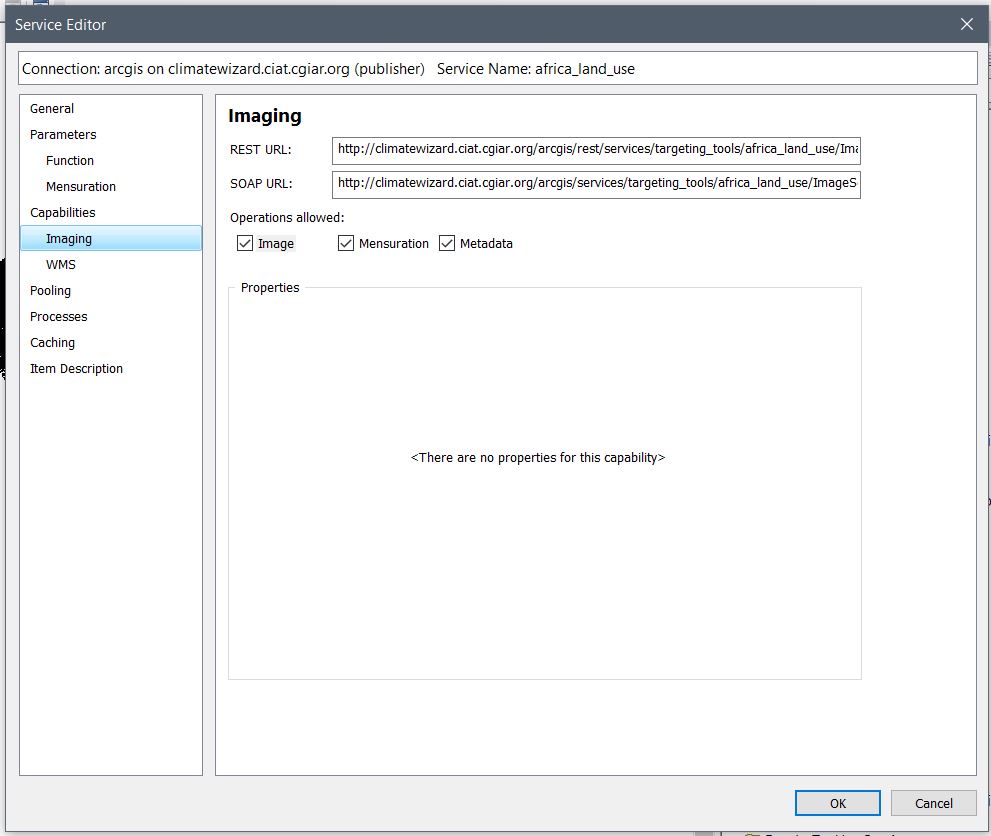
Unfortunately, there is no option for Upload and download and other useful capabilities. Is it missing because of the type of ArcGIS version?
- Mark as New
- Bookmark
- Subscribe
- Mute
- Subscribe to RSS Feed
- Permalink
License: As of 10.5, you must license your ArcGIS Server as an ArcGIS Image Server in order to use this resource.- Mark as New
- Bookmark
- Subscribe
- Mute
- Subscribe to RSS Feed
- Permalink
Oh I see the problem now. Thank you very much for the help!