- Home
- :
- All Communities
- :
- Products
- :
- ArcGIS Vector Tile Style Editor
- :
- ArcGIS Vector Tile Style Editor Questions
- :
- Please fix this glitch that has existed for months
- Subscribe to RSS Feed
- Mark Topic as New
- Mark Topic as Read
- Float this Topic for Current User
- Bookmark
- Subscribe
- Mute
- Printer Friendly Page
Please fix this glitch that has existed for months
- Mark as New
- Bookmark
- Subscribe
- Mute
- Subscribe to RSS Feed
- Permalink
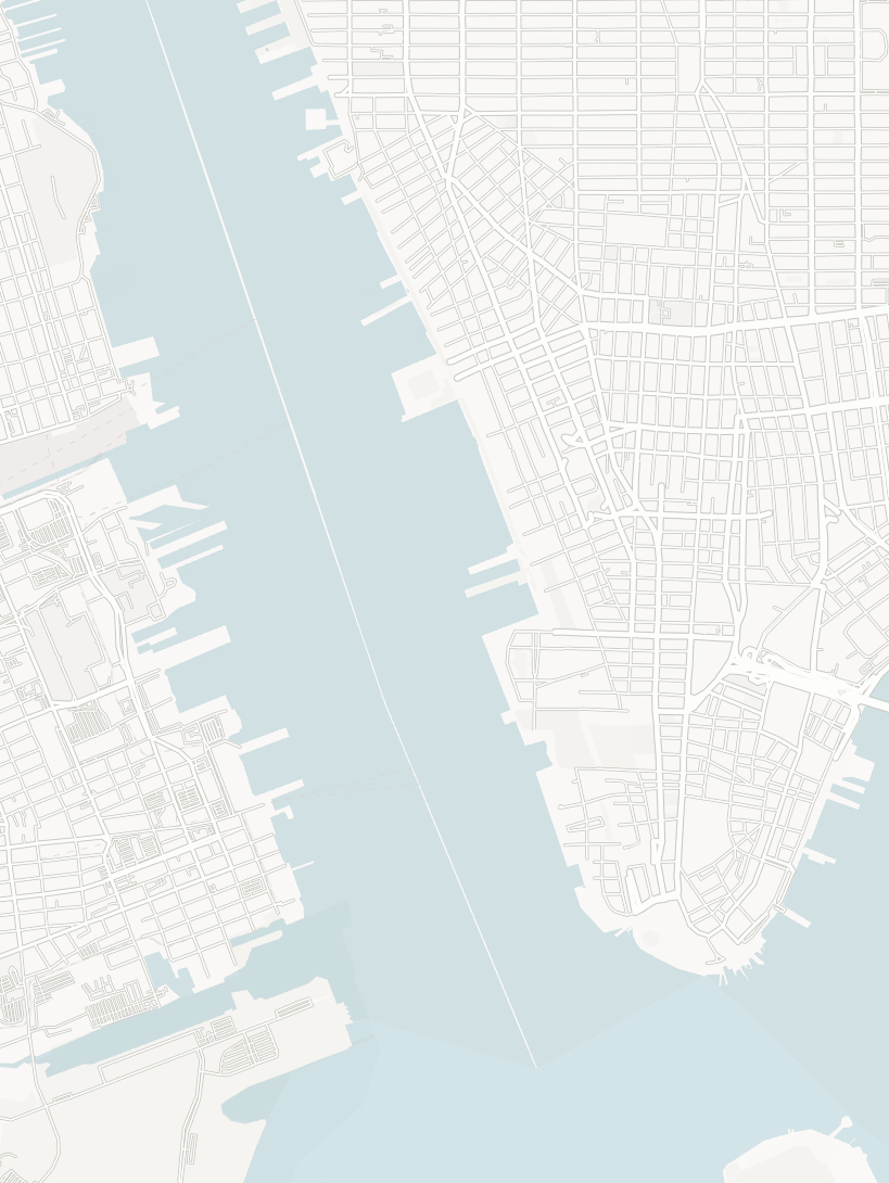
This small gap appears on all vector basemaps from Esri when the boundaries are taken off. This is the Hudson River between NYC and Jersey
Also, what is with the two colors of the water?
Esri, please fix. Its annoying that I need to photoshop this out everytime I export the map out.
Thanks
- Mark as New
- Bookmark
- Subscribe
- Mute
- Subscribe to RSS Feed
- Permalink
we will look into this and get back to you. thanks for reporting it.
- Mark as New
- Bookmark
- Subscribe
- Mute
- Subscribe to RSS Feed
- Permalink
In the Vector Tile Style Editor, you can actually see that the "two colors" is due to the Land/Not Ice layer showing trough the water layer, either because of transparency of layer blending. Not all basemap styles include this layer, and as with any layer in the vector style editor, you can remove/restyle it as needed.

Kendall County GIS
- Mark as New
- Bookmark
- Subscribe
- Mute
- Subscribe to RSS Feed
- Permalink
The boundary gap should be resolved in our December release (~16th of the month). Thanks for the comments.
In addition to Esri Community, we have basemap, geocoding and imagery feedback services where users can add comments on the map and get items fixed: https://www.arcgis.com/home/group.html?id=e796c4f5b27b431a804184fc51d10b40#overview
- Mark as New
- Bookmark
- Subscribe
- Mute
- Subscribe to RSS Feed
- Permalink
This glitch still exists. The only current solution is to deactivate the land layer in ArcGIS VTSE, to download the custom basemap, and then to load a secondary basemap from ArcGIS Pro under the custom one, which "hides" the gaps. Not ideal.