We have a potential client and they have basically one straightforward YES/NO question - can you represent our situation in UN? If, yes, we are in, if, no, there is no need for us to migrate to ArcGIS and UN.
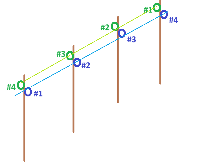
I said - yes, it is possible, however with my none experience I cannot say that I know how to do it properly. They have one pole that holds two lines with a junction on each side AND the numbering of junctions that hold the line to pole is each in different numbering. They do not want to change the numbering, obviously because the real life markers on poles are as they are in they own way. Please see my Paint masterpiece attached. I keep my fingers crossed for any suggestions or experience!