- Home
- :
- All Communities
- :
- Products
- :
- ArcGIS Utility Network
- :
- ArcGIS Utility Network Questions
- :
- ArcGIS Pro 2.5: How to create “junctions” at point...
- Subscribe to RSS Feed
- Mark Topic as New
- Mark Topic as Read
- Float this Topic for Current User
- Bookmark
- Subscribe
- Mute
- Printer Friendly Page
ArcGIS Pro 2.5: How to create “junctions” at points of intersections of “lines” in a utility network?
- Mark as New
- Bookmark
- Subscribe
- Mute
- Subscribe to RSS Feed
- Permalink
ArcGIS Pro 2.5: How to create “junctions” at points of intersections of “lines” in a utility network?
I couldn’t figure out how to create “junctions” at the points of intersections between “lines”. In ArcMap, “junctions” are created automatically as “geometric network” is created.
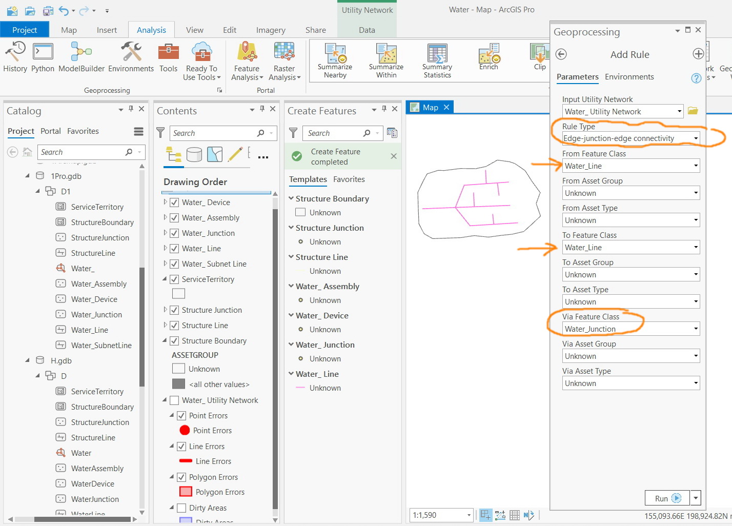
For example, in the screenshot below, a “edge-junction-edge” rule is added to configure the connectivity between “water_line” to be via “water_junction”. However, these junctions are not created knowing that “enable network topology” and “disabled network topology” tools are performed.
What could be the issue here?
Jamal Numan
Geomolg Geoportal for Spatial Information
Ramallah, West Bank, Palestine
- Mark as New
- Bookmark
- Subscribe
- Mute
- Subscribe to RSS Feed
- Permalink
I think you would like to create system junctions rather than intermediate junctions, if that is my correct understanding then you need to do as -
- validate the network topology for creating system junctions
- generate a network diagram for viewing system junctions created
BUT as shown in the image (1), you would like to add a junction-edge-junction rule for the water network scenario. This won't be allowed using the systems junctions because of -
"Edge-junction-edge connectivity is used to connect two lines using an intermediate point. This type of connectivity does not support terminals or midspan connectivity."
So in your data model, you need to define a water junction feature and feature restrictions (network rules) for the business scenario you have depicted in your images.
Hope this will help you.
Manoj Patil
- Mark as New
- Bookmark
- Subscribe
- Mute
- Subscribe to RSS Feed
- Permalink
Hi Manoj Patil,
I was struggling with how to see systems junctions created by the Utility Network itself, and your post helps me to figure out it easily.
- Mark as New
- Bookmark
- Subscribe
- Mute
- Subscribe to RSS Feed
- Permalink
Jay,
Did you figure out if there is any way to show systems junctions without having to generate a network diagram? It seems crazy that there is no way to ensure that when a line is split, the Utility Network doesn't require that some type of Junction or Device is placed at that location. Was just wondering if the network diagram fully met your needs or if you found another way to enforce the connectivity rules that were inherent in the geometric network. I posted a similar question on the site, but no one seems to know why that functionality would matter, which seems obvious to me. Please let me know if you found any additional info. Thanks.
- Mark as New
- Bookmark
- Subscribe
- Mute
- Subscribe to RSS Feed
- Permalink
Jay,
I finally found what I needed here: https://community.esri.com/t5/arcgis-utility-network-questions/finding-system-junctions/td-p/1351529
It allows you to view the system junctions.