- Home
- :
- All Communities
- :
- Products
- :
- ArcGIS Spatial Analyst
- :
- ArcGIS Spatial Analyst Questions
- :
- Re: Focal Statistics: convert raster into torus
- Subscribe to RSS Feed
- Mark Topic as New
- Mark Topic as Read
- Float this Topic for Current User
- Bookmark
- Subscribe
- Mute
- Printer Friendly Page
Focal Statistics: convert raster into torus
- Mark as New
- Bookmark
- Subscribe
- Mute
- Subscribe to RSS Feed
- Permalink
Hello,
I am using the Focal Statistics tool to calculate the density of certain parameters of an irregularly shaped region. Thus, I get edge effects whenever the distance between the pixels and the border of my dataset is smaller than the radius I apply to calculate the statistics.
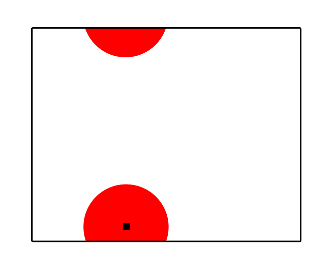
Is there a way of transforming my raster to a fictive 3D-object (something like an irregular torus let's say) for this tool to include the opponent side of the raster wherever the radius applied by Focal Statistics exceeds the end of the raster? see picture below as well
Thanks in advance!
Max
- Mark as New
- Bookmark
- Subscribe
- Mute
- Subscribe to RSS Feed
- Permalink
hmmmm grass link Annulus is different in Arc...so how about a wedge neighborhood consisting of 1/2 a circle but it isn't going to wrap around you would have to run it 4 times using rotated wedges to cover all edges/wraps
- Mark as New
- Bookmark
- Subscribe
- Mute
- Subscribe to RSS Feed
- Permalink
You could make 8 copies of your raster (Copy Raster), position each one to surround your original raster using the Shift tool, mosaic these 9 raster together (Mosaic to New Raster), and run Focal Statistics on this new raster. Finally, clip out the original raster using the method of your choice (Con, perhaps).
- Mark as New
- Bookmark
- Subscribe
- Mute
- Subscribe to RSS Feed
- Permalink
Thank you very much for your suggestions! Anyway, the image above was just to illustrate how I want the radius to continue on the opposite site; the shape of the dataset is much more irregular (it is a part of a federal state) and does not resemble a rectangle at all so I would need a much more integrative approach to solve that 😕