- Home
- :
- All Communities
- :
- Products
- :
- ArcGIS Pro
- :
- ArcGIS Pro Questions
- :
- Re: Raster not visible with vector layors
- Subscribe to RSS Feed
- Mark Topic as New
- Mark Topic as Read
- Float this Topic for Current User
- Bookmark
- Subscribe
- Mute
- Printer Friendly Page
Raster not visible with vector layors
- Mark as New
- Bookmark
- Subscribe
- Mute
- Subscribe to RSS Feed
- Permalink
EDIT:
I have figured out that the zoom extent is not the issue. Rather, the Raster is located in a different, incorrect area. This is based on the x,y coordinates in the bottom of the screen. Is the only way to fix this using georeferencing?
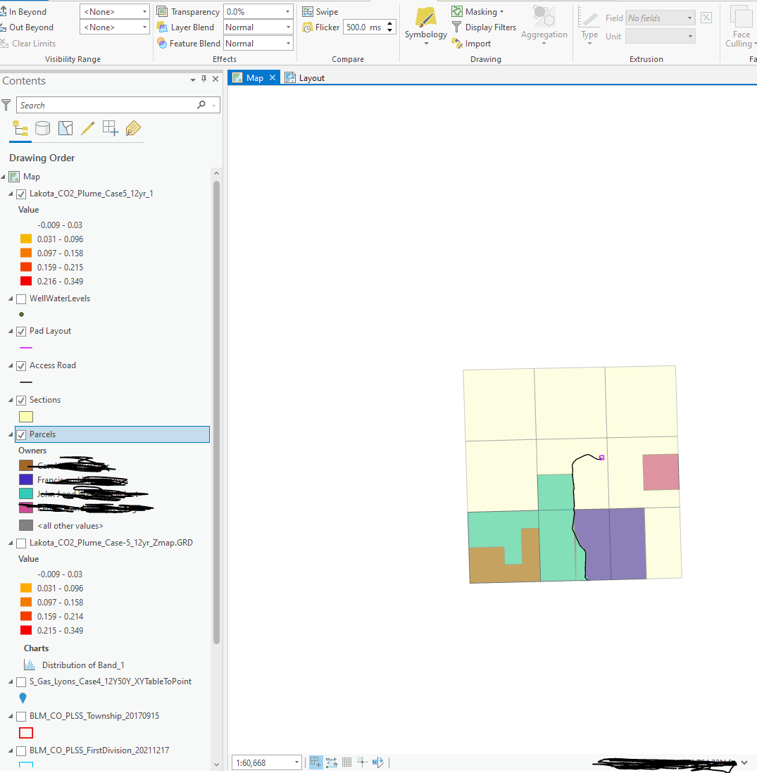
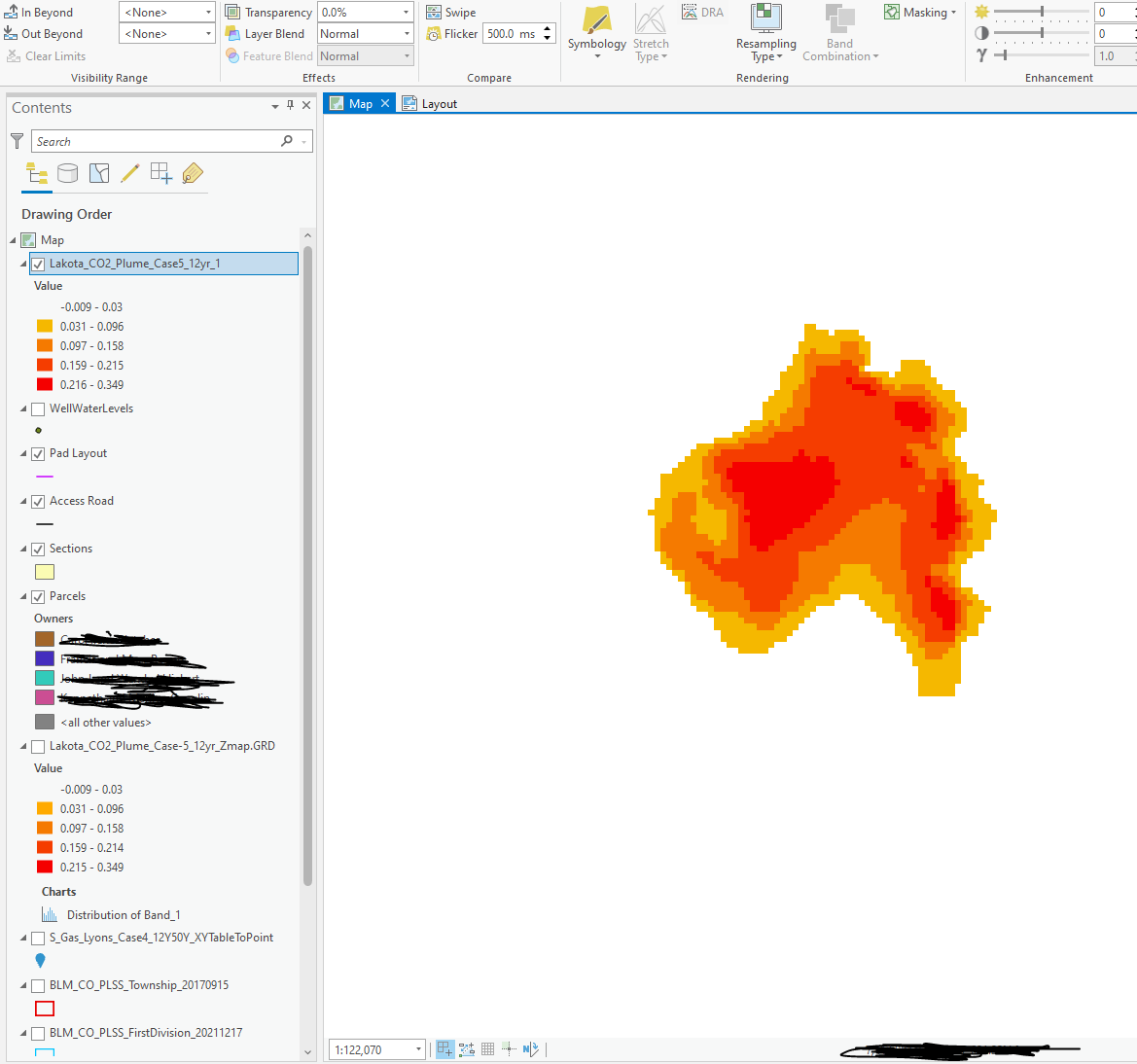
I have a raster of a plume extent that is only visible when I click zoom to layer. When I am looking at the rest of my map, which includes vector layers of polygon sections, land parcels, and polylines of an access road, the raster plume disappears. I transformed the raster into the same projection. Even when I'm at the same extent as the vector layers, the raster is still not visible. It's like the different data types are in their own plane is that makes sense. I've tried to convert the raster to a polygon, but I get the following error: "The input raster is nothing within the defined domain" and "ERROR 000969: The input raster is not integer type". The visibility range is set at None.
I'll also add that the original raster file was a .GRD file, which would not allow me to set a spatial reference in properties. This is why I transformed it with the Projections and Transformations tool.
It seems like the plume might be in a different location than the sections (based on the X,Y coordinates). If that's the case, how would I move the plume to where the parcels are in an accurate way? Is the original .GRD useless if it doesn't come with any spatial/attribute data aside from the contours?
- Mark as New
- Bookmark
- Subscribe
- Mute
- Subscribe to RSS Feed
- Permalink
Could you share the screenshot of the layer properties (Extent, Spatial Reference) of a vector and a Raster layer? The issue could be related to a wrongly defined spatial reference.
Ideally, which country should the data be overlaying upon?
Think Location
- Mark as New
- Bookmark
- Subscribe
- Mute
- Subscribe to RSS Feed
- Permalink
Ideally it will be overlaying on Colorado in the US.


- Mark as New
- Bookmark
- Subscribe
- Mute
- Subscribe to RSS Feed
- Permalink
The input raster must be of type integer.
- Mark as New
- Bookmark
- Subscribe
- Mute
- Subscribe to RSS Feed
- Permalink
besides the wrong raster type, you can project a raster once it has a properly defined coordinate system.
So define it then you can project it and deal with the inputs types.
Project Raster (Data Management)—ArcGIS Pro | Documentation
... sort of retired...
- Mark as New
- Bookmark
- Subscribe
- Mute
- Subscribe to RSS Feed
- Permalink
The RasterToPolygon tool threw 2 errors, viz.,
ERROR 000864: Input raster: The input is not within the defined domain.
ERROR 000969: The input raster is not integer type.
The first one is stating that the tool requires a certain type of raster, for example, integer raster, integer image service, integer mosaic, etc.
and because the supplied raster is of type Float it does not fall within that domain and then the second error is self explanatory.
It is always helpful to look at the error Error 000864